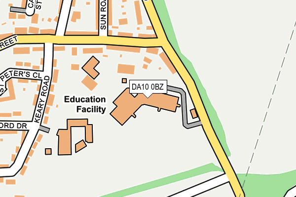
DA10 0BZ is located in the Swanscombe electoral ward, within the local authority district of Dartford and the English Parliamentary constituency of Dartford. The Sub Integrated Care Board (ICB) Location is NHS Kent and Medway ICB - 91Q and the police force is Kent. This postcode has been in use since December 1998.


GetTheData
Source: OS OpenMap – Local (Ordnance Survey)
Source: OS VectorMap District (Ordnance Survey)
Licence: Open Government Licence (requires attribution)
| Easting | 560829 |
| Northing | 173926 |
| Latitude | 51.441497 |
| Longitude | 0.312716 |
GetTheData
Source: Open Postcode Geo
Licence: Open Government Licence
| Country | England |
| Postcode District | DA10 |
| ➜ DA10 open data dashboard ➜ See where DA10 is on a map ➜ Where is Swanscombe? | |
GetTheData
Source: Land Registry Price Paid Data
Licence: Open Government Licence
Elevation or altitude of DA10 0BZ as distance above sea level:
| Metres | Feet | |
|---|---|---|
| Elevation | 30m | 98ft |
Elevation is measured from the approximate centre of the postcode, to the nearest point on an OS contour line from OS Terrain 50, which has contour spacing of ten vertical metres.
➜ How high above sea level am I? Find the elevation of your current position using your device's GPS.
GetTheData
Source: Open Postcode Elevation
Licence: Open Government Licence
| Ward | Swanscombe |
| Constituency | Dartford |
GetTheData
Source: ONS Postcode Database
Licence: Open Government Licence
| June 2022 | Drugs | On or near Keary Road | 225m |
| June 2022 | Burglary | On or near Keary Road | 225m |
| June 2022 | Violence and sexual offences | On or near Keary Road | 225m |
| ➜ Get more crime data in our Crime section | |||
GetTheData
Source: data.police.uk
Licence: Open Government Licence
| Ebbsfleet Academy (Southfleet Road) | Swanscombe | 72m |
| The Sun (Swanscombe Street) | Swanscombe | 134m |
| The Sun (Swanscombe Street) | Swanscombe | 149m |
| North Road | Swanscombe | 200m |
| Morning Star (Church Road) | Swanscombe | 223m |
| Ebbsfleet International Station | 0.6km |
| Swanscombe Station | 0.9km |
| Northfleet Station | 0.9km |
GetTheData
Source: NaPTAN
Licence: Open Government Licence
GetTheData
Source: ONS Postcode Database
Licence: Open Government Licence


➜ Get more ratings from the Food Standards Agency
GetTheData
Source: Food Standards Agency
Licence: FSA terms & conditions
| Last Collection | |||
|---|---|---|---|
| Location | Mon-Fri | Sat | Distance |
| Durrant Way | 17:30 | 11:30 | 706m |
| Alamein Road | 17:30 | 11:30 | 849m |
| Ames Road | 17:30 | 11:30 | 855m |
GetTheData
Source: Dracos
Licence: Creative Commons Attribution-ShareAlike
| Facility | Distance |
|---|---|
| The Ebbsfleet Academy Southfleet Road, Swanscombe Sports Hall, Artificial Grass Pitch, Health and Fitness Gym, Grass Pitches, Studio | 0m |
| Manor Community Primary School Keary Road, Swanscombe Grass Pitches, Artificial Grass Pitch | 152m |
| Swanscombe Park Park Road, Swanscombe Outdoor Tennis Courts | 547m |
GetTheData
Source: Active Places
Licence: Open Government Licence
| School | Phase of Education | Distance |
|---|---|---|
| Ebbsfleet Academy Southfleet Road, Swanscombe, DA10 0BZ | Secondary | 0m |
| Manor Community Primary School Keary Road, Swanscombe, DA10 0BU | Primary | 225m |
| Ebbsfleet Green Primary School Ackers Drive Weldon, Ebbsfleet Valley, Swanscombe, DA10 1AL | Primary | 684m |
GetTheData
Source: Edubase
Licence: Open Government Licence
The below table lists the International Territorial Level (ITL) codes (formerly Nomenclature of Territorial Units for Statistics (NUTS) codes) and Local Administrative Units (LAU) codes for DA10 0BZ:
| ITL 1 Code | Name |
|---|---|
| TLJ | South East (England) |
| ITL 2 Code | Name |
| TLJ4 | Kent |
| ITL 3 Code | Name |
| TLJ43 | Kent Thames Gateway |
| LAU 1 Code | Name |
| E07000107 | Dartford |
GetTheData
Source: ONS Postcode Directory
Licence: Open Government Licence
The below table lists the Census Output Area (OA), Lower Layer Super Output Area (LSOA), and Middle Layer Super Output Area (MSOA) for DA10 0BZ:
| Code | Name | |
|---|---|---|
| OA | E00122735 | |
| LSOA | E01024176 | Dartford 004B |
| MSOA | E02005031 | Dartford 004 |
GetTheData
Source: ONS Postcode Directory
Licence: Open Government Licence
| DA10 0BB | Southfleet Road | 84m |
| DA10 0BQ | Swanscombe Street | 122m |
| DA10 0BG | Swanscombe Street | 127m |
| DA10 0BN | Swanscombe Street | 190m |
| DA10 0BH | Sun Road | 214m |
| DA10 0BU | Keary Road | 225m |
| DA10 0HL | Church Road | 252m |
| DA10 0BL | Vernon Road | 253m |
| DA10 0AZ | Stanhope Road | 261m |
| DA10 0HP | Church Road | 264m |
GetTheData
Source: Open Postcode Geo; Land Registry Price Paid Data
Licence: Open Government Licence