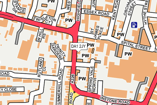
DA1 2JY is located in the Town electoral ward, within the local authority district of Dartford and the English Parliamentary constituency of Dartford. The Sub Integrated Care Board (ICB) Location is NHS Kent and Medway ICB - 91Q and the police force is Kent. This postcode has been in use since January 1980.


GetTheData
Source: OS OpenMap – Local (Ordnance Survey)
Source: OS VectorMap District (Ordnance Survey)
Licence: Open Government Licence (requires attribution)
| Easting | 553872 |
| Northing | 174041 |
| Latitude | 51.444461 |
| Longitude | 0.212746 |
GetTheData
Source: Open Postcode Geo
Licence: Open Government Licence
| Country | England |
| Postcode District | DA1 |
| ➜ DA1 open data dashboard ➜ See where DA1 is on a map ➜ Where is Dartford? | |
GetTheData
Source: Land Registry Price Paid Data
Licence: Open Government Licence
Elevation or altitude of DA1 2JY as distance above sea level:
| Metres | Feet | |
|---|---|---|
| Elevation | 10m | 33ft |
Elevation is measured from the approximate centre of the postcode, to the nearest point on an OS contour line from OS Terrain 50, which has contour spacing of ten vertical metres.
➜ How high above sea level am I? Find the elevation of your current position using your device's GPS.
GetTheData
Source: Open Postcode Elevation
Licence: Open Government Licence
| Ward | Town |
| Constituency | Dartford |
GetTheData
Source: ONS Postcode Database
Licence: Open Government Licence
2A, HIGHFIELD ROAD, DARTFORD, DA1 2JY 2022 1 AUG £720,000 |
SUMMIT HOUSE, 2 - 2A, HIGHFIELD ROAD, DARTFORD, DA1 2JY 2022 1 AUG £720,000 |
GetTheData
Source: HM Land Registry Price Paid Data
Licence: Contains HM Land Registry data © Crown copyright and database right 2024. This data is licensed under the Open Government Licence v3.0.
| January 2024 | Other theft | On or near Parking Area | 96m |
| January 2024 | Burglary | On or near Parking Area | 392m |
| November 2023 | Criminal damage and arson | On or near Parking Area | 96m |
| ➜ Get more crime data in our Crime section | |||
GetTheData
Source: data.police.uk
Licence: Open Government Licence
| Highfield Road Magistrates Court (Highfield Road) | Dartford | 34m |
| Priory Hill (West Hill) | Dartford | 195m |
| Instone Road | Dartford | 239m |
| Instone Road | Dartford | 250m |
| Hythe Street Post Office (Hythe Street) | Dartford | 274m |
| Dartford Station | 0.6km |
| Crayford Station | 2.4km |
| Slade Green Station | 3km |
GetTheData
Source: NaPTAN
Licence: Open Government Licence
GetTheData
Source: ONS Postcode Database
Licence: Open Government Licence


➜ Get more ratings from the Food Standards Agency
GetTheData
Source: Food Standards Agency
Licence: FSA terms & conditions
| Last Collection | |||
|---|---|---|---|
| Location | Mon-Fri | Sat | Distance |
| West Hill Meter Box | 19:30 | 216m | |
| Dartford Mail Centre | 19:30 | 12:45 | 222m |
| High Street | 18:30 | 12:15 | 405m |
GetTheData
Source: Dracos
Licence: Creative Commons Attribution-ShareAlike
| Facility | Distance |
|---|---|
| Reflexions Muscle & Fitness Gym West Hill, Dartford Health and Fitness Gym | 310m |
| The Gym Group (Dartford) The Orchards, Dartford Health and Fitness Gym | 455m |
| Becket Sports Centre Shepherds Lane, Dartford Sports Hall, Health and Fitness Gym, Studio | 503m |
GetTheData
Source: Active Places
Licence: Open Government Licence
| School | Phase of Education | Distance |
|---|---|---|
| Westgate Primary School Summerhill Road, Dartford, DA1 2LP | Primary | 181m |
| Our Lady's Catholic Primary School, Dartford King Edward Avenue, Dartford, DA1 2HX | Primary | 422m |
| Dartford Grammar School West Hill, Dartford, DA1 2HW | Secondary | 512m |
GetTheData
Source: Edubase
Licence: Open Government Licence
The below table lists the International Territorial Level (ITL) codes (formerly Nomenclature of Territorial Units for Statistics (NUTS) codes) and Local Administrative Units (LAU) codes for DA1 2JY:
| ITL 1 Code | Name |
|---|---|
| TLJ | South East (England) |
| ITL 2 Code | Name |
| TLJ4 | Kent |
| ITL 3 Code | Name |
| TLJ43 | Kent Thames Gateway |
| LAU 1 Code | Name |
| E07000107 | Dartford |
GetTheData
Source: ONS Postcode Directory
Licence: Open Government Licence
The below table lists the Census Output Area (OA), Lower Layer Super Output Area (LSOA), and Middle Layer Super Output Area (MSOA) for DA1 2JY:
| Code | Name | |
|---|---|---|
| OA | E00122765 | |
| LSOA | E01024182 | Dartford 003C |
| MSOA | E02005030 | Dartford 003 |
GetTheData
Source: ONS Postcode Directory
Licence: Open Government Licence
| DA1 2JH | Highfield Road | 35m |
| DA1 2LN | Spring Vale North | 80m |
| DA1 2EQ | West Hill | 81m |
| DA1 2EH | Spital Street | 102m |
| DA1 2DU | Woodin Close | 108m |
| DA1 2DX | Spital Street | 110m |
| DA1 2ED | St James Place | 112m |
| DA1 2LR | Trinity Gardens | 114m |
| DA1 2LL | Spring Vale North | 115m |
| DA1 2EL | West Hill | 119m |
GetTheData
Source: Open Postcode Geo; Land Registry Price Paid Data
Licence: Open Government Licence