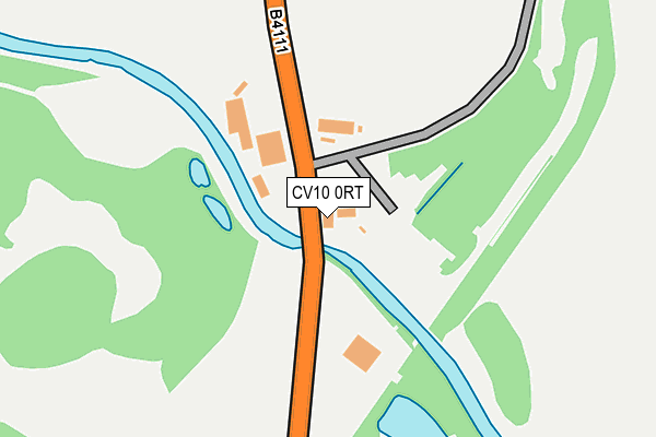
CV10 0RT is located in the Hartshill electoral ward, within the local authority district of North Warwickshire and the English Parliamentary constituency of Nuneaton. The Sub Integrated Care Board (ICB) Location is NHS Coventry and Warwickshire ICB - B2M3M and the police force is Warwickshire. This postcode has been in use since January 1980.


GetTheData
Source: OS OpenMap – Local (Ordnance Survey)
Source: OS VectorMap District (Ordnance Survey)
Licence: Open Government Licence (requires attribution)
| Easting | 433508 |
| Northing | 294703 |
| Latitude | 52.549166 |
| Longitude | -1.507271 |
GetTheData
Source: Open Postcode Geo
Licence: Open Government Licence
| Country | England |
| Postcode District | CV10 |
| ➜ CV10 open data dashboard ➜ See where CV10 is on a map | |
GetTheData
Source: Land Registry Price Paid Data
Licence: Open Government Licence
Elevation or altitude of CV10 0RT as distance above sea level:
| Metres | Feet | |
|---|---|---|
| Elevation | 90m | 295ft |
Elevation is measured from the approximate centre of the postcode, to the nearest point on an OS contour line from OS Terrain 50, which has contour spacing of ten vertical metres.
➜ How high above sea level am I? Find the elevation of your current position using your device's GPS.
GetTheData
Source: Open Postcode Elevation
Licence: Open Government Licence
| Ward | Hartshill |
| Constituency | Nuneaton |
GetTheData
Source: ONS Postcode Database
Licence: Open Government Licence
| Hartshill Wharf (Atherstone Road) | Hartshill | 838m |
| Hartshill Wharf (Atherstone Road) | Hartshill | 854m |
| Nuneaton Road (Woodford Lane) | Hartshill | 864m |
| Nuneaton Road (Woodford Lane) | Hartshill | 875m |
| Castle View (Castle Road) | Hartshill | 930m |
| Nuneaton Station | 3.9km |
| Atherstone Station | 4.5km |
GetTheData
Source: NaPTAN
Licence: Open Government Licence
GetTheData
Source: ONS Postcode Database
Licence: Open Government Licence


➜ Get more ratings from the Food Standards Agency
GetTheData
Source: Food Standards Agency
Licence: FSA terms & conditions
| Last Collection | |||
|---|---|---|---|
| Location | Mon-Fri | Sat | Distance |
| Hartshill Post Office | 16:45 | 11:45 | 1,276m |
| School Hill | 16:45 | 11:45 | 1,712m |
| Oldbury | 16:00 | 10:30 | 2,196m |
GetTheData
Source: Dracos
Licence: Creative Commons Attribution-ShareAlike
| Facility | Distance |
|---|---|
| Hartshill Recreation Ground (Closed) Grange Road, Hartshill , Nuneaton Grass Pitches | 736m |
| Windmill Sports And Social Club Mancetter Road, Nuneaton Grass Pitches | 1.2km |
| Michael Drayton Junior School The Woodlands, Nuneaton Grass Pitches | 1.2km |
GetTheData
Source: Active Places
Licence: Open Government Licence
| School | Phase of Education | Distance |
|---|---|---|
| Michael Drayton Junior School The Woodlands, Hartshill, Nuneaton, CV10 0SZ | Primary | 1.2km |
| Hartshill Academy Church Road, Nuneaton, CV10 0NA | Secondary | 1.3km |
| Nathaniel Newton Infant School Victoria Road, Hartshill, Nuneaton, CV10 0LS | Primary | 1.4km |
GetTheData
Source: Edubase
Licence: Open Government Licence
The below table lists the International Territorial Level (ITL) codes (formerly Nomenclature of Territorial Units for Statistics (NUTS) codes) and Local Administrative Units (LAU) codes for CV10 0RT:
| ITL 1 Code | Name |
|---|---|
| TLG | West Midlands (England) |
| ITL 2 Code | Name |
| TLG1 | Herefordshire, Worcestershire and Warwickshire |
| ITL 3 Code | Name |
| TLG13 | Warwickshire CC |
| LAU 1 Code | Name |
| E07000218 | North Warwickshire |
GetTheData
Source: ONS Postcode Directory
Licence: Open Government Licence
The below table lists the Census Output Area (OA), Lower Layer Super Output Area (LSOA), and Middle Layer Super Output Area (MSOA) for CV10 0RT:
| Code | Name | |
|---|---|---|
| OA | E00158184 | |
| LSOA | E01031030 | North Warwickshire 005F |
| MSOA | E02006472 | North Warwickshire 005 |
GetTheData
Source: ONS Postcode Directory
Licence: Open Government Licence
| CV10 0SX | Corporation Cottages | 636m |
| CV10 0RX | Leather Mills Lane | 726m |
| CV10 0TG | Cottage Gardens | 743m |
| CV10 0SR | Nuneaton Road | 814m |
| CV10 0SS | Grange Road | 816m |
| CV10 0TB | Atherstone Road | 826m |
| CV10 0SP | Atherstone Road | 881m |
| CV10 0UH | Ashbrook Rise | 899m |
| CV10 0SW | The Green | 904m |
| CV10 0SF | Castle Road | 908m |
GetTheData
Source: Open Postcode Geo; Land Registry Price Paid Data
Licence: Open Government Licence