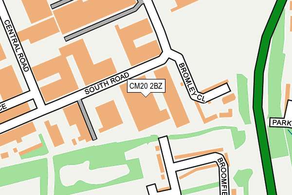
CM20 2BZ is located in the Mark Hall electoral ward, within the local authority district of Harlow and the English Parliamentary constituency of Harlow. The Sub Integrated Care Board (ICB) Location is NHS Hertfordshire and West Essex ICB - 07H and the police force is Essex. This postcode has been in use since December 1997.


GetTheData
Source: OS OpenMap – Local (Ordnance Survey)
Source: OS VectorMap District (Ordnance Survey)
Licence: Open Government Licence (requires attribution)
| Easting | 546606 |
| Northing | 211536 |
| Latitude | 51.783291 |
| Longitude | 0.123969 |
GetTheData
Source: Open Postcode Geo
Licence: Open Government Licence
| Country | England |
| Postcode District | CM20 |
| ➜ CM20 open data dashboard ➜ See where CM20 is on a map ➜ Where is Harlow? | |
GetTheData
Source: Land Registry Price Paid Data
Licence: Open Government Licence
Elevation or altitude of CM20 2BZ as distance above sea level:
| Metres | Feet | |
|---|---|---|
| Elevation | 50m | 164ft |
Elevation is measured from the approximate centre of the postcode, to the nearest point on an OS contour line from OS Terrain 50, which has contour spacing of ten vertical metres.
➜ How high above sea level am I? Find the elevation of your current position using your device's GPS.
GetTheData
Source: Open Postcode Elevation
Licence: Open Government Licence
| Ward | Mark Hall |
| Constituency | Harlow |
GetTheData
Source: ONS Postcode Database
Licence: Open Government Licence
| January 2024 | Violence and sexual offences | On or near Mark Hall Moors | 339m |
| January 2024 | Public order | On or near Mark Hall Moors | 339m |
| November 2023 | Vehicle crime | On or near Mark Hall Moors | 339m |
| ➜ Get more crime data in our Crime section | |||
GetTheData
Source: data.police.uk
Licence: Open Government Licence
| Ascent Park (Edinburgh Way) | Harlow | 369m |
| Ascent Park (Edinburgh Way) | Harlow | 388m |
| Temple Fields Tesco Store (Edinburgh Way) | Harlow | 400m |
| River Way (Edinburgh Way) | Harlow | 467m |
| River Way (Edinburgh Way) | Harlow | 502m |
| Harlow Mill Station | 1km |
| Harlow Town Station | 2km |
| Sawbridgeworth Station | 4.3km |
GetTheData
Source: NaPTAN
Licence: Open Government Licence
| Median download speed | 80.0Mbps |
| Average download speed | 70.8Mbps |
| Maximum download speed | 80.00Mbps |
| Median upload speed | 20.0Mbps |
| Average upload speed | 18.0Mbps |
| Maximum upload speed | 20.00Mbps |
GetTheData
Source: Ofcom
Licence: Ofcom Terms of Use (requires attribution)
GetTheData
Source: ONS Postcode Database
Licence: Open Government Licence


➜ Get more ratings from the Food Standards Agency
GetTheData
Source: Food Standards Agency
Licence: FSA terms & conditions
| Last Collection | |||
|---|---|---|---|
| Location | Mon-Fri | Sat | Distance |
| Tesco | 17:30 | 12:30 | 345m |
| London Road P.o. | 17:30 | 12:30 | 624m |
| Pittmans Field | 17:45 | 12:00 | 1,109m |
GetTheData
Source: Dracos
Licence: Creative Commons Attribution-ShareAlike
| Facility | Distance |
|---|---|
| Tany's Dell Primary School & Nursery Tanys Dell, Harlow Grass Pitches | 408m |
| Mark Hall Sports Centre London Road, Harlow Artificial Grass Pitch, Athletics, Health and Fitness Gym, Grass Pitches, Sports Hall, Studio, Outdoor Tennis Courts | 801m |
| Harlow Cricket Club Chippingfield, Harlow Grass Pitches | 975m |
GetTheData
Source: Active Places
Licence: Open Government Licence
| School | Phase of Education | Distance |
|---|---|---|
| Tany's Dell Primary School and Nursery Mowbray Road, Harlow, CM20 2LS | Primary | 505m |
| Fawbert and Barnard's Primary School London Road, Old Harlow, CM17 0DA | Primary | 656m |
| Mark Hall Academy First Avenue, Harlow, CM17 9LR | Secondary | 679m |
GetTheData
Source: Edubase
Licence: Open Government Licence
The below table lists the International Territorial Level (ITL) codes (formerly Nomenclature of Territorial Units for Statistics (NUTS) codes) and Local Administrative Units (LAU) codes for CM20 2BZ:
| ITL 1 Code | Name |
|---|---|
| TLH | East |
| ITL 2 Code | Name |
| TLH3 | Essex |
| ITL 3 Code | Name |
| TLH35 | West Essex |
| LAU 1 Code | Name |
| E07000073 | Harlow |
GetTheData
Source: ONS Postcode Directory
Licence: Open Government Licence
The below table lists the Census Output Area (OA), Lower Layer Super Output Area (LSOA), and Middle Layer Super Output Area (MSOA) for CM20 2BZ:
| Code | Name | |
|---|---|---|
| OA | E00110978 | |
| LSOA | E01021848 | Harlow 002E |
| MSOA | E02004545 | Harlow 002 |
GetTheData
Source: ONS Postcode Directory
Licence: Open Government Licence
| CM20 2JY | Broomfield | 142m |
| CM20 2LD | Stackfield | 146m |
| CM20 2GD | Bromley Close | 150m |
| CM20 2LB | Stackfield | 247m |
| CM20 2SX | St James Centre | 249m |
| CM20 2JZ | Broomfield | 258m |
| CM20 2ST | Central Road | 273m |
| CM20 2AR | South Road | 308m |
| CM20 2NG | Mark Hall Moors | 310m |
| CM20 2LA | Stackfield | 311m |
GetTheData
Source: Open Postcode Geo; Land Registry Price Paid Data
Licence: Open Government Licence