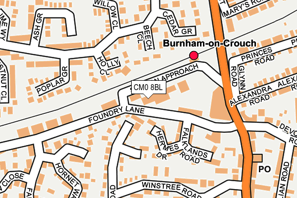
CM0 8BL is located in the Burnham-on-Crouch South electoral ward, within the local authority district of Maldon and the English Parliamentary constituency of Maldon. The Sub Integrated Care Board (ICB) Location is NHS Mid and South Essex ICB - 06Q and the police force is Essex. This postcode has been in use since January 1980.


GetTheData
Source: OS OpenMap – Local (Ordnance Survey)
Source: OS VectorMap District (Ordnance Survey)
Licence: Open Government Licence (requires attribution)
| Easting | 594543 |
| Northing | 196371 |
| Latitude | 51.632508 |
| Longitude | 0.809665 |
GetTheData
Source: Open Postcode Geo
Licence: Open Government Licence
| Country | England |
| Postcode District | CM0 |
| ➜ CM0 open data dashboard ➜ See where CM0 is on a map ➜ Where is Burnham-on-Crouch? | |
GetTheData
Source: Land Registry Price Paid Data
Licence: Open Government Licence
Elevation or altitude of CM0 8BL as distance above sea level:
| Metres | Feet | |
|---|---|---|
| Elevation | 10m | 33ft |
Elevation is measured from the approximate centre of the postcode, to the nearest point on an OS contour line from OS Terrain 50, which has contour spacing of ten vertical metres.
➜ How high above sea level am I? Find the elevation of your current position using your device's GPS.
GetTheData
Source: Open Postcode Elevation
Licence: Open Government Licence
| Ward | Burnham-on-crouch South |
| Constituency | Maldon |
GetTheData
Source: ONS Postcode Database
Licence: Open Government Licence
| December 2023 | Drugs | On or near Parking Area | 363m |
| November 2023 | Other theft | On or near Maple Way | 339m |
| November 2023 | Other crime | On or near Maple Way | 339m |
| ➜ Get more crime data in our Crime section | |||
GetTheData
Source: data.police.uk
Licence: Open Government Licence
| Railway Station (Station Approach) | Burnham-on-crouch | 338m |
| Maple Way | Burnham-on-crouch | 379m |
| The Railway Hotel (Station Road) | Burnham-on-crouch | 388m |
| The Railway Hotel (Station Road) | Burnham-on-crouch | 401m |
| Burnham Library (Station Road) | Burnham-on-crouch | 504m |
| Burnham-on-Crouch Station | 0.3km |
| Southminster Station | 3.6km |
| Althorne Station | 4.3km |
GetTheData
Source: NaPTAN
Licence: Open Government Licence
| Median download speed | 57.0Mbps |
| Average download speed | 48.0Mbps |
| Maximum download speed | 80.00Mbps |
| Median upload speed | 15.0Mbps |
| Average upload speed | 12.0Mbps |
| Maximum upload speed | 20.00Mbps |
GetTheData
Source: Ofcom
Licence: Ofcom Terms of Use (requires attribution)
GetTheData
Source: ONS Postcode Database
Licence: Open Government Licence


➜ Get more ratings from the Food Standards Agency
GetTheData
Source: Food Standards Agency
Licence: FSA terms & conditions
| Last Collection | |||
|---|---|---|---|
| Location | Mon-Fri | Sat | Distance |
| Eastern Road | 17:00 | 12:30 | 596m |
| 236 Southminster P.o. | 17:00 | 12:00 | 3,593m |
| Railway Station | 16:30 | 11:30 | 3,637m |
GetTheData
Source: Dracos
Licence: Creative Commons Attribution-ShareAlike
| Facility | Distance |
|---|---|
| Trackside Fitness Station Approach, Burnham-on-crouch Health and Fitness Gym, Studio | 40m |
| Dengie Hundred Sports Centre Station Road, Burnham-on-crouch Sports Hall, Health and Fitness Gym | 530m |
| Ormiston Rivers Academy Southminster Road, Burnham-on-crouch Sports Hall, Artificial Grass Pitch, Grass Pitches | 570m |
GetTheData
Source: Active Places
Licence: Open Government Licence
| School | Phase of Education | Distance |
|---|---|---|
| Ormiston Rivers Academy Southminster Road, Burnham-on-Crouch, CM0 8QB | Secondary | 570m |
| St Mary's Church of England Voluntary Aided Primary School, Burnham-on-Crouch Marsh Road, Marsh Rd, Burnham-on-Crouch, CM0 8LZ | Primary | 771m |
| Burnham-on-Crouch Primary School Dunkirk Road, Burnham-on-Crouch, CM0 8LG | Primary | 988m |
GetTheData
Source: Edubase
Licence: Open Government Licence
The below table lists the International Territorial Level (ITL) codes (formerly Nomenclature of Territorial Units for Statistics (NUTS) codes) and Local Administrative Units (LAU) codes for CM0 8BL:
| ITL 1 Code | Name |
|---|---|
| TLH | East |
| ITL 2 Code | Name |
| TLH3 | Essex |
| ITL 3 Code | Name |
| TLH36 | Heart of Essex |
| LAU 1 Code | Name |
| E07000074 | Maldon |
GetTheData
Source: ONS Postcode Directory
Licence: Open Government Licence
The below table lists the Census Output Area (OA), Lower Layer Super Output Area (LSOA), and Middle Layer Super Output Area (MSOA) for CM0 8BL:
| Code | Name | |
|---|---|---|
| OA | E00111140 | |
| LSOA | E01021881 | Maldon 008F |
| MSOA | E02004562 | Maldon 008 |
GetTheData
Source: ONS Postcode Directory
Licence: Open Government Licence
| CM0 8EN | Sheerwater Close | 70m |
| CM0 8RJ | Poplar Grove | 73m |
| CM0 8DW | Maple Way | 127m |
| CM0 8RL | Chestnut Close | 143m |
| CM0 8EW | Hornet Way | 144m |
| CM0 8PW | Dragon Close | 153m |
| CM0 8EX | Fernlea Road | 153m |
| CM0 8DL | Holly Close | 165m |
| CM0 8DN | Maple Way | 188m |
| CM0 8EP | Galahad Close | 190m |
GetTheData
Source: Open Postcode Geo; Land Registry Price Paid Data
Licence: Open Government Licence