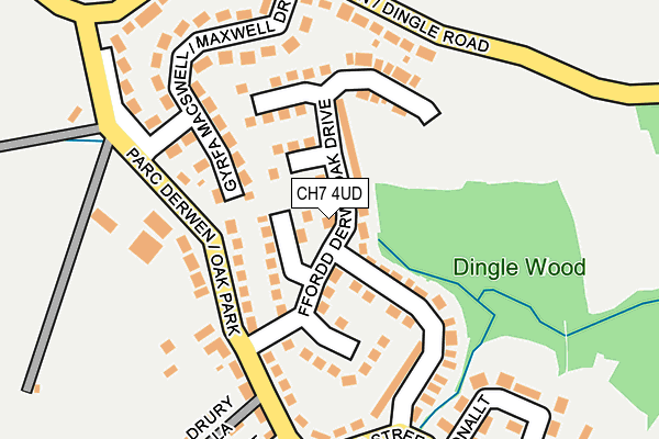
CH7 4UD lies on Ffordd Derw in Leeswood, Mold. CH7 4UD is located in the Leeswood electoral ward, within the unitary authority of Flintshire and the Welsh Parliamentary constituency of Delyn. The Local Health Board is Betsi Cadwaladr University and the police force is North Wales. This postcode has been in use since January 1980.


GetTheData
Source: OS OpenMap – Local (Ordnance Survey)
Source: OS VectorMap District (Ordnance Survey)
Licence: Open Government Licence (requires attribution)
| Easting | 326920 |
| Northing | 360333 |
| Latitude | 53.135122 |
| Longitude | -3.093806 |
GetTheData
Source: Open Postcode Geo
Licence: Open Government Licence
| Street | Ffordd Derw |
| Locality | Leeswood |
| Town/City | Mold |
| Country | Wales |
| Postcode District | CH7 |
➜ See where CH7 is on a map ➜ Where is Leeswood? | |
GetTheData
Source: Land Registry Price Paid Data
Licence: Open Government Licence
Elevation or altitude of CH7 4UD as distance above sea level:
| Metres | Feet | |
|---|---|---|
| Elevation | 150m | 492ft |
Elevation is measured from the approximate centre of the postcode, to the nearest point on an OS contour line from OS Terrain 50, which has contour spacing of ten vertical metres.
➜ How high above sea level am I? Find the elevation of your current position using your device's GPS.
GetTheData
Source: Open Postcode Elevation
Licence: Open Government Licence
| Ward | Leeswood |
| Constituency | Delyn |
GetTheData
Source: ONS Postcode Database
Licence: Open Government Licence
| Drury Lane (Oak Park) | Leeswood | 170m |
| Bethel Chapel (King Street) | Leeswood | 223m |
| Bryn-estyn (Oak Park) | Leeswood | 304m |
| Bryn-estyn (Oak Park) | Leeswood | 310m |
| Wesley Methodist Church (King Street) | Leeswood | 478m |
| Penyffordd Station | 2.8km |
| Buckley Station | 4km |
| Hope (Flintshire) Station | 4.3km |
GetTheData
Source: NaPTAN
Licence: Open Government Licence
| Percentage of properties with Next Generation Access | 100.0% |
| Percentage of properties with Superfast Broadband | 100.0% |
| Percentage of properties with Ultrafast Broadband | 0.0% |
| Percentage of properties with Full Fibre Broadband | 0.0% |
Superfast Broadband is between 30Mbps and 300Mbps
Ultrafast Broadband is > 300Mbps
| Median download speed | 39.1Mbps |
| Average download speed | 36.6Mbps |
| Maximum download speed | 55.00Mbps |
| Median upload speed | 7.5Mbps |
| Average upload speed | 6.8Mbps |
| Maximum upload speed | 10.49Mbps |
| Percentage of properties unable to receive 2Mbps | 0.0% |
| Percentage of properties unable to receive 5Mbps | 0.0% |
| Percentage of properties unable to receive 10Mbps | 0.0% |
| Percentage of properties unable to receive 30Mbps | 0.0% |
GetTheData
Source: Ofcom
Licence: Ofcom Terms of Use (requires attribution)
Estimated total energy consumption in CH7 4UD by fuel type, 2015.
| Consumption (kWh) | 365,487 |
|---|---|
| Meter count | 28 |
| Mean (kWh/meter) | 13,053 |
| Median (kWh/meter) | 12,763 |
| Consumption (kWh) | 111,075 |
|---|---|
| Meter count | 24 |
| Mean (kWh/meter) | 4,628 |
| Median (kWh/meter) | 4,597 |
GetTheData
Source: Postcode level gas estimates: 2015 (experimental)
Source: Postcode level electricity estimates: 2015 (experimental)
Licence: Open Government Licence
GetTheData
Source: ONS Postcode Database
Licence: Open Government Licence


➜ Get more ratings from the Food Standards Agency
GetTheData
Source: Food Standards Agency
Licence: FSA terms & conditions
| Last Collection | |||
|---|---|---|---|
| Location | Mon-Fri | Sat | Distance |
| Queen Street | 16:00 | 11:00 | 231m |
| Bryn Estyn Leeswood | 16:00 | 11:00 | 275m |
| Leeswood Post Office | 15:48 | 10:45 | 663m |
GetTheData
Source: Dracos
Licence: Creative Commons Attribution-ShareAlike
The below table lists the International Territorial Level (ITL) codes (formerly Nomenclature of Territorial Units for Statistics (NUTS) codes) and Local Administrative Units (LAU) codes for CH7 4UD:
| ITL 1 Code | Name |
|---|---|
| TLL | Wales |
| ITL 2 Code | Name |
| TLL2 | East Wales |
| ITL 3 Code | Name |
| TLL23 | Flintshire and Wrexham |
| LAU 1 Code | Name |
| W06000005 | Flintshire |
GetTheData
Source: ONS Postcode Directory
Licence: Open Government Licence
The below table lists the Census Output Area (OA), Lower Layer Super Output Area (LSOA), and Middle Layer Super Output Area (MSOA) for CH7 4UD:
| Code | Name | |
|---|---|---|
| OA | W00001659 | |
| LSOA | W01000309 | Flintshire 019C |
| MSOA | W02000076 | Flintshire 019 |
GetTheData
Source: ONS Postcode Directory
Licence: Open Government Licence
| CH7 4UE | Sycamore Drive | 68m |
| CH7 4UF | Birch Court | 76m |
| CH7 4UH | Parc Derwen | 111m |
| CH7 4UJ | Rhodfa Helyg | 120m |
| CH7 4UG | Ash Grove | 137m |
| CH7 4UQ | Llys Celyn | 139m |
| CH7 4UL | Wood Grove | 148m |
| CH7 4SY | Goodwood Grove | 154m |
| CH7 4SR | Maxwell Drive | 177m |
| CH7 4SQ | 189m |
GetTheData
Source: Open Postcode Geo; Land Registry Price Paid Data
Licence: Open Government Licence