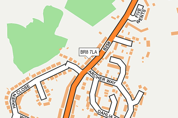
BR8 7LA is located in the Swanley White Oak electoral ward, within the local authority district of Sevenoaks and the English Parliamentary constituency of Sevenoaks. The Sub Integrated Care Board (ICB) Location is NHS Kent and Medway ICB - 91Q and the police force is Kent. This postcode has been in use since January 1980.


GetTheData
Source: OS OpenMap – Local (Ordnance Survey)
Source: OS VectorMap District (Ordnance Survey)
Licence: Open Government Licence (requires attribution)
| Easting | 551904 |
| Northing | 169259 |
| Latitude | 51.402026 |
| Longitude | 0.182402 |
GetTheData
Source: Open Postcode Geo
Licence: Open Government Licence
| Country | England |
| Postcode District | BR8 |
| ➜ BR8 open data dashboard ➜ See where BR8 is on a map ➜ Where is Swanley? | |
GetTheData
Source: Land Registry Price Paid Data
Licence: Open Government Licence
Elevation or altitude of BR8 7LA as distance above sea level:
| Metres | Feet | |
|---|---|---|
| Elevation | 60m | 197ft |
Elevation is measured from the approximate centre of the postcode, to the nearest point on an OS contour line from OS Terrain 50, which has contour spacing of ten vertical metres.
➜ How high above sea level am I? Find the elevation of your current position using your device's GPS.
GetTheData
Source: Open Postcode Elevation
Licence: Open Government Licence
| Ward | Swanley White Oak |
| Constituency | Sevenoaks |
GetTheData
Source: ONS Postcode Database
Licence: Open Government Licence
| January 2024 | Criminal damage and arson | On or near Archer Way | 249m |
| January 2024 | Burglary | On or near Archer Way | 249m |
| January 2024 | Burglary | On or near Archer Way | 249m |
| ➜ Get more crime data in our Crime section | |||
GetTheData
Source: data.police.uk
Licence: Open Government Licence
| Five Wents (Swanley Lane) | Swanley | 146m |
| Woodlands Rise (Swanley Lane) | Swanley | 206m |
| Woodlands Rise (Swanley Lane) | Swanley | 236m |
| Five Wents (Main Road) | Swanley | 346m |
| Homefield Close (Swanley Lane) | Swanley | 430m |
| Swanley Station | 1.3km |
| Farningham Road Station | 3.7km |
| Eynsford Station | 4.6km |
GetTheData
Source: NaPTAN
Licence: Open Government Licence
GetTheData
Source: ONS Postcode Database
Licence: Open Government Licence


➜ Get more ratings from the Food Standards Agency
GetTheData
Source: Food Standards Agency
Licence: FSA terms & conditions
| Last Collection | |||
|---|---|---|---|
| Location | Mon-Fri | Sat | Distance |
| Swanley Lane (193) | 18:00 | 12:00 | 52m |
| Swanley Lane (71) | 18:00 | 12:00 | 423m |
| Northview (100) | 18:00 | 11:30 | 524m |
GetTheData
Source: Dracos
Licence: Creative Commons Attribution-ShareAlike
| Facility | Distance |
|---|---|
| Downsview Primary School Beech Avenue, Swanley Grass Pitches | 730m |
| Hextable School (Closed) Egerton Avenue, Swanley Grass Pitches, Sports Hall, Studio | 745m |
| Swanley Rfc Egerton Avenue, Egerton Avenue, Swanley Grass Pitches | 747m |
GetTheData
Source: Active Places
Licence: Open Government Licence
| School | Phase of Education | Distance |
|---|---|---|
| St Bartholomew's Catholic Primary School, Swanley Sycamore Drive, Swanley, BR8 7AY | Primary | 672m |
| Downsview Community Primary School Beech Avenue, Swanley, BR8 8AU | Primary | 730m |
| Horizon Primary Academy Hilda May Avenue, Swanley, BR8 7BT | Primary | 751m |
GetTheData
Source: Edubase
Licence: Open Government Licence
The below table lists the International Territorial Level (ITL) codes (formerly Nomenclature of Territorial Units for Statistics (NUTS) codes) and Local Administrative Units (LAU) codes for BR8 7LA:
| ITL 1 Code | Name |
|---|---|
| TLJ | South East (England) |
| ITL 2 Code | Name |
| TLJ4 | Kent |
| ITL 3 Code | Name |
| TLJ46 | West Kent |
| LAU 1 Code | Name |
| E07000111 | Sevenoaks |
GetTheData
Source: ONS Postcode Directory
Licence: Open Government Licence
The below table lists the Census Output Area (OA), Lower Layer Super Output Area (LSOA), and Middle Layer Super Output Area (MSOA) for BR8 7LA:
| Code | Name | |
|---|---|---|
| OA | E00124251 | |
| LSOA | E01024479 | Sevenoaks 001E |
| MSOA | E02005087 | Sevenoaks 001 |
GetTheData
Source: ONS Postcode Directory
Licence: Open Government Licence
| BR8 7LD | Swanley Lane | 53m |
| BR8 7LJ | Woodgers Grove | 64m |
| BR8 7XR | Archer Way | 104m |
| BR8 7LB | Swanley Lane | 158m |
| BR8 7LH | Swanley Lane | 158m |
| BR8 7XS | Dahlia Drive | 168m |
| BR8 7FB | Hawthorn Park | 177m |
| BR8 7JZ | Haven Close | 209m |
| BR8 7JY | Haven Close | 230m |
| BR8 7LE | Five Wents | 237m |
GetTheData
Source: Open Postcode Geo; Land Registry Price Paid Data
Licence: Open Government Licence