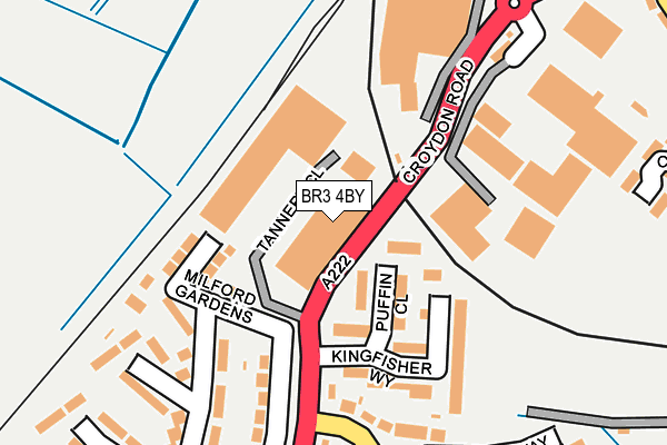
BR3 4BY is located in the Kelsey & Eden Park electoral ward, within the London borough of Bromley and the English Parliamentary constituency of Beckenham. The Sub Integrated Care Board (ICB) Location is NHS South East London ICB - 72Q and the police force is Metropolitan Police. This postcode has been in use since July 1983.


GetTheData
Source: OS OpenMap – Local (Ordnance Survey)
Source: OS VectorMap District (Ordnance Survey)
Licence: Open Government Licence (requires attribution)
| Easting | 535658 |
| Northing | 168003 |
| Latitude | 51.394853 |
| Longitude | -0.051479 |
GetTheData
Source: Open Postcode Geo
Licence: Open Government Licence
| Country | England |
| Postcode District | BR3 |
| ➜ BR3 open data dashboard ➜ See where BR3 is on a map ➜ Where is London? | |
GetTheData
Source: Land Registry Price Paid Data
Licence: Open Government Licence
Elevation or altitude of BR3 4BY as distance above sea level:
| Metres | Feet | |
|---|---|---|
| Elevation | 40m | 131ft |
Elevation is measured from the approximate centre of the postcode, to the nearest point on an OS contour line from OS Terrain 50, which has contour spacing of ten vertical metres.
➜ How high above sea level am I? Find the elevation of your current position using your device's GPS.
GetTheData
Source: Open Postcode Elevation
Licence: Open Government Licence
| Ward | Kelsey & Eden Park |
| Constituency | Beckenham |
GetTheData
Source: ONS Postcode Database
Licence: Open Government Licence
| June 2022 | Public order | On or near Tannery Close | 94m |
| June 2022 | Other theft | On or near Tannery Close | 94m |
| June 2022 | Anti-social behaviour | On or near Kingfisher Way | 120m |
| ➜ Get more crime data in our Crime section | |||
GetTheData
Source: data.police.uk
Licence: Open Government Licence
| Kingfisher Way (Cr0) (Long Lane) | Elmers End | 158m |
| Horton Way (The Glade) | Elmers End | 263m |
| The Glade (Cr0) (Long Lane) | Elmers End | 282m |
| Elmers End Tesco (Croydon Road) | Elmers End | 282m |
| Horton Way (The Glade) | Elmers End | 284m |
| Elmers End Tram Stop (Off Elmers End Road) | Elmers End | 424m |
| Arena Tram Stop (Off Albert Road) | Woodside | 605m |
| Harrington Road Tram Stop (Off Harrington Road) | South Norwood | 846m |
| Birkbeck Tram Stop (Elmers End Road) | Anerley | 1,036m |
| Woodside Tram Stop (Spring Lane) | Woodside | 1,295m |
| Elmers End Station | 0.4km |
| Birkbeck Station | 1km |
| Norwood Junction Station | 1.7km |
GetTheData
Source: NaPTAN
Licence: Open Government Licence
Estimated total energy consumption in BR3 4BY by fuel type, 2015.
| Consumption (kWh) | 204,089 |
|---|---|
| Meter count | 8 |
| Mean (kWh/meter) | 25,511 |
| Median (kWh/meter) | 16,391 |
GetTheData
Source: Postcode level gas estimates: 2015 (experimental)
Source: Postcode level electricity estimates: 2015 (experimental)
Licence: Open Government Licence
GetTheData
Source: ONS Postcode Database
Licence: Open Government Licence


➜ Get more ratings from the Food Standards Agency
GetTheData
Source: Food Standards Agency
Licence: FSA terms & conditions
| Last Collection | |||
|---|---|---|---|
| Location | Mon-Fri | Sat | Distance |
| Tesco Croydon Road | 17:45 | 12:00 | 262m |
| Factories Croydon Road | 18:00 | 12:00 | 321m |
| Long Lane (207) | 18:00 | 12:00 | 379m |
GetTheData
Source: Dracos
Licence: Creative Commons Attribution-ShareAlike
| Facility | Distance |
|---|---|
| Monks Orchard Primary School The Glade, Croydon Grass Pitches | 443m |
| Goals (Beckenham) Elmers End Road, Beckenham Artificial Grass Pitch | 444m |
| The Longheath Centre Longheath Gardens, Croydon Sports Hall | 491m |
GetTheData
Source: Active Places
Licence: Open Government Licence
| School | Phase of Education | Distance |
|---|---|---|
| Marian Vian Primary School Shirley Crescent, Elmers End, Beckenham, BR3 4AZ | Primary | 416m |
| Monks Orchard Primary School The Glade, Shirley, Croydon, CR0 7UF | Primary | 443m |
| Oasis Academy Arena Albert Road, South Norwood, London, SE25 4QL | Secondary | 769m |
GetTheData
Source: Edubase
Licence: Open Government Licence
The below table lists the International Territorial Level (ITL) codes (formerly Nomenclature of Territorial Units for Statistics (NUTS) codes) and Local Administrative Units (LAU) codes for BR3 4BY:
| ITL 1 Code | Name |
|---|---|
| TLI | London |
| ITL 2 Code | Name |
| TLI6 | Outer London - South |
| ITL 3 Code | Name |
| TLI61 | Bromley |
| LAU 1 Code | Name |
| E09000006 | Bromley |
GetTheData
Source: ONS Postcode Directory
Licence: Open Government Licence
The below table lists the Census Output Area (OA), Lower Layer Super Output Area (LSOA), and Middle Layer Super Output Area (MSOA) for BR3 4BY:
| Code | Name | |
|---|---|---|
| OA | E00165793 | |
| LSOA | E01032568 | Bromley 041E |
| MSOA | E02006787 | Bromley 041 |
GetTheData
Source: ONS Postcode Directory
Licence: Open Government Licence
| CR0 7UJ | The Glade | 188m |
| CR0 7TA | Long Lane | 200m |
| CR0 7TF | Long Lane | 201m |
| CR0 7TZ | Longheath Gardens | 213m |
| CR0 7UQ | The Glade | 261m |
| CR0 7TY | Longheath Gardens | 268m |
| CR0 7TW | Longheath Gardens | 300m |
| CR0 7TR | Longheath Gardens | 305m |
| BR3 4AA | Croydon Road | 308m |
| CR0 7UG | The Glade | 327m |
GetTheData
Source: Open Postcode Geo; Land Registry Price Paid Data
Licence: Open Government Licence