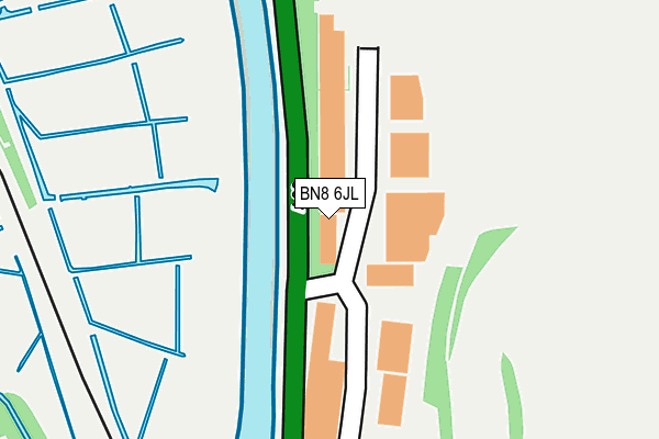
BN8 6JL is located in the Lewes Bridge electoral ward, within the local authority district of Lewes and the English Parliamentary constituency of Lewes. The Sub Integrated Care Board (ICB) Location is NHS Sussex ICB - 97R and the police force is Sussex. This postcode has been in use since October 1984.


GetTheData
Source: OS OpenMap – Local (Ordnance Survey)
Source: OS VectorMap District (Ordnance Survey)
Licence: Open Government Licence (requires attribution)
| Easting | 542582 |
| Northing | 109599 |
| Latitude | 50.868313 |
| Longitude | 0.024917 |
GetTheData
Source: Open Postcode Geo
Licence: Open Government Licence
| Country | England |
| Postcode District | BN8 |
| ➜ BN8 open data dashboard ➜ See where BN8 is on a map ➜ Where is Lewes? | |
GetTheData
Source: Land Registry Price Paid Data
Licence: Open Government Licence
Elevation or altitude of BN8 6JL as distance above sea level:
| Metres | Feet | |
|---|---|---|
| Elevation | 10m | 33ft |
Elevation is measured from the approximate centre of the postcode, to the nearest point on an OS contour line from OS Terrain 50, which has contour spacing of ten vertical metres.
➜ How high above sea level am I? Find the elevation of your current position using your device's GPS.
GetTheData
Source: Open Postcode Elevation
Licence: Open Government Licence
| Ward | Lewes Bridge |
| Constituency | Lewes |
GetTheData
Source: ONS Postcode Database
Licence: Open Government Licence
| May 2022 | Other theft | On or near A26 | 360m |
| April 2022 | Violence and sexual offences | On or near A26 | 360m |
| April 2022 | Other theft | On or near A26 | 360m |
| ➜ Get more crime data in our Crime section | |||
GetTheData
Source: data.police.uk
Licence: Open Government Licence
| Priory School (Mountfield Road) | Lewes | 629m |
| Brooks Road (Malling Street) | Lewes | 941m |
| Friars' Walk (Friar's Walk) | Lewes | 953m |
| Tesco Filling Station (Phoenix Causeway) | Lewes | 977m |
| Tesco Filling Station (Phoenix Causeway) | Lewes | 993m |
| Lewes Station | 1km |
| Glynde Station | 3.3km |
| Southease Station | 4.1km |
GetTheData
Source: NaPTAN
Licence: Open Government Licence
| Median download speed | 80.0Mbps |
| Average download speed | 56.4Mbps |
| Maximum download speed | 80.00Mbps |
| Median upload speed | 20.0Mbps |
| Average upload speed | 12.9Mbps |
| Maximum upload speed | 20.00Mbps |
GetTheData
Source: Ofcom
Licence: Ofcom Terms of Use (requires attribution)
Estimated total energy consumption in BN8 6JL by fuel type, 2015.
| Consumption (kWh) | 336,905 |
|---|---|
| Meter count | 15 |
| Mean (kWh/meter) | 22,460 |
| Median (kWh/meter) | 20,012 |
GetTheData
Source: Postcode level gas estimates: 2015 (experimental)
Source: Postcode level electricity estimates: 2015 (experimental)
Licence: Open Government Licence
GetTheData
Source: ONS Postcode Database
Licence: Open Government Licence


➜ Get more ratings from the Food Standards Agency
GetTheData
Source: Food Standards Agency
Licence: FSA terms & conditions
| Last Collection | |||
|---|---|---|---|
| Location | Mon-Fri | Sat | Distance |
| Cliffe Industrial Estate | 17:00 | 11:00 | 83m |
| South Street | 17:15 | 11:30 | 596m |
| Cliffe Corner | 17:15 | 11:30 | 773m |
GetTheData
Source: Dracos
Licence: Creative Commons Attribution-ShareAlike
| Facility | Distance |
|---|---|
| Lewes Golf Club Chapel Hill, Lewes Golf | 352m |
| Lewes Leisure Centre Mountfield Road, Lewes Sports Hall, Athletics, Swimming Pool, Health and Fitness Gym | 463m |
| Priory School Mountfield Road, Lewes Grass Pitches | 566m |
GetTheData
Source: Active Places
Licence: Open Government Licence
| School | Phase of Education | Distance |
|---|---|---|
| Priory School Mountfield Road, Lewes, BN7 2XN | Secondary | 615m |
| Southover CofE Primary School Potters Lane, Lewes, BN7 1JP | Primary | 1.5km |
| Western Road Community Primary School Southover High Street, Lewes, BN7 1JB | Primary | 1.5km |
GetTheData
Source: Edubase
Licence: Open Government Licence
The below table lists the International Territorial Level (ITL) codes (formerly Nomenclature of Territorial Units for Statistics (NUTS) codes) and Local Administrative Units (LAU) codes for BN8 6JL:
| ITL 1 Code | Name |
|---|---|
| TLJ | South East (England) |
| ITL 2 Code | Name |
| TLJ2 | Surrey, East and West Sussex |
| ITL 3 Code | Name |
| TLJ22 | East Sussex CC |
| LAU 1 Code | Name |
| E07000063 | Lewes |
GetTheData
Source: ONS Postcode Directory
Licence: Open Government Licence
The below table lists the Census Output Area (OA), Lower Layer Super Output Area (LSOA), and Middle Layer Super Output Area (MSOA) for BN8 6JL:
| Code | Name | |
|---|---|---|
| OA | E00106825 | |
| LSOA | E01021035 | Lewes 003C |
| MSOA | E02004381 | Lewes 003 |
GetTheData
Source: ONS Postcode Directory
Licence: Open Government Licence
| BN8 6JN | 361m | |
| BN7 3PS | Ham Lane | 534m |
| BN7 2BS | South Street | 549m |
| BN7 2BX | Wille Cottages | 556m |
| BN7 2BU | South Street | 574m |
| BN7 2BW | The Moorings | 583m |
| BN7 2FA | Hillman Close | 627m |
| BN7 2AX | Timber Yard Cottages | 631m |
| BN7 2AU | Timberyard Lane | 667m |
| BN7 2UR | Mountfield Road | 703m |
GetTheData
Source: Open Postcode Geo; Land Registry Price Paid Data
Licence: Open Government Licence