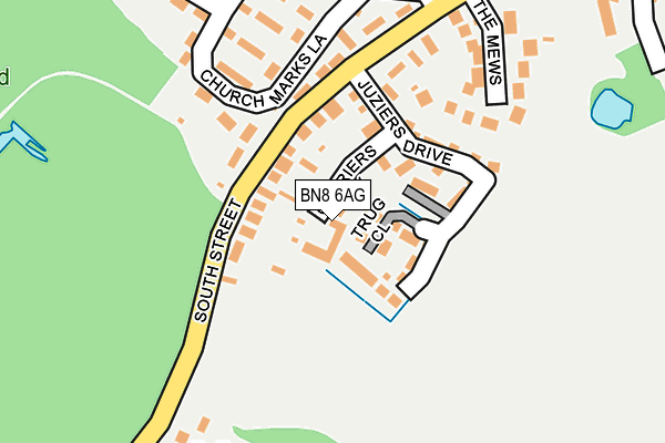
BN8 6AG is located in the Chiddingly, East Hoathly & Waldron electoral ward, within the local authority district of Wealden and the English Parliamentary constituency of Wealden. The Sub Integrated Care Board (ICB) Location is NHS Sussex ICB - 97R and the police force is Sussex. This postcode has been in use since December 2008.


GetTheData
Source: OS OpenMap – Local (Ordnance Survey)
Source: OS VectorMap District (Ordnance Survey)
Licence: Open Government Licence (requires attribution)
| Easting | 552002 |
| Northing | 115919 |
| Latitude | 50.922712 |
| Longitude | 0.161288 |
GetTheData
Source: Open Postcode Geo
Licence: Open Government Licence
| Country | England |
| Postcode District | BN8 |
| ➜ BN8 open data dashboard ➜ See where BN8 is on a map ➜ Where is East Hoathly? | |
GetTheData
Source: Land Registry Price Paid Data
Licence: Open Government Licence
Elevation or altitude of BN8 6AG as distance above sea level:
| Metres | Feet | |
|---|---|---|
| Elevation | 50m | 164ft |
Elevation is measured from the approximate centre of the postcode, to the nearest point on an OS contour line from OS Terrain 50, which has contour spacing of ten vertical metres.
➜ How high above sea level am I? Find the elevation of your current position using your device's GPS.
GetTheData
Source: Open Postcode Elevation
Licence: Open Government Licence
| Ward | Chiddingly, East Hoathly & Waldron |
| Constituency | Wealden |
GetTheData
Source: ONS Postcode Database
Licence: Open Government Licence
| June 2023 | Anti-social behaviour | On or near Parking Area | 205m |
| August 2022 | Other theft | On or near High Street | 350m |
| June 2022 | Violence and sexual offences | On or near Buttsfield Lane | 440m |
| ➜ Get more crime data in our Crime section | |||
GetTheData
Source: data.police.uk
Licence: Open Government Licence
| Rectory Close (High Street) | East Hoathly | 260m |
| Rectory Close (High Street) | East Hoathly | 287m |
| Paine's Oast (South Street) | East Hoathly | 335m |
| Paine's Oast (South Street) | East Hoathly | 346m |
| Bentley Wood (Eastbourne Road) | Halland | 1,569m |
| Uckfield Station | 6.9km |
GetTheData
Source: NaPTAN
Licence: Open Government Licence
GetTheData
Source: ONS Postcode Database
Licence: Open Government Licence


➜ Get more ratings from the Food Standards Agency
GetTheData
Source: Food Standards Agency
Licence: FSA terms & conditions
| Last Collection | |||
|---|---|---|---|
| Location | Mon-Fri | Sat | Distance |
| South Street, East Hoathly | 14:15 | 09:45 | 121m |
| East Hoathly | 16:00 | 09:45 | 462m |
| Park Corner | 15:30 | 07:00 | 1,195m |
GetTheData
Source: Dracos
Licence: Creative Commons Attribution-ShareAlike
| Facility | Distance |
|---|---|
| The War Memorial Sports Ground London Road, East Hoathly, Lewes Grass Pitches | 403m |
| East Hoathly And Halland Tennis Club London Road, East Hoathly, Lewes Outdoor Tennis Courts | 430m |
| Chiddingly Cricket Club The Street, Chiddingly, Lewes Grass Pitches | 3km |
GetTheData
Source: Active Places
Licence: Open Government Licence
| School | Phase of Education | Distance |
|---|---|---|
| East Hoathly CofE Primary School Church Marks Lane, East Hoathly, Lewes, BN8 6EQ | Primary | 259m |
| Annan School Annan Farm, Lewes Road, Easons Green, Uckfield, TN22 5RE | Not applicable | 2.2km |
| Chiddingly Primary School Muddles Green, Chiddingly, Lewes, BN8 6HN | Primary | 3.4km |
GetTheData
Source: Edubase
Licence: Open Government Licence
The below table lists the International Territorial Level (ITL) codes (formerly Nomenclature of Territorial Units for Statistics (NUTS) codes) and Local Administrative Units (LAU) codes for BN8 6AG:
| ITL 1 Code | Name |
|---|---|
| TLJ | South East (England) |
| ITL 2 Code | Name |
| TLJ2 | Surrey, East and West Sussex |
| ITL 3 Code | Name |
| TLJ22 | East Sussex CC |
| LAU 1 Code | Name |
| E07000065 | Wealden |
GetTheData
Source: ONS Postcode Directory
Licence: Open Government Licence
The below table lists the Census Output Area (OA), Lower Layer Super Output Area (LSOA), and Middle Layer Super Output Area (MSOA) for BN8 6AG:
| Code | Name | |
|---|---|---|
| OA | E00107425 | |
| LSOA | E01021148 | Wealden 013C |
| MSOA | E02004415 | Wealden 013 |
GetTheData
Source: ONS Postcode Directory
Licence: Open Government Licence
| BN8 6AF | Trug Close | 52m |
| BN8 6AE | Juziers Drive | 87m |
| BN8 6DS | South Street | 93m |
| BN8 6EH | The Mews | 187m |
| BN8 6EQ | Church Marks Lane | 197m |
| BN8 6EG | Rectory Close | 289m |
| BN8 6DN | Nightingales | 291m |
| BN8 6DT | South Street | 378m |
| BN8 6EF | Buttsfield Lane | 403m |
| BN8 6EB | High Street | 408m |
GetTheData
Source: Open Postcode Geo; Land Registry Price Paid Data
Licence: Open Government Licence