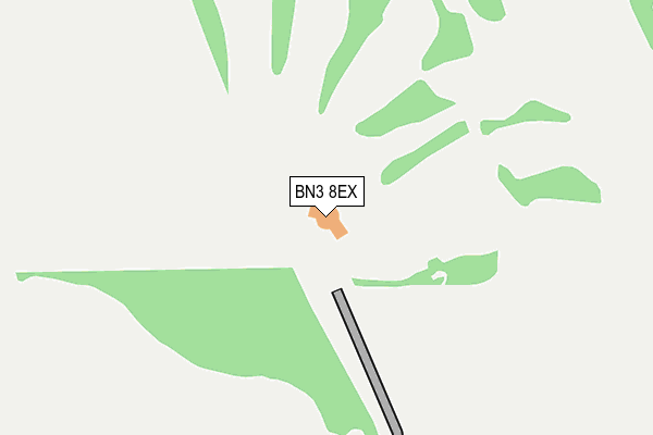
BN3 8EX is located in the Hangleton & Knoll electoral ward, within the unitary authority of Brighton and Hove and the English Parliamentary constituency of Hove. The Sub Integrated Care Board (ICB) Location is NHS Sussex ICB - 09D and the police force is Sussex. This postcode has been in use since August 1992.


GetTheData
Source: OS OpenMap – Local (Ordnance Survey)
Source: OS VectorMap District (Ordnance Survey)
Licence: Open Government Licence (requires attribution)
| Easting | 526316 |
| Northing | 108016 |
| Latitude | 50.857870 |
| Longitude | -0.206687 |
GetTheData
Source: Open Postcode Geo
Licence: Open Government Licence
| Country | England |
| Postcode District | BN3 |
| ➜ BN3 open data dashboard ➜ See where BN3 is on a map | |
GetTheData
Source: Land Registry Price Paid Data
Licence: Open Government Licence
Elevation or altitude of BN3 8EX as distance above sea level:
| Metres | Feet | |
|---|---|---|
| Elevation | 60m | 197ft |
Elevation is measured from the approximate centre of the postcode, to the nearest point on an OS contour line from OS Terrain 50, which has contour spacing of ten vertical metres.
➜ How high above sea level am I? Find the elevation of your current position using your device's GPS.
GetTheData
Source: Open Postcode Elevation
Licence: Open Government Licence
| Ward | Hangleton & Knoll |
| Constituency | Hove |
GetTheData
Source: ONS Postcode Database
Licence: Open Government Licence
| Warenne Road (Hangleton Valley Drive) | Hangleton | 477m |
| Northfield Rise (Hangleton Valley Drive) | Hangleton | 601m |
| Bottom Of Downsview (Hangleton Valley Drive) | Hangleton | 672m |
| Honeycroft (Hangleton Valley Drive) | Hangleton | 750m |
| Hangleton Valley Drive (Hangleton Way) | Hangleton | 841m |
| Portslade Station | 2.5km |
| Fishersgate Station | 2.8km |
| Aldrington Station | 2.9km |
GetTheData
Source: NaPTAN
Licence: Open Government Licence
GetTheData
Source: ONS Postcode Database
Licence: Open Government Licence


➜ Get more ratings from the Food Standards Agency
GetTheData
Source: Food Standards Agency
Licence: FSA terms & conditions
| Last Collection | |||
|---|---|---|---|
| Location | Mon-Fri | Sat | Distance |
| Hangleton Way | 16:15 | 10:45 | 961m |
| Northease Drive | 16:30 | 10:30 | 1,215m |
| Benfield Heights | 17:00 | 12:00 | 1,285m |
GetTheData
Source: Dracos
Licence: Creative Commons Attribution-ShareAlike
| Facility | Distance |
|---|---|
| West Hove Golf Club Badgers Way, Hove Golf | 0m |
| Benfield Valley Golf Course (Closed) Hangleton Lane, Hove Golf | 887m |
| Hangleton Park Harmsworth Crescent, Hove Artificial Grass Pitch, Grass Pitches | 1.1km |
GetTheData
Source: Active Places
Licence: Open Government Licence
| School | Phase of Education | Distance |
|---|---|---|
| King's School Hangleton Way, Hove, BN3 8BN | Secondary | 1.1km |
| West Blatchington Primary and Nursery School Hangleton Way, Hove, BN3 8BN | Primary | 1.2km |
| Hangleton Primary School Dale View, Hove, BN3 8LF | Primary | 1.3km |
GetTheData
Source: Edubase
Licence: Open Government Licence
The below table lists the International Territorial Level (ITL) codes (formerly Nomenclature of Territorial Units for Statistics (NUTS) codes) and Local Administrative Units (LAU) codes for BN3 8EX:
| ITL 1 Code | Name |
|---|---|
| TLJ | South East (England) |
| ITL 2 Code | Name |
| TLJ2 | Surrey, East and West Sussex |
| ITL 3 Code | Name |
| TLJ21 | Brighton and Hove |
| LAU 1 Code | Name |
| E06000043 | Brighton and Hove |
GetTheData
Source: ONS Postcode Directory
Licence: Open Government Licence
The below table lists the Census Output Area (OA), Lower Layer Super Output Area (LSOA), and Middle Layer Super Output Area (MSOA) for BN3 8EX:
| Code | Name | |
|---|---|---|
| OA | E00085223 | |
| LSOA | E01016885 | Brighton and Hove 006D |
| MSOA | E02003496 | Brighton and Hove 006 |
GetTheData
Source: ONS Postcode Directory
Licence: Open Government Licence
| BN3 8FD | The Down | 523m |
| BN3 8EG | Warenne Road | 528m |
| BN3 8EJ | Hangleton Valley Drive | 563m |
| BN3 8FB | Cowdens Close | 585m |
| BN3 8EH | Meyners Close | 614m |
| BN3 8FA | Northfield Rise | 619m |
| BN3 8EL | Lynchets Crescent | 638m |
| BN3 8FE | Hangleton Valley Drive | 642m |
| BN3 8EW | Broad Rig Avenue | 665m |
| BN3 8EZ | Honey Croft | 719m |
GetTheData
Source: Open Postcode Geo; Land Registry Price Paid Data
Licence: Open Government Licence