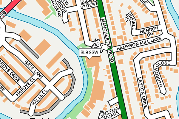
BL9 9SW is located in the Unsworth electoral ward, within the metropolitan district of Bury and the English Parliamentary constituency of Bury North. The Sub Integrated Care Board (ICB) Location is NHS Greater Manchester ICB - 00V and the police force is Greater Manchester. This postcode has been in use since January 1991.


GetTheData
Source: OS OpenMap – Local (Ordnance Survey)
Source: OS VectorMap District (Ordnance Survey)
Licence: Open Government Licence (requires attribution)
| Easting | 380540 |
| Northing | 408262 |
| Latitude | 53.570614 |
| Longitude | -2.295320 |
GetTheData
Source: Open Postcode Geo
Licence: Open Government Licence
| Country | England |
| Postcode District | BL9 |
| ➜ BL9 open data dashboard ➜ See where BL9 is on a map ➜ Where is Bury? | |
GetTheData
Source: Land Registry Price Paid Data
Licence: Open Government Licence
Elevation or altitude of BL9 9SW as distance above sea level:
| Metres | Feet | |
|---|---|---|
| Elevation | 70m | 230ft |
Elevation is measured from the approximate centre of the postcode, to the nearest point on an OS contour line from OS Terrain 50, which has contour spacing of ten vertical metres.
➜ How high above sea level am I? Find the elevation of your current position using your device's GPS.
GetTheData
Source: Open Postcode Elevation
Licence: Open Government Licence
| Ward | Unsworth |
| Constituency | Bury North |
GetTheData
Source: ONS Postcode Database
Licence: Open Government Licence
| Manchester Rd/Mount Zion Rd (Manchester Rd) | Fletcher Fold | 77m |
| Manchester Rd/Mount Zion Rd (Manchester Rd) | Fletcher Fold | 81m |
| Manchester Road/Bird I'th' Hand (Manchester Road) | Blackford Bridge | 183m |
| Manchester Rd/Bird I'th' Hand (Manchester Rd) | Blackford Bridge | 254m |
| Manchester Rd/Dumers Ln (Manchester Rd) | Fletcher Fold | 263m |
GetTheData
Source: NaPTAN
Licence: Open Government Licence
GetTheData
Source: ONS Postcode Database
Licence: Open Government Licence


➜ Get more ratings from the Food Standards Agency
GetTheData
Source: Food Standards Agency
Licence: FSA terms & conditions
| Last Collection | |||
|---|---|---|---|
| Location | Mon-Fri | Sat | Distance |
| Fishpool P O | 18:30 | 11:20 | 1,352m |
| 126 Parkhills Road | 17:20 | 10:50 | 1,632m |
| Rectory Lane | 17:30 | 12:00 | 1,794m |
GetTheData
Source: Dracos
Licence: Creative Commons Attribution-ShareAlike
| Facility | Distance |
|---|---|
| Barlow Recreation Ground Leyland Street, Bury Grass Pitches | 466m |
| Goshen Sports Centre Tennyson Avenue, Bury Artificial Grass Pitch, Grass Pitches, Cycling | 722m |
| Bury Golf Club Manchester Road, Bury Golf | 749m |
GetTheData
Source: Active Places
Licence: Open Government Licence
| School | Phase of Education | Distance |
|---|---|---|
| St Peter's Church of England Primary School Whitefield Road, Bury, BL9 9PW | Primary | 877m |
| Hollins Grundy Primary School The Hags, Off Hollins Lane, Hollins, Bury, BL9 8AY | Primary | 903m |
| Sunny Bank Primary School Hathaway Road, Bury, BL9 8EQ | Primary | 1.1km |
GetTheData
Source: Edubase
Licence: Open Government Licence
The below table lists the International Territorial Level (ITL) codes (formerly Nomenclature of Territorial Units for Statistics (NUTS) codes) and Local Administrative Units (LAU) codes for BL9 9SW:
| ITL 1 Code | Name |
|---|---|
| TLD | North West (England) |
| ITL 2 Code | Name |
| TLD3 | Greater Manchester |
| ITL 3 Code | Name |
| TLD37 | Greater Manchester North East |
| LAU 1 Code | Name |
| E08000002 | Bury |
GetTheData
Source: ONS Postcode Directory
Licence: Open Government Licence
The below table lists the Census Output Area (OA), Lower Layer Super Output Area (LSOA), and Middle Layer Super Output Area (MSOA) for BL9 9SW:
| Code | Name | |
|---|---|---|
| OA | E00025585 | |
| LSOA | E01005060 | Bury 013D |
| MSOA | E02001031 | Bury 013 |
GetTheData
Source: ONS Postcode Directory
Licence: Open Government Licence
| BL9 9PA | Manchester Road | 110m |
| BL9 9PB | Britain Street | 115m |
| M26 2AD | Riverview Close | 174m |
| BL9 9TS | Leyton Drive | 174m |
| BL9 9SH | Manchester Road | 176m |
| BL9 9SU | Manchester Road | 178m |
| BL9 9ST | Manchester Road | 180m |
| BL9 9PD | Britain Street | 186m |
| BL9 9TT | Hendon Drive | 198m |
| M26 2AF | Gate Lane | 203m |
GetTheData
Source: Open Postcode Geo; Land Registry Price Paid Data
Licence: Open Government Licence