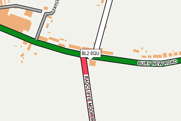
BL2 6QU is located in the Radcliffe North & Ainsworth electoral ward, within the metropolitan district of Bury and the English Parliamentary constituency of Bury South. The Sub Integrated Care Board (ICB) Location is NHS Greater Manchester ICB - 00V and the police force is Greater Manchester. This postcode has been in use since January 1980.


GetTheData
Source: OS OpenMap – Local (Ordnance Survey)
Source: OS VectorMap District (Ordnance Survey)
Licence: Open Government Licence (requires attribution)
| Easting | 375765 |
| Northing | 409045 |
| Latitude | 53.577436 |
| Longitude | -2.367486 |
GetTheData
Source: Open Postcode Geo
Licence: Open Government Licence
| Country | England |
| Postcode District | BL2 |
| ➜ BL2 open data dashboard ➜ See where BL2 is on a map ➜ Where is Bolton? | |
GetTheData
Source: Land Registry Price Paid Data
Licence: Open Government Licence
Elevation or altitude of BL2 6QU as distance above sea level:
| Metres | Feet | |
|---|---|---|
| Elevation | 120m | 394ft |
Elevation is measured from the approximate centre of the postcode, to the nearest point on an OS contour line from OS Terrain 50, which has contour spacing of ten vertical metres.
➜ How high above sea level am I? Find the elevation of your current position using your device's GPS.
GetTheData
Source: Open Postcode Elevation
Licence: Open Government Licence
| Ward | Radcliffe North & Ainsworth |
| Constituency | Bury South |
GetTheData
Source: ONS Postcode Database
Licence: Open Government Licence
| Bury New Rd/Ainsworth Hall Rd (Bury New Rd) | Bradley Fold | 97m |
| Bury New Rd/Radcliffe Moor Rd (Bury New Rd) | Bradley Fold | 106m |
| Bury New Rd/Ainsworth Hall Rd (Bury New Rd) | Bradley Fold | 210m |
| Bury New Rd/Top Bull (Bury New Rd) | Bradley Fold | 211m |
| Radcliffe Moor Rd/Garden Ctr (Radcliffe Mr Rd) | Bradley Fold | 355m |
| Moses Gate Station | 3.3km |
| Farnworth Station | 3.3km |
| Kearsley Station | 3.7km |
GetTheData
Source: NaPTAN
Licence: Open Government Licence
GetTheData
Source: ONS Postcode Database
Licence: Open Government Licence


➜ Get more ratings from the Food Standards Agency
GetTheData
Source: Food Standards Agency
Licence: FSA terms & conditions
| Last Collection | |||
|---|---|---|---|
| Location | Mon-Fri | Sat | Distance |
| 16 Montgomery Way | 17:30 | 12:00 | 995m |
| Breightmet P O | 18:30 | 12:05 | 1,719m |
| Beechcroft Avenue | 17:45 | 11:20 | 1,783m |
GetTheData
Source: Dracos
Licence: Creative Commons Attribution-ShareAlike
| Facility | Distance |
|---|---|
| Afc Dobbies Ainsworth Hall Road, Bolton Grass Pitches | 122m |
| Phoenix Health & Fitness Centre Bradley Fold Trading Estate, Radcliffe Moor Road, Bradley Fold, Bolton Health and Fitness Gym, Studio | 548m |
| Bolton Wyresdale Afc Inverbeg Drive, Bolton Grass Pitches | 732m |
GetTheData
Source: Active Places
Licence: Open Government Licence
| School | Phase of Education | Distance |
|---|---|---|
| Blackshaw Primary School Bideford Drive, Breightmet, Bolton, BL2 6TE | Primary | 777m |
| SS Osmund and Andrew's R.C. Primary School Falkirk Drive, Bolton, BL2 6NW | Primary | 1.1km |
| Christ Church Ainsworth Church of England Primary School Tommy Lane, Ainsworth, Bolton, BL2 5SQ | Primary | 1.3km |
GetTheData
Source: Edubase
Licence: Open Government Licence
The below table lists the International Territorial Level (ITL) codes (formerly Nomenclature of Territorial Units for Statistics (NUTS) codes) and Local Administrative Units (LAU) codes for BL2 6QU:
| ITL 1 Code | Name |
|---|---|
| TLD | North West (England) |
| ITL 2 Code | Name |
| TLD3 | Greater Manchester |
| ITL 3 Code | Name |
| TLD37 | Greater Manchester North East |
| LAU 1 Code | Name |
| E08000002 | Bury |
GetTheData
Source: ONS Postcode Directory
Licence: Open Government Licence
The below table lists the Census Output Area (OA), Lower Layer Super Output Area (LSOA), and Middle Layer Super Output Area (MSOA) for BL2 6QU:
| Code | Name | |
|---|---|---|
| OA | E00025295 | |
| LSOA | E01005000 | Bury 012A |
| MSOA | E02001030 | Bury 012 |
GetTheData
Source: ONS Postcode Directory
Licence: Open Government Licence
| BL2 6QG | Bury New Road | 101m |
| BL2 6QR | Ainsworth Hall Road | 212m |
| BL2 6QB | Bury New Road | 229m |
| BL2 6QQ | Bury New Road | 268m |
| BL2 6QS | Taylors Lane | 275m |
| BL2 6QE | Bury New Road | 311m |
| BL2 6QP | Bradley Fold Road | 470m |
| BL2 6RG | Starmount Close | 512m |
| BL2 6RH | Denton Road | 523m |
| BL2 6RN | Bradley Fold Cottages | 525m |
GetTheData
Source: Open Postcode Geo; Land Registry Price Paid Data
Licence: Open Government Licence