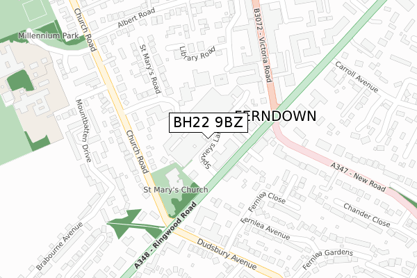
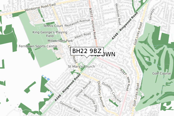
BH22 9BZ is located in the Ferndown North electoral ward, within the unitary authority of Dorset and the English Parliamentary constituency of Christchurch. The Sub Integrated Care Board (ICB) Location is NHS Dorset ICB - 11J and the police force is Dorset. This postcode has been in use since April 2018.


GetTheData
Source: OS Open Zoomstack (Ordnance Survey)
Licence: Open Government Licence (requires attribution)
Attribution: Contains OS data © Crown copyright and database right 2024
Source: Open Postcode Geo
Licence: Open Government Licence (requires attribution)
Attribution: Contains OS data © Crown copyright and database right 2024; Contains Royal Mail data © Royal Mail copyright and database right 2024; Source: Office for National Statistics licensed under the Open Government Licence v.3.0
| Easting | 407670 |
| Northing | 100139 |
| Latitude | 50.800752 |
| Longitude | -1.892521 |
GetTheData
Source: Open Postcode Geo
Licence: Open Government Licence
| Country | England |
| Postcode District | BH22 |
| ➜ BH22 open data dashboard ➜ See where BH22 is on a map ➜ Where is Ferndown? | |
GetTheData
Source: Land Registry Price Paid Data
Licence: Open Government Licence
Elevation or altitude of BH22 9BZ as distance above sea level:
| Metres | Feet | |
|---|---|---|
| Elevation | 30m | 98ft |
Elevation is measured from the approximate centre of the postcode, to the nearest point on an OS contour line from OS Terrain 50, which has contour spacing of ten vertical metres.
➜ How high above sea level am I? Find the elevation of your current position using your device's GPS.
GetTheData
Source: Open Postcode Elevation
Licence: Open Government Licence
| Ward | Ferndown North |
| Constituency | Christchurch |
GetTheData
Source: ONS Postcode Database
Licence: Open Government Licence
| January 2024 | Violence and sexual offences | On or near Petrol Station | 86m |
| January 2024 | Criminal damage and arson | On or near Petrol Station | 86m |
| January 2024 | Shoplifting | On or near Library Road | 215m |
| ➜ Get more crime data in our Crime section | |||
GetTheData
Source: data.police.uk
Licence: Open Government Licence
| Dudsbury Avenue (Ringwood Road) | Ferndown | 181m |
| Town Centre | Ferndown | 199m |
| Town Centre (Victoria Road) | Ferndown | 223m |
| Dudsbury Avenue (Ringwood Road) | Ferndown | 269m |
| Carroll Avenue (Ringwood Road) | Ferndown | 347m |
GetTheData
Source: NaPTAN
Licence: Open Government Licence
GetTheData
Source: ONS Postcode Database
Licence: Open Government Licence


➜ Get more ratings from the Food Standards Agency
GetTheData
Source: Food Standards Agency
Licence: FSA terms & conditions
| Last Collection | |||
|---|---|---|---|
| Location | Mon-Fri | Sat | Distance |
| Ferndown Centre | 17:30 | 12:30 | 143m |
| Ferndown P.o. | 17:30 | 12:30 | 204m |
| Brabourne Ave | 16:00 | 12:00 | 328m |
GetTheData
Source: Dracos
Licence: Creative Commons Attribution-ShareAlike
| Facility | Distance |
|---|---|
| Ferndown Middle School Peter Grant Way, Ferndown Sports Hall | 538m |
| King George V Fields (Ferndown) Peter Grant Way, Ferndown Grass Pitches, Outdoor Tennis Courts | 640m |
| Ferndown Leisure Centre Cherry Grove, Ferndown Sports Hall, Swimming Pool, Health and Fitness Gym, Athletics, Grass Pitches, Squash Courts, Studio | 946m |
GetTheData
Source: Active Places
Licence: Open Government Licence
| School | Phase of Education | Distance |
|---|---|---|
| Ferndown First School Mountbatten Drive, Ferndown, BH22 9FB | Primary | 430m |
| Ferndown Middle School Peter Grant Way, Ferndown, BH22 9UP | Middle deemed secondary | 538m |
| Parley First School Glenmoor Road, Ferndown, BH22 8QE | Primary | 881m |
GetTheData
Source: Edubase
Licence: Open Government Licence
The below table lists the International Territorial Level (ITL) codes (formerly Nomenclature of Territorial Units for Statistics (NUTS) codes) and Local Administrative Units (LAU) codes for BH22 9BZ:
| ITL 1 Code | Name |
|---|---|
| TLK | South West (England) |
| ITL 2 Code | Name |
| TLK2 | Dorset and Somerset |
| ITL 3 Code | Name |
| TLK25 | Dorset |
| LAU 1 Code | Name |
| E06000059 | Dorset |
GetTheData
Source: ONS Postcode Directory
Licence: Open Government Licence
The below table lists the Census Output Area (OA), Lower Layer Super Output Area (LSOA), and Middle Layer Super Output Area (MSOA) for BH22 9BZ:
| Code | Name | |
|---|---|---|
| OA | E00103317 | |
| LSOA | E01020392 | East Dorset 008C |
| MSOA | E02004250 | East Dorset 008 |
GetTheData
Source: ONS Postcode Directory
Licence: Open Government Licence
| BH22 9AG | Ringwood Road | 53m |
| BH22 9AT | Ringwood Road | 102m |
| BH22 9AU | Ringwood Road | 129m |
| BH22 9TH | Pennys Walk | 140m |
| BH22 9HT | Victoria Road | 170m |
| BH22 9HB | St Marys Road | 180m |
| BH22 8HF | Fernlea Avenue | 180m |
| BH22 9ES | Church Road | 195m |
| BH22 9HZ | Victoria Road | 213m |
| BH22 8HH | Fernlea Close | 213m |
GetTheData
Source: Open Postcode Geo; Land Registry Price Paid Data
Licence: Open Government Licence