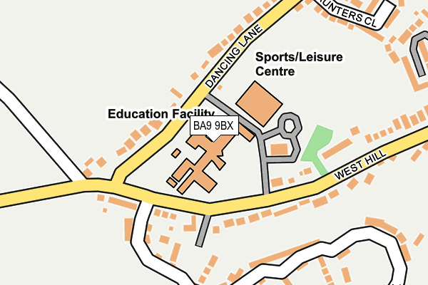
BA9 9BX is located in the Wincanton & Bruton electoral ward, within the unitary authority of Somerset and the English Parliamentary constituency of Somerton and Frome. The Sub Integrated Care Board (ICB) Location is NHS Somerset ICB - 11X and the police force is Avon and Somerset. This postcode has been in use since January 1980.


GetTheData
Source: OS OpenMap – Local (Ordnance Survey)
Source: OS VectorMap District (Ordnance Survey)
Licence: Open Government Licence (requires attribution)
| Easting | 370349 |
| Northing | 128572 |
| Latitude | 51.055718 |
| Longitude | -2.424433 |
GetTheData
Source: Open Postcode Geo
Licence: Open Government Licence
| Country | England |
| Postcode District | BA9 |
| ➜ BA9 open data dashboard ➜ See where BA9 is on a map ➜ Where is Wincanton? | |
GetTheData
Source: Land Registry Price Paid Data
Licence: Open Government Licence
Elevation or altitude of BA9 9BX as distance above sea level:
| Metres | Feet | |
|---|---|---|
| Elevation | 110m | 361ft |
Elevation is measured from the approximate centre of the postcode, to the nearest point on an OS contour line from OS Terrain 50, which has contour spacing of ten vertical metres.
➜ How high above sea level am I? Find the elevation of your current position using your device's GPS.
GetTheData
Source: Open Postcode Elevation
Licence: Open Government Licence
| Ward | Wincanton & Bruton |
| Constituency | Somerton And Frome |
GetTheData
Source: ONS Postcode Database
Licence: Open Government Licence
| August 2023 | Violence and sexual offences | On or near Grants Close | 356m |
| November 2022 | Violence and sexual offences | On or near Saunters Close | 262m |
| June 2022 | Violence and sexual offences | On or near Dancing Lane | 273m |
| ➜ Get more crime data in our Crime section | |||
GetTheData
Source: data.police.uk
Licence: Open Government Licence
| King Arthur's School (West Hill) | West Hill | 127m |
| King Arthur's School (West Hill) | West Hill | 132m |
| West Hill House (West Hill) | West Hill | 219m |
| The Mount (West Hill) | West Hill | 261m |
| Springfield Road | Verrington | 371m |
GetTheData
Source: NaPTAN
Licence: Open Government Licence
GetTheData
Source: ONS Postcode Database
Licence: Open Government Licence


➜ Get more ratings from the Food Standards Agency
GetTheData
Source: Food Standards Agency
Licence: FSA terms & conditions
| Last Collection | |||
|---|---|---|---|
| Location | Mon-Fri | Sat | Distance |
| North Street | 17:30 | 11:30 | 800m |
| South Road | 17:30 | 11:30 | 966m |
| Shalford | 11:00 | 09:30 | 2,285m |
GetTheData
Source: Dracos
Licence: Creative Commons Attribution-ShareAlike
| Facility | Distance |
|---|---|
| King Arthurs Community School And Specialist Sports College West Hill, Wincanton Grass Pitches, Sports Hall, Studio, Outdoor Tennis Courts | 0m |
| Wincanton Sports Centre West Hill, Wincanton Sports Hall, Swimming Pool, Health and Fitness Gym, Studio | 84m |
| Wincanton Cricket Club Station Road, Wincanton Grass Pitches | 540m |
GetTheData
Source: Active Places
Licence: Open Government Licence
| School | Phase of Education | Distance |
|---|---|---|
| King Arthur's School West Hill, Wincanton, BA9 9BX | Secondary | 0m |
| Wincanton Primary School Station Road, Wincanton, BA9 9EL | Primary | 928m |
| Our Lady of Mount Carmel Catholic Primary Tout Hill, Wincanton, BA9 9DH | Primary | 982m |
GetTheData
Source: Edubase
Licence: Open Government Licence
The below table lists the International Territorial Level (ITL) codes (formerly Nomenclature of Territorial Units for Statistics (NUTS) codes) and Local Administrative Units (LAU) codes for BA9 9BX:
| ITL 1 Code | Name |
|---|---|
| TLK | South West (England) |
| ITL 2 Code | Name |
| TLK2 | Dorset and Somerset |
| ITL 3 Code | Name |
| TLK23 | Somerset CC |
| LAU 1 Code | Name |
| E07000189 | South Somerset |
GetTheData
Source: ONS Postcode Directory
Licence: Open Government Licence
The below table lists the Census Output Area (OA), Lower Layer Super Output Area (LSOA), and Middle Layer Super Output Area (MSOA) for BA9 9BX:
| Code | Name | |
|---|---|---|
| OA | E00148889 | |
| LSOA | E01029227 | South Somerset 005B |
| MSOA | E02006079 | South Somerset 005 |
GetTheData
Source: ONS Postcode Directory
Licence: Open Government Licence
| BA9 9DF | Dancing Lane | 80m |
| BA9 9BU | West Hill | 123m |
| BA9 9DE | Dancing Lane | 141m |
| BA9 9GA | Atkins Hill | 178m |
| BA9 9BY | West Hill | 220m |
| BA9 9FZ | Atkins Hill | 230m |
| BA9 9BZ | West Hill | 279m |
| BA9 9QB | Saunters Close | 282m |
| BA9 9FX | Crocker Way | 289m |
| BA9 9NS | Grants Close | 320m |
GetTheData
Source: Open Postcode Geo; Land Registry Price Paid Data
Licence: Open Government Licence