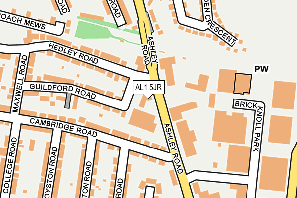
AL1 5JR is located in the Clarence electoral ward, within the local authority district of St Albans and the English Parliamentary constituency of St Albans. The Sub Integrated Care Board (ICB) Location is NHS Hertfordshire and West Essex ICB - 06N and the police force is Hertfordshire. This postcode has been in use since January 1980.


GetTheData
Source: OS OpenMap – Local (Ordnance Survey)
Source: OS VectorMap District (Ordnance Survey)
Licence: Open Government Licence (requires attribution)
| Easting | 517061 |
| Northing | 206969 |
| Latitude | 51.749202 |
| Longitude | -0.305658 |
GetTheData
Source: Open Postcode Geo
Licence: Open Government Licence
| Country | England |
| Postcode District | AL1 |
| ➜ AL1 open data dashboard ➜ See where AL1 is on a map ➜ Where is St Albans? | |
GetTheData
Source: Land Registry Price Paid Data
Licence: Open Government Licence
Elevation or altitude of AL1 5JR as distance above sea level:
| Metres | Feet | |
|---|---|---|
| Elevation | 90m | 295ft |
Elevation is measured from the approximate centre of the postcode, to the nearest point on an OS contour line from OS Terrain 50, which has contour spacing of ten vertical metres.
➜ How high above sea level am I? Find the elevation of your current position using your device's GPS.
GetTheData
Source: Open Postcode Elevation
Licence: Open Government Licence
| Ward | Clarence |
| Constituency | St Albans |
GetTheData
Source: ONS Postcode Database
Licence: Open Government Licence
| January 2024 | Burglary | On or near Ashley Road | 32m |
| January 2024 | Violence and sexual offences | On or near Buttermere Close | 489m |
| December 2023 | Violence and sexual offences | On or near Buttermere Close | 489m |
| ➜ Get more crime data in our Crime section | |||
GetTheData
Source: data.police.uk
Licence: Open Government Licence
| Industrial Estate (Ashley Road) | Cell Barnes | 213m |
| Oakdene Way (Ashley Road) | Fleetville | 233m |
| Oakdene Way (Ashley Road) | Fleetville | 254m |
| Industrial Estate (Ashley Road) | Cell Barnes | 283m |
| Russet Drive (Hill End Lane) | Hill End | 326m |
| St Albans City Station | 1.5km |
| St Albans Abbey Station | 2.6km |
| Park Street Station | 3.6km |
GetTheData
Source: NaPTAN
Licence: Open Government Licence
| Percentage of properties with Next Generation Access | 100.0% |
| Percentage of properties with Superfast Broadband | 100.0% |
| Percentage of properties with Ultrafast Broadband | 100.0% |
| Percentage of properties with Full Fibre Broadband | 0.0% |
Superfast Broadband is between 30Mbps and 300Mbps
Ultrafast Broadband is > 300Mbps
| Percentage of properties unable to receive 2Mbps | 0.0% |
| Percentage of properties unable to receive 5Mbps | 0.0% |
| Percentage of properties unable to receive 10Mbps | 0.0% |
| Percentage of properties unable to receive 30Mbps | 0.0% |
GetTheData
Source: Ofcom
Licence: Ofcom Terms of Use (requires attribution)
GetTheData
Source: ONS Postcode Database
Licence: Open Government Licence


➜ Get more ratings from the Food Standards Agency
GetTheData
Source: Food Standards Agency
Licence: FSA terms & conditions
| Last Collection | |||
|---|---|---|---|
| Location | Mon-Fri | Sat | Distance |
| Ashley Road Hedley Road | 17:30 | 12:00 | 27m |
| St Albans Delivery Office | 19:00 | 12:30 | 310m |
| Cambridge Road | 17:30 | 12:00 | 356m |
GetTheData
Source: Dracos
Licence: Creative Commons Attribution-ShareAlike
| Facility | Distance |
|---|---|
| Windermere Primary School Windermere Avenue, St. Albans Grass Pitches | 603m |
| Ymca St Albans Russet Drive, St. Albans Sports Hall, Health and Fitness Gym, Studio, Artificial Grass Pitch | 630m |
| Fleetville Junior School Hatfield Road, St. Albans Grass Pitches, Sports Hall | 669m |
GetTheData
Source: Active Places
Licence: Open Government Licence
| School | Phase of Education | Distance |
|---|---|---|
| Camp Primary and Nursery School Camp Road, St Albans, AL1 5PG | Primary | 375m |
| Windermere Primary School Windermere Avenue, St. Albans, AL1 5QP | Primary | 603m |
| Fleetville Infant and Nursery School Royal Road, St Albans, AL1 4LX | Primary | 608m |
GetTheData
Source: Edubase
Licence: Open Government Licence
The below table lists the International Territorial Level (ITL) codes (formerly Nomenclature of Territorial Units for Statistics (NUTS) codes) and Local Administrative Units (LAU) codes for AL1 5JR:
| ITL 1 Code | Name |
|---|---|
| TLH | East |
| ITL 2 Code | Name |
| TLH2 | Bedfordshire and Hertfordshire |
| ITL 3 Code | Name |
| TLH23 | Hertfordshire CC |
| LAU 1 Code | Name |
| E07000240 | St Albans |
GetTheData
Source: ONS Postcode Directory
Licence: Open Government Licence
The below table lists the Census Output Area (OA), Lower Layer Super Output Area (LSOA), and Middle Layer Super Output Area (MSOA) for AL1 5JR:
| Code | Name | |
|---|---|---|
| OA | E00120193 | |
| LSOA | E01023667 | St Albans 013C |
| MSOA | E02004936 | St Albans 013 |
GetTheData
Source: ONS Postcode Directory
Licence: Open Government Licence
| AL1 5LG | Cambridge Road | 106m |
| AL1 5GA | Berkeley Mews | 108m |
| AL1 5LF | Cambridge Road | 109m |
| AL1 5JX | Guildford Road | 115m |
| AL1 5JP | Hedley Road | 125m |
| AL1 5DE | Ashley Road | 126m |
| AL1 5JL | Hedley Road | 142m |
| AL1 5DR | Carlbury Close | 161m |
| AL1 5LE | Cambridge Road | 161m |
| AL1 5DD | Linden Crescent | 183m |
GetTheData
Source: Open Postcode Geo; Land Registry Price Paid Data
Licence: Open Government Licence