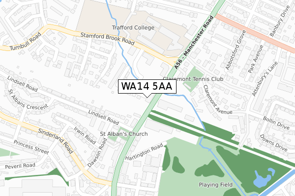
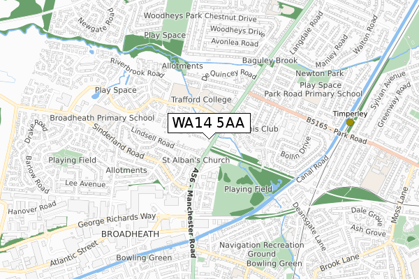
WA14 5AA is located in the Broadheath electoral ward, within the metropolitan district of Trafford and the English Parliamentary constituency of Altrincham and Sale West. The Sub Integrated Care Board (ICB) Location is NHS Greater Manchester ICB - 02A and the police force is Greater Manchester. This postcode has been in use since September 2018.


GetTheData
Source: OS Open Zoomstack (Ordnance Survey)
Licence: Open Government Licence (requires attribution)
Attribution: Contains OS data © Crown copyright and database right 2024
Source: Open Postcode Geo
Licence: Open Government Licence (requires attribution)
Attribution: Contains OS data © Crown copyright and database right 2024; Contains Royal Mail data © Royal Mail copyright and database right 2024; Source: Office for National Statistics licensed under the Open Government Licence v.3.0
| Easting | 376776 |
| Northing | 389695 |
| Latitude | 53.403576 |
| Longitude | -2.350778 |
GetTheData
Source: Open Postcode Geo
Licence: Open Government Licence
| Country | England |
| Postcode District | WA14 |
| ➜ WA14 open data dashboard ➜ See where WA14 is on a map ➜ Where is Altrincham? | |
GetTheData
Source: Land Registry Price Paid Data
Licence: Open Government Licence
| Ward | Broadheath |
| Constituency | Altrincham And Sale West |
GetTheData
Source: ONS Postcode Database
Licence: Open Government Licence
| Manchester Road/Railway Bridge (Manchester Road) | Broadheath | 52m |
| Manchester Road/Railway Bridge (Manchester Road) | Broadheath | 54m |
| Manchester Rd/Stamford Brook Rd (Manchester Rd) | Broadheath | 89m |
| Manchester Rd/Lindsell Rd (Manchester Road) | Broadheath | 100m |
| Manchester Rd/Trafford College (Manchester Road) | Broadheath | 211m |
| Timperley (Manchester Metrolink) (Park Road) | Timperley | 805m |
| Navigation Road (Manchester Metrolink) (Navigation Road) | Navigation Road | 1,050m |
| Navigation Road Station | 1km |
| Altrincham Station | 1.8km |
| Hale Station | 2.8km |
GetTheData
Source: NaPTAN
Licence: Open Government Licence
➜ Broadband speed and availability dashboard for WA14 5AA
| Percentage of properties with Next Generation Access | 100.0% |
| Percentage of properties with Superfast Broadband | 100.0% |
| Percentage of properties with Ultrafast Broadband | 0.0% |
| Percentage of properties with Full Fibre Broadband | 0.0% |
Superfast Broadband is between 30Mbps and 300Mbps
Ultrafast Broadband is > 300Mbps
| Median download speed | 39.1Mbps |
| Average download speed | 35.7Mbps |
| Maximum download speed | 60.06Mbps |
| Median upload speed | 9.8Mbps |
| Average upload speed | 8.7Mbps |
| Maximum upload speed | 17.76Mbps |
| Percentage of properties unable to receive 2Mbps | 0.0% |
| Percentage of properties unable to receive 5Mbps | 0.0% |
| Percentage of properties unable to receive 10Mbps | 0.0% |
| Percentage of properties unable to receive 30Mbps | 0.0% |
➜ Broadband speed and availability dashboard for WA14 5AA
GetTheData
Source: Ofcom
Licence: Ofcom Terms of Use (requires attribution)
GetTheData
Source: ONS Postcode Database
Licence: Open Government Licence


➜ Get more ratings from the Food Standards Agency
GetTheData
Source: Food Standards Agency
Licence: FSA terms & conditions
| Last Collection | |||
|---|---|---|---|
| Location | Mon-Fri | Sat | Distance |
| Lindsell Road | 16:00 | 11:00 | 165m |
| Outside Co-op | 17:30 | 12:00 | 400m |
| Peveril Road | 16:00 | 11:00 | 615m |
GetTheData
Source: Dracos
Licence: Creative Commons Attribution-ShareAlike
| Facility | Distance |
|---|---|
| Claremont Tennis Club Claremont Drive, West Timperley, Altrincham Outdoor Tennis Courts | 142m |
| Trafford College (Altrincham) Manchester Road, West Timperley, Altrincham Health and Fitness Gym, Artificial Grass Pitch, Sports Hall | 189m |
| Salisbury Road Playing Fields Salisbury Road, Altrincham Grass Pitches | 329m |
GetTheData
Source: Active Places
Licence: Open Government Licence
| School | Phase of Education | Distance |
|---|---|---|
| The Trafford and Stockport College Group Manchester Road, Altrincham, WA14 5PQ | 16 plus | 228m |
| Broadheath Primary School Sinderland Road, Broadheath, Altrincham, WA14 5JQ | Primary | 619m |
| Trafford Alternative Education Provision Brentwood Avenue, Timperley, Altrincham, WA14 1SR | Not applicable | 742m |
GetTheData
Source: Edubase
Licence: Open Government Licence
| Risk of WA14 5AA flooding from rivers and sea | Very Low |
| ➜ WA14 5AA flood map | |
GetTheData
Source: Open Flood Risk by Postcode
Licence: Open Government Licence
The below table lists the International Territorial Level (ITL) codes (formerly Nomenclature of Territorial Units for Statistics (NUTS) codes) and Local Administrative Units (LAU) codes for WA14 5AA:
| ITL 1 Code | Name |
|---|---|
| TLD | North West (England) |
| ITL 2 Code | Name |
| TLD3 | Greater Manchester |
| ITL 3 Code | Name |
| TLD34 | Greater Manchester South West |
| LAU 1 Code | Name |
| E08000009 | Trafford |
GetTheData
Source: ONS Postcode Directory
Licence: Open Government Licence
The below table lists the Census Output Area (OA), Lower Layer Super Output Area (LSOA), and Middle Layer Super Output Area (MSOA) for WA14 5AA:
| Code | Name | |
|---|---|---|
| OA | E00030881 | |
| LSOA | E01006089 | Trafford 024C |
| MSOA | E02001282 | Trafford 024 |
GetTheData
Source: ONS Postcode Directory
Licence: Open Government Licence
| WA14 5PB | Manchester Road | 88m |
| WA14 5GQ | Berryfield Gardens | 132m |
| WA14 5LZ | Manchester Road | 146m |
| WA14 5NG | Arley Close | 159m |
| WA14 5HN | Sandiacre | 185m |
| WA14 5GN | Provender Close | 194m |
| WA14 5NX | Lindsell Road | 203m |
| WA14 5PQ | Manchester Road | 228m |
| WA14 5NB | Manchester Road | 238m |
| WA14 5NF | Claremont Avenue | 243m |
GetTheData
Source: Open Postcode Geo; Land Registry Price Paid Data
Licence: Open Government Licence