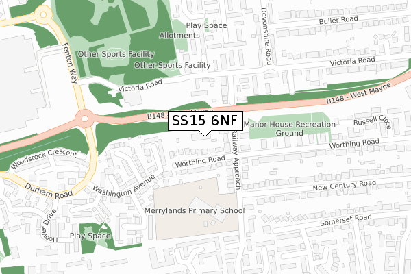
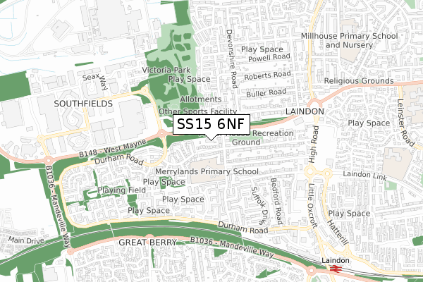
SS15 6NF is located in the Laindon Park electoral ward, within the local authority district of Basildon and the English Parliamentary constituency of Basildon and Billericay. The Sub Integrated Care Board (ICB) Location is NHS Mid and South Essex ICB - 99E and the police force is Essex. This postcode has been in use since October 2017.


GetTheData
Source: OS Open Zoomstack (Ordnance Survey)
Licence: Open Government Licence (requires attribution)
Attribution: Contains OS data © Crown copyright and database right 2024
Source: Open Postcode Geo
Licence: Open Government Licence (requires attribution)
Attribution: Contains OS data © Crown copyright and database right 2024; Contains Royal Mail data © Royal Mail copyright and database right 2024; Source: Office for National Statistics licensed under the Open Government Licence v.3.0
| Easting | 567334 |
| Northing | 188950 |
| Latitude | 51.574585 |
| Longitude | 0.413380 |
GetTheData
Source: Open Postcode Geo
Licence: Open Government Licence
| Country | England |
| Postcode District | SS15 |
| ➜ SS15 open data dashboard ➜ See where SS15 is on a map ➜ Where is Basildon? | |
GetTheData
Source: Land Registry Price Paid Data
Licence: Open Government Licence
| Ward | Laindon Park |
| Constituency | Basildon And Billericay |
GetTheData
Source: ONS Postcode Database
Licence: Open Government Licence
2022 13 OCT £472,500 |
2022 27 JUL £510,000 |
2022 28 JAN £470,000 |
2018 10 MAY £360,000 |
3, RAILWAY MEWS, BASILDON, SS15 6NF 2018 2 MAY £420,000 |
2, RAILWAY MEWS, BASILDON, SS15 6NF 2018 24 APR £420,000 |
4, RAILWAY MEWS, BASILDON, SS15 6NF 2018 13 MAR £420,000 |
2017 22 SEP £425,000 |
GetTheData
Source: HM Land Registry Price Paid Data
Licence: Contains HM Land Registry data © Crown copyright and database right 2024. This data is licensed under the Open Government Licence v3.0.
| January 2024 | Burglary | On or near Hoover Drive | 418m |
| January 2024 | Burglary | On or near Hoover Drive | 418m |
| January 2024 | Burglary | On or near Hoover Drive | 418m |
| ➜ Get more crime data in our Crime section | |||
GetTheData
Source: data.police.uk
Licence: Open Government Licence
| Victoria Road | Laindon | 154m |
| Victoria Road | Laindon | 175m |
| Fenton Way (Victoria Road) | Laindon | 311m |
| Fenton Way | Laindon | 323m |
| Hoover Drive (Durham Road) | Laindon | 424m |
| Laindon Station | 1.1km |
| Basildon Station | 3.1km |
GetTheData
Source: NaPTAN
Licence: Open Government Licence
➜ Broadband speed and availability dashboard for SS15 6NF
| Percentage of properties with Next Generation Access | 100.0% |
| Percentage of properties with Superfast Broadband | 100.0% |
| Percentage of properties with Ultrafast Broadband | 0.0% |
| Percentage of properties with Full Fibre Broadband | 0.0% |
Superfast Broadband is between 30Mbps and 300Mbps
Ultrafast Broadband is > 300Mbps
| Median download speed | 38.1Mbps |
| Average download speed | 31.0Mbps |
| Maximum download speed | 45.47Mbps |
| Median upload speed | 6.4Mbps |
| Average upload speed | 6.4Mbps |
| Maximum upload speed | 8.09Mbps |
| Percentage of properties unable to receive 2Mbps | 0.0% |
| Percentage of properties unable to receive 5Mbps | 0.0% |
| Percentage of properties unable to receive 10Mbps | 0.0% |
| Percentage of properties unable to receive 30Mbps | 0.0% |
➜ Broadband speed and availability dashboard for SS15 6NF
GetTheData
Source: Ofcom
Licence: Ofcom Terms of Use (requires attribution)
GetTheData
Source: ONS Postcode Database
Licence: Open Government Licence


➜ Get more ratings from the Food Standards Agency
GetTheData
Source: Food Standards Agency
Licence: FSA terms & conditions
| Last Collection | |||
|---|---|---|---|
| Location | Mon-Fri | Sat | Distance |
| Railway Approach | 17:30 | 12:00 | 126m |
| Hornbeam Way | 17:45 | 12:00 | 727m |
| Somercotes | 17:30 | 11:45 | 1,348m |
GetTheData
Source: Dracos
Licence: Creative Commons Attribution-ShareAlike
| Facility | Distance |
|---|---|
| Merrylands Primary School Cumberland Drive, Cumberland Drive, Basildon Grass Pitches | 171m |
| Laindon School (Closed) High Road, Laindon, Basildon Grass Pitches | 961m |
| Millhouse Primary School And Nursery Tavistock Road, Tavistock Road, Basildon Grass Pitches | 1.1km |
GetTheData
Source: Active Places
Licence: Open Government Licence
| School | Phase of Education | Distance |
|---|---|---|
| Merrylands Primary School Cumberland Drive, Laindon, Basildon, SS15 6QS | Primary | 353m |
| Millhouse Primary School Tavistock Road, Laindon, Basildon, SS15 5QF | Primary | 1.1km |
| The Phoenix Primary School Leinster Road, Laindon, Basildon, SS15 5NQ | Primary | 1.1km |
GetTheData
Source: Edubase
Licence: Open Government Licence
The below table lists the International Territorial Level (ITL) codes (formerly Nomenclature of Territorial Units for Statistics (NUTS) codes) and Local Administrative Units (LAU) codes for SS15 6NF:
| ITL 1 Code | Name |
|---|---|
| TLH | East |
| ITL 2 Code | Name |
| TLH3 | Essex |
| ITL 3 Code | Name |
| TLH37 | Essex Thames Gateway |
| LAU 1 Code | Name |
| E07000066 | Basildon |
GetTheData
Source: ONS Postcode Directory
Licence: Open Government Licence
The below table lists the Census Output Area (OA), Lower Layer Super Output Area (LSOA), and Middle Layer Super Output Area (MSOA) for SS15 6NF:
| Code | Name | |
|---|---|---|
| OA | E00108076 | |
| LSOA | E01021275 | Basildon 014B |
| MSOA | E02004437 | Basildon 014 |
GetTheData
Source: ONS Postcode Directory
Licence: Open Government Licence
| SS15 6JU | Worthing Road | 40m |
| SS15 6JT | Railway Approach | 94m |
| SS15 6RQ | Victoria Road | 107m |
| SS15 6JX | Railway Approach | 115m |
| SS15 6JN | Roosevelt Road | 116m |
| SS15 6JW | Washington Avenue | 195m |
| SS15 6RB | Victoria Road | 198m |
| SS15 6RA | Victoria Road | 204m |
| SS15 6AJ | Worthing Road | 206m |
| SS15 6JR | Eisenhower Road | 210m |
GetTheData
Source: Open Postcode Geo; Land Registry Price Paid Data
Licence: Open Government Licence