SN1 1BE maps, stats, and open data
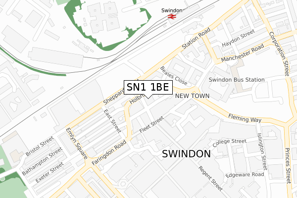
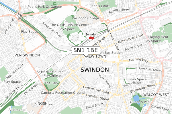
SN1 1BE lies on Holbrook Way in Swindon. SN1 1BE is located in the Central electoral ward, within the unitary authority of Swindon and the English Parliamentary constituency of South Swindon. The Sub Integrated Care Board (ICB) Location is NHS Bath and North East Somerset, Swindon and Wiltshire ICB - 92 and the police force is Wiltshire. This postcode has been in use since October 2002.
SN1 1BE maps


Licence: Open Government Licence (requires attribution)
Attribution: Contains OS data © Crown copyright and database right 2026
Source: Open Postcode Geo
Licence: Open Government Licence (requires attribution)
Attribution: Contains OS data © Crown copyright and database right 2026; Contains Royal Mail data © Royal Mail copyright and database right 2026; Source: Office for National Statistics licensed under the Open Government Licence v.3.0
SN1 1BE geodata
| Easting | 414841 |
| Northing | 184945 |
| Latitude | 51.563190 |
| Longitude | -1.787296 |
Where is SN1 1BE?
| Street | Holbrook Way |
| Town/City | Swindon |
| Country | England |
| Postcode District | SN1 |
SN1 1BE Elevation
Elevation or altitude of SN1 1BE as distance above sea level:
| Metres | Feet | |
|---|---|---|
| Elevation | 100m | 328ft |
Elevation is measured from the approximate centre of the postcode, to the nearest point on an OS contour line from OS Terrain 50, which has contour spacing of ten vertical metres.
➜ How high above sea level am I? Find the elevation of your current position using your device's GPS.
Politics
| Ward | Central |
|---|---|
| Constituency | South Swindon |
Transport
Nearest bus stops to SN1 1BE
| Sheppard Street | Swindon | 86m |
| Catherine Street | Swindon | 110m |
| Fleming Way | Swindon | 190m |
| Fleming Way | Swindon | 198m |
| Fleming Way | Swindon | 207m |
Nearest railway stations to SN1 1BE
| Swindon Station | 0.3km |
Broadband
Broadband access in SN1 1BE (2020 data)
| Percentage of properties with Next Generation Access | 100.0% |
| Percentage of properties with Superfast Broadband | 100.0% |
| Percentage of properties with Ultrafast Broadband | 100.0% |
| Percentage of properties with Full Fibre Broadband | 100.0% |
Superfast Broadband is between 30Mbps and 300Mbps
Ultrafast Broadband is > 300Mbps
Broadband speed in SN1 1BE (2019 data)
Download
| Median download speed | 30.0Mbps |
| Average download speed | 37.9Mbps |
| Maximum download speed | 77.61Mbps |
Upload
| Median upload speed | 6.6Mbps |
| Average upload speed | 6.7Mbps |
| Maximum upload speed | 17.70Mbps |
Broadband limitations in SN1 1BE (2020 data)
| Percentage of properties unable to receive 2Mbps | 0.0% |
| Percentage of properties unable to receive 5Mbps | 0.0% |
| Percentage of properties unable to receive 10Mbps | 0.0% |
| Percentage of properties unable to receive 30Mbps | 0.0% |
SN1 1BE gas and electricity consumption
Estimated total energy consumption in SN1 1BE by fuel type, 2015.
Gas
| Consumption (kWh) | 229,484 |
|---|---|
| Meter count | 22 |
| Mean (kWh/meter) | 10,431 |
| Median (kWh/meter) | 9,116 |
- Consumption: The estimated total energy consumption, in kWh, across all meters in SN1 1BE, for 2015.
- Meter count: The total number of meters in SN1 1BE.
- Mean: The mean average consumption per meter, in kWh.
- Median: The median average consumption per meter, in kWh.
Source: Postcode level electricity estimates: 2015 (experimental)
Licence: Open Government Licence
Deprivation
82.5% of English postcodes are less deprived than SN1 1BE:Food Standards Agency
Three nearest food hygiene ratings to SN1 1BE (metres)


➜ Get more ratings from the Food Standards Agency
Nearest post box to SN1 1BE
| Last Collection | |||
|---|---|---|---|
| Location | Mon-Fri | Sat | Distance |
| Fleet Street | 18:30 | 12:00 | 76m |
| Canal Walk | 18:30 | 12:00 | 246m |
| Fleming Way | 18:30 | 12:00 | 252m |
SN1 1BE ITL and SN1 1BE LAU
The below table lists the International Territorial Level (ITL) codes (formerly Nomenclature of Territorial Units for Statistics (NUTS) codes) and Local Administrative Units (LAU) codes for SN1 1BE:
| ITL 1 Code | Name |
|---|---|
| TLK | South West (England) |
| ITL 2 Code | Name |
| TLK1 | Gloucestershire, Wiltshire and Bath/Bristol area |
| ITL 3 Code | Name |
| TLK14 | Swindon |
| LAU 1 Code | Name |
| E06000030 | Swindon |
SN1 1BE census areas
The below table lists the Census Output Area (OA), Lower Layer Super Output Area (LSOA), and Middle Layer Super Output Area (MSOA) for SN1 1BE:
| Code | Name | |
|---|---|---|
| OA | E00166492 | |
| LSOA | E01015476 | Swindon 015B |
| MSOA | E02003226 | Swindon 015 |
Nearest postcodes to SN1 1BE
| SN1 1BT | Bridge Street | 42m |
| SN1 1RQ | Fleet Street | 55m |
| SN1 1RL | Fleet Street | 68m |
| SN1 1RE | Fleet Street | 94m |
| SN1 5DB | Sheppard Street | 96m |
| SN1 5BY | Holbrook Way | 103m |
| SN1 5AF | Harding Street | 124m |
| SN1 5BX | Henry Street | 126m |
| SN1 1BP | Bridge Street | 134m |
| SN1 1BL | Bridge Street | 143m |