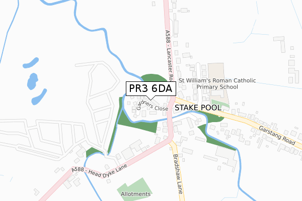
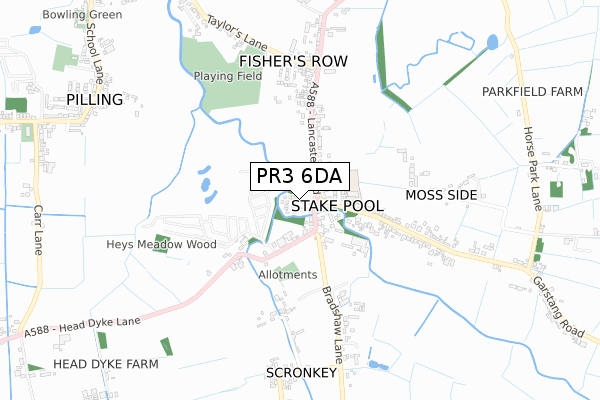
PR3 6DA is located in the Pilling electoral ward, within the local authority district of Wyre and the English Parliamentary constituency of Lancaster and Fleetwood. The Sub Integrated Care Board (ICB) Location is NHS Lancashire and South Cumbria ICB - 02M and the police force is Lancashire. This postcode has been in use since February 2018.


GetTheData
Source: OS Open Zoomstack (Ordnance Survey)
Licence: Open Government Licence (requires attribution)
Attribution: Contains OS data © Crown copyright and database right 2024
Source: Open Postcode Geo
Licence: Open Government Licence (requires attribution)
Attribution: Contains OS data © Crown copyright and database right 2024; Contains Royal Mail data © Royal Mail copyright and database right 2024; Source: Office for National Statistics licensed under the Open Government Licence v.3.0
| Easting | 341203 |
| Northing | 447864 |
| Latitude | 53.923570 |
| Longitude | -2.896813 |
GetTheData
Source: Open Postcode Geo
Licence: Open Government Licence
| Country | England |
| Postcode District | PR3 |
| ➜ PR3 open data dashboard ➜ See where PR3 is on a map ➜ Where is Stake Pool? | |
GetTheData
Source: Land Registry Price Paid Data
Licence: Open Government Licence
| Ward | Pilling |
| Constituency | Lancaster And Fleetwood |
GetTheData
Source: ONS Postcode Database
Licence: Open Government Licence
| June 2022 | Violence and sexual offences | On or near Stakepool Drive | 184m |
| June 2022 | Public order | On or near Stakepool Drive | 184m |
| June 2022 | Anti-social behaviour | On or near Stakepool Drive | 184m |
| ➜ Get more crime data in our Crime section | |||
GetTheData
Source: data.police.uk
Licence: Open Government Licence
| Elletsons Arms (Lancaster Road) | Stake Pool | 80m |
| Ellletson Arms (Lancaster Road) | Stake Pool | 109m |
| St Williams Rc School (Garstang Road) | Stake Pool | 207m |
| Taylors Lane | Pilling | 572m |
| Scronkey Farm (Lancaster Road) | Scronkey | 716m |
GetTheData
Source: NaPTAN
Licence: Open Government Licence
| Percentage of properties with Next Generation Access | 85.7% |
| Percentage of properties with Superfast Broadband | 85.7% |
| Percentage of properties with Ultrafast Broadband | 85.7% |
| Percentage of properties with Full Fibre Broadband | 85.7% |
Superfast Broadband is between 30Mbps and 300Mbps
Ultrafast Broadband is > 300Mbps
| Percentage of properties unable to receive 2Mbps | 0.0% |
| Percentage of properties unable to receive 5Mbps | 0.0% |
| Percentage of properties unable to receive 10Mbps | 0.0% |
| Percentage of properties unable to receive 30Mbps | 14.3% |
GetTheData
Source: Ofcom
Licence: Ofcom Terms of Use (requires attribution)
GetTheData
Source: ONS Postcode Database
Licence: Open Government Licence


➜ Get more ratings from the Food Standards Agency
GetTheData
Source: Food Standards Agency
Licence: FSA terms & conditions
| Last Collection | |||
|---|---|---|---|
| Location | Mon-Fri | Sat | Distance |
| 1 Smithy Lane | 17:00 | 11:15 | 4,063m |
| Stalmine Post Office | 17:00 | 11:15 | 4,471m |
| Stricklands Lane | 17:00 | 11:30 | 4,473m |
GetTheData
Source: Dracos
Licence: Creative Commons Attribution-ShareAlike
| Facility | Distance |
|---|---|
| St William's Catholic Primary School Garstang Road, Pilling, Preston Grass Pitches | 233m |
| Pilling Playing Fields Taylors Lane, Pilling, Preston Grass Pitches | 673m |
| Pilling St Johns C Of E Primary School Fluke Hall Lane, Pilling, Preston Grass Pitches | 1.3km |
GetTheData
Source: Active Places
Licence: Open Government Licence
| School | Phase of Education | Distance |
|---|---|---|
| St William's Catholic Primary School, Pilling Garstang Road, Pilling, Preston, PR3 6AL | Primary | 217m |
| Pilling St John's Church of England Voluntary Aided Primary School Ladies Hill, Pilling, Preston, PR3 6HA | Primary | 1.3km |
| Springfield House School Wheel Lane, Pilling, Lancashire, PR3 6HL | Not applicable | 2km |
GetTheData
Source: Edubase
Licence: Open Government Licence
| Risk of PR3 6DA flooding from rivers and sea | Low |
| ➜ PR3 6DA flood map | |
GetTheData
Source: Open Flood Risk by Postcode
Licence: Open Government Licence
The below table lists the International Territorial Level (ITL) codes (formerly Nomenclature of Territorial Units for Statistics (NUTS) codes) and Local Administrative Units (LAU) codes for PR3 6DA:
| ITL 1 Code | Name |
|---|---|
| TLD | North West (England) |
| ITL 2 Code | Name |
| TLD4 | Lancashire |
| ITL 3 Code | Name |
| TLD44 | Lancaster and Wyre |
| LAU 1 Code | Name |
| E07000128 | Wyre |
GetTheData
Source: ONS Postcode Directory
Licence: Open Government Licence
The below table lists the Census Output Area (OA), Lower Layer Super Output Area (LSOA), and Middle Layer Super Output Area (MSOA) for PR3 6DA:
| Code | Name | |
|---|---|---|
| OA | E00129840 | |
| LSOA | E01025585 | Wyre 009C |
| MSOA | E02005327 | Wyre 009 |
GetTheData
Source: ONS Postcode Directory
Licence: Open Government Licence
| PR3 6AH | 112m | |
| PR3 6BU | Stakepool Drive | 176m |
| PR3 6AE | Lancaster Road | 327m |
| PR3 6AL | Garstang Road | 358m |
| PR3 6BG | Field House Lane | 428m |
| PR3 6SN | Bradshaw Lane | 453m |
| PR3 6SJ | Head Dyke Lane | 472m |
| PR3 6AF | Laburnum Cottages | 583m |
| PR3 6AQ | Garstang Road | 603m |
| PR3 6AG | Tarnbrook Cottages | 614m |
GetTheData
Source: Open Postcode Geo; Land Registry Price Paid Data
Licence: Open Government Licence