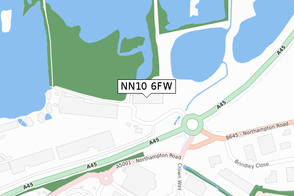
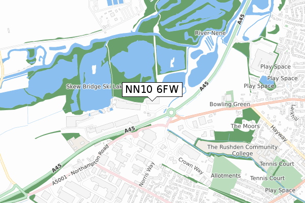
NN10 6FW is located in the Higham Ferrers electoral ward, within the unitary authority of North Northamptonshire and the English Parliamentary constituency of Wellingborough. The Sub Integrated Care Board (ICB) Location is NHS Northamptonshire ICB - 78H and the police force is Northamptonshire. This postcode has been in use since August 2018.


GetTheData
Source: OS Open Zoomstack (Ordnance Survey)
Licence: Open Government Licence (requires attribution)
Attribution: Contains OS data © Crown copyright and database right 2024
Source: Open Postcode Geo
Licence: Open Government Licence (requires attribution)
Attribution: Contains OS data © Crown copyright and database right 2024; Contains Royal Mail data © Royal Mail copyright and database right 2024; Source: Office for National Statistics licensed under the Open Government Licence v.3.0
| Easting | 494261 |
| Northing | 267998 |
| Latitude | 52.302039 |
| Longitude | -0.619035 |
GetTheData
Source: Open Postcode Geo
Licence: Open Government Licence
| Country | England |
| Postcode District | NN10 |
| ➜ NN10 open data dashboard ➜ See where NN10 is on a map ➜ Where is Rushden? | |
GetTheData
Source: Land Registry Price Paid Data
Licence: Open Government Licence
| Ward | Higham Ferrers |
| Constituency | Wellingborough |
GetTheData
Source: ONS Postcode Database
Licence: Open Government Licence
| June 2022 | Criminal damage and arson | On or near Park/Open Space | 205m |
| June 2022 | Criminal damage and arson | On or near Park/Open Space | 205m |
| June 2022 | Other theft | On or near Park/Open Space | 205m |
| ➜ Get more crime data in our Crime section | |||
GetTheData
Source: data.police.uk
Licence: Open Government Licence
| Waitrose (Crown Way) | Rushden | 349m |
| Totectors Factory (Crown Way) | Rushden | 453m |
| White Arches Caravans (Wellingborough Road) | Rushden | 667m |
| White Arches Caravans (Wellingborough Road) | Rushden | 680m |
| Saxonlea Close (Wellingborough Road) | Rushden | 739m |
| Wellingborough Station | 3.9km |
GetTheData
Source: NaPTAN
Licence: Open Government Licence
GetTheData
Source: ONS Postcode Database
Licence: Open Government Licence

➜ Get more ratings from the Food Standards Agency
GetTheData
Source: Food Standards Agency
Licence: FSA terms & conditions
| Last Collection | |||
|---|---|---|---|
| Location | Mon-Fri | Sat | Distance |
| Mazefield Road | 17:15 | 11:00 | 811m |
| Larkhill | 17:00 | 11:00 | 1,139m |
| Washbrook Road | 17:15 | 11:15 | 1,225m |
GetTheData
Source: Dracos
Licence: Creative Commons Attribution-ShareAlike
| Facility | Distance |
|---|---|
| Rushden Town Indoor Bowls Club Northampton Road, Rushden Indoor Bowls | 623m |
| Rushden Academy Hayway, Rushden Grass Pitches, Sports Hall, Outdoor Tennis Courts | 1.1km |
| Spencer Park Washbrook Road, Rushden Grass Pitches, Outdoor Tennis Courts | 1.2km |
GetTheData
Source: Active Places
Licence: Open Government Licence
| School | Phase of Education | Distance |
|---|---|---|
| Rushden Academy Hayway, Rushden, NN10 6AG | Secondary | 1.1km |
| Higham Ferrers Nursery and Infant School Wharf Road, Higham Ferrers, Rushden, NN10 8BQ | Primary | 1.6km |
| Higham Ferrers Junior School Saffron Road, Higham Ferrers, Rushden, NN10 8ED | Primary | 1.7km |
GetTheData
Source: Edubase
Licence: Open Government Licence
| Risk of NN10 6FW flooding from rivers and sea | Low |
| ➜ NN10 6FW flood map | |
GetTheData
Source: Open Flood Risk by Postcode
Licence: Open Government Licence
The below table lists the International Territorial Level (ITL) codes (formerly Nomenclature of Territorial Units for Statistics (NUTS) codes) and Local Administrative Units (LAU) codes for NN10 6FW:
| ITL 1 Code | Name |
|---|---|
| TLF | East Midlands (England) |
| ITL 2 Code | Name |
| TLF2 | Leicestershire, Rutland and Northamptonshire |
| ITL 3 Code | Name |
| TLF25 | North Northamptonshire |
| LAU 1 Code | Name |
| E07000152 | East Northamptonshire |
GetTheData
Source: ONS Postcode Directory
Licence: Open Government Licence
The below table lists the Census Output Area (OA), Lower Layer Super Output Area (LSOA), and Middle Layer Super Output Area (MSOA) for NN10 6FW:
| Code | Name | |
|---|---|---|
| OA | E00137653 | |
| LSOA | E01027063 | East Northamptonshire 008C |
| MSOA | E02005636 | East Northamptonshire 008 |
GetTheData
Source: ONS Postcode Directory
Licence: Open Government Licence
| NN10 6AR | Northampton Road | 286m |
| NN10 6BT | Crown Way | 336m |
| NN10 6EN | Brindley Close | 509m |
| NN10 6BP | Norris Way | 620m |
| NN10 6AN | Northampton Road | 623m |
| NN10 6PZ | Pippin Close | 636m |
| NN10 6BF | Saxonlea Close | 691m |
| NN10 6RL | Bramley Close | 693m |
| NN10 6BA | Wellingborough Road | 729m |
| NN10 6RW | Orchard Close | 736m |
GetTheData
Source: Open Postcode Geo; Land Registry Price Paid Data
Licence: Open Government Licence