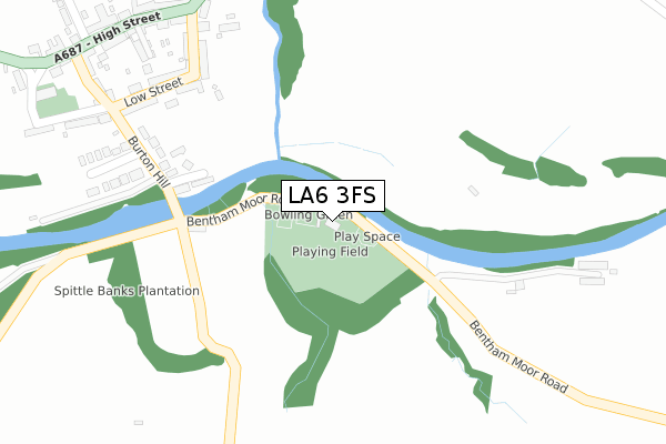
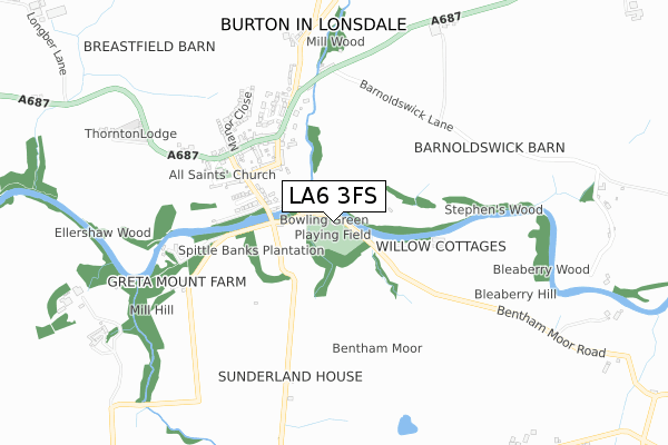
LA6 3FS is located in the Bentham & Ingleton electoral ward, within the unitary authority of North Yorkshire and the English Parliamentary constituency of Skipton and Ripon. The Sub Integrated Care Board (ICB) Location is NHS Lancashire and South Cumbria ICB - 01K and the police force is North Yorkshire. This postcode has been in use since December 2019.


GetTheData
Source: OS Open Zoomstack (Ordnance Survey)
Licence: Open Government Licence (requires attribution)
Attribution: Contains OS data © Crown copyright and database right 2024
Source: Open Postcode Geo
Licence: Open Government Licence (requires attribution)
Attribution: Contains OS data © Crown copyright and database right 2024; Contains Royal Mail data © Royal Mail copyright and database right 2024; Source: Office for National Statistics licensed under the Open Government Licence v.3.0
| Easting | 369198 |
| Northing | 472783 |
| Latitude | 54.149951 |
| Longitude | -2.473087 |
GetTheData
Source: Open Postcode Geo
Licence: Open Government Licence
| Country | England |
| Postcode District | LA6 |
| ➜ LA6 open data dashboard ➜ See where LA6 is on a map ➜ Where is Ingleton? | |
GetTheData
Source: Land Registry Price Paid Data
Licence: Open Government Licence
| Ward | Bentham & Ingleton |
| Constituency | Skipton And Ripon |
GetTheData
Source: ONS Postcode Database
Licence: Open Government Licence
SUNNYBANK HOUSE, GRETA DRIVE, INGLETON, CARNFORTH, LA6 3FS 2019 21 MAR £149,000 |
GetTheData
Source: HM Land Registry Price Paid Data
Licence: Contains HM Land Registry data © Crown copyright and database right 2024. This data is licensed under the Open Government Licence v3.0.
| January 2024 | Criminal damage and arson | On or near Low Demesne | 421m |
| August 2023 | Other theft | On or near Main Street | 149m |
| August 2023 | Violence and sexual offences | On or near Police Station | 166m |
| ➜ Get more crime data in our Crime section | |||
GetTheData
Source: data.police.uk
Licence: Open Government Licence
| The Bridge Inn (New Road) | Ingleton | 230m |
| The Bridge Inn (Bentham Road) | Ingleton | 236m |
| Community Centre (Bank Top) | Ingleton | 341m |
| Garage (Laundry Lane) | Ingleton | 417m |
| Garage (Laundry Lane) | Ingleton | 418m |
| Bentham Station | 4.6km |
| Clapham (N Yorks) Station | 6.4km |
GetTheData
Source: NaPTAN
Licence: Open Government Licence
GetTheData
Source: ONS Postcode Database
Licence: Open Government Licence


➜ Get more ratings from the Food Standards Agency
GetTheData
Source: Food Standards Agency
Licence: FSA terms & conditions
| Last Collection | |||
|---|---|---|---|
| Location | Mon-Fri | Sat | Distance |
| Hollin Tree | 16:30 | 11:45 | 17m |
| Backgate, Lowdemesne | 16:30 | 11:45 | 259m |
| Laundry Lane | 16:15 | 11:30 | 282m |
GetTheData
Source: Dracos
Licence: Creative Commons Attribution-ShareAlike
| Facility | Distance |
|---|---|
| Ingleton Middle School (Closed) Ingleton, Carnforth Sports Hall, Grass Pitches | 134m |
| Ingleton Primary School Lower Demesne, Ingleton, Carnforth Grass Pitches | 321m |
| Ingleborough Community Centre Main Street, Ingleton, Carnforth Sports Hall, Artificial Grass Pitch | 352m |
GetTheData
Source: Active Places
Licence: Open Government Licence
| School | Phase of Education | Distance |
|---|---|---|
| Ingleton Primary School Low Demesne, Ingleton, Carnforth, LA6 3DY | Primary | 318m |
| Bentham Community Primary School Low Bentham Road, Bentham, Bentham Community Primary School, LANCASTER, LA2 7BP | Primary | 4.6km |
| Stonegate School 13 Main Street, Low Bentham, Lancaster, Lancashire, LA2 7BX | Not applicable | 5.4km |
GetTheData
Source: Edubase
Licence: Open Government Licence
| Risk of LA6 3FS flooding from rivers and sea | Low |
| ➜ LA6 3FS flood map | |
GetTheData
Source: Open Flood Risk by Postcode
Licence: Open Government Licence
The below table lists the International Territorial Level (ITL) codes (formerly Nomenclature of Territorial Units for Statistics (NUTS) codes) and Local Administrative Units (LAU) codes for LA6 3FS:
| ITL 1 Code | Name |
|---|---|
| TLE | Yorkshire and The Humber |
| ITL 2 Code | Name |
| TLE2 | North Yorkshire |
| ITL 3 Code | Name |
| TLE22 | North Yorkshire CC |
| LAU 1 Code | Name |
| E07000163 | Craven |
GetTheData
Source: ONS Postcode Directory
Licence: Open Government Licence
The below table lists the Census Output Area (OA), Lower Layer Super Output Area (LSOA), and Middle Layer Super Output Area (MSOA) for LA6 3FS:
| Code | Name | |
|---|---|---|
| OA | E00140344 | |
| LSOA | E01027570 | Craven 001D |
| MSOA | E02005742 | Craven 001 |
GetTheData
Source: ONS Postcode Directory
Licence: Open Government Licence
| LA6 3BY | 64m | |
| LA6 3HH | Main Street | 79m |
| LA6 3HF | Main Street | 87m |
| LA6 3BX | Tansey Terrace | 93m |
| LA6 3BZ | Croft Road | 114m |
| LA6 3HJ | Main Street | 117m |
| LA6 3BT | Back Gate | 151m |
| LA6 3FE | Green Meadow Close | 155m |
| LA6 3PP | The Ingles | 156m |
| LA6 3HE | 175m |
GetTheData
Source: Open Postcode Geo; Land Registry Price Paid Data
Licence: Open Government Licence