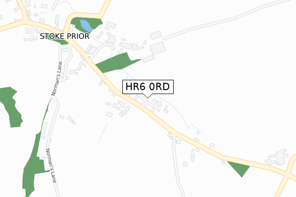
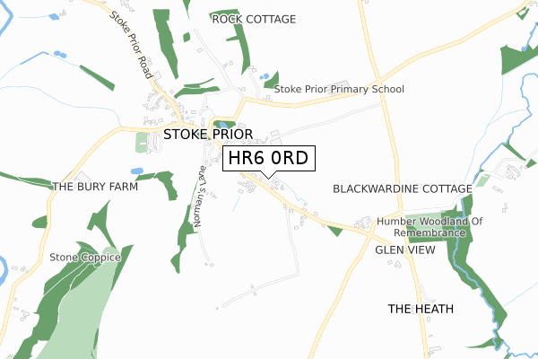
HR6 0RD is located in the Hampton electoral ward, within the unitary authority of Herefordshire, County of and the English Parliamentary constituency of North Herefordshire. The Sub Integrated Care Board (ICB) Location is NHS Herefordshire and Worcestershire ICB - 18C and the police force is West Mercia. This postcode has been in use since July 2018.


GetTheData
Source: OS Open Zoomstack (Ordnance Survey)
Licence: Open Government Licence (requires attribution)
Attribution: Contains OS data © Crown copyright and database right 2024
Source: Open Postcode Geo
Licence: Open Government Licence (requires attribution)
Attribution: Contains OS data © Crown copyright and database right 2024; Contains Royal Mail data © Royal Mail copyright and database right 2024; Source: Office for National Statistics licensed under the Open Government Licence v.3.0
| Easting | 352562 |
| Northing | 256322 |
| Latitude | 52.203084 |
| Longitude | -2.695553 |
GetTheData
Source: Open Postcode Geo
Licence: Open Government Licence
| Country | England |
| Postcode District | HR6 |
| ➜ HR6 open data dashboard ➜ See where HR6 is on a map ➜ Where is Stoke Prior? | |
GetTheData
Source: Land Registry Price Paid Data
Licence: Open Government Licence
| Ward | Hampton |
| Constituency | North Herefordshire |
GetTheData
Source: ONS Postcode Database
Licence: Open Government Licence
2020 22 DEC £500,000 |
5, EASTMEAD, STOKE PRIOR, LEOMINSTER, HR6 0RD 2020 21 MAY £160,000 |
6, EASTMEAD, STOKE PRIOR, LEOMINSTER, HR6 0RD 2020 27 MAR £150,000 |
8, EASTMEAD, STOKE PRIOR, LEOMINSTER, HR6 0RD 2017 15 DEC £200,000 |
GetTheData
Source: HM Land Registry Price Paid Data
Licence: Contains HM Land Registry data © Crown copyright and database right 2024. This data is licensed under the Open Government Licence v3.0.
| Old Village Pump (Unclassified Road) | Stoke Prior | 469m |
| Old Village Pump (Unclassified Road) | Stoke Prior | 478m |
| Lamb Inn (Stoke Prior Road) | Stoke Prior | 582m |
| Lamb Inn (Unclassified Road) | Stoke Prior | 587m |
| Drum Crossroads (Hereford Road) | Drum Crossroads | 1,224m |
| Leominster Station | 3.5km |
GetTheData
Source: NaPTAN
Licence: Open Government Licence
| Percentage of properties with Next Generation Access | 100.0% |
| Percentage of properties with Superfast Broadband | 100.0% |
| Percentage of properties with Ultrafast Broadband | 0.0% |
| Percentage of properties with Full Fibre Broadband | 0.0% |
Superfast Broadband is between 30Mbps and 300Mbps
Ultrafast Broadband is > 300Mbps
| Percentage of properties unable to receive 2Mbps | 0.0% |
| Percentage of properties unable to receive 5Mbps | 0.0% |
| Percentage of properties unable to receive 10Mbps | 0.0% |
| Percentage of properties unable to receive 30Mbps | 0.0% |
GetTheData
Source: Ofcom
Licence: Ofcom Terms of Use (requires attribution)
GetTheData
Source: ONS Postcode Database
Licence: Open Government Licence


➜ Get more ratings from the Food Standards Agency
GetTheData
Source: Food Standards Agency
Licence: FSA terms & conditions
| Last Collection | |||
|---|---|---|---|
| Location | Mon-Fri | Sat | Distance |
| Castlefields | 16:00 | 11:00 | 3,434m |
| Pinsley Road | 16:45 | 11:00 | 3,758m |
| The Mallards | 15:00 | 08:00 | 4,718m |
GetTheData
Source: Dracos
Licence: Creative Commons Attribution-ShareAlike
| Facility | Distance |
|---|---|
| Stoke Prior Primary School Stoke Prior, Leominster Grass Pitches | 516m |
| Leominster Golf Club Ford Bridge, Leominster Golf | 1.9km |
| Earl Mortimer College And Sixth Form Centre (Closed) Castlefields, Leominster Grass Pitches | 3.4km |
GetTheData
Source: Active Places
Licence: Open Government Licence
| School | Phase of Education | Distance |
|---|---|---|
| Stoke Prior Primary School Stoke Prior, Leominster, HR6 0ND | Primary | 516m |
| Earl Mortimer College South Street, Leominster, HR6 8JJ | Secondary | 3.6km |
| Leominster Primary School Hereford Road, Leominster, HR6 8JU | Primary | 3.7km |
GetTheData
Source: Edubase
Licence: Open Government Licence
The below table lists the International Territorial Level (ITL) codes (formerly Nomenclature of Territorial Units for Statistics (NUTS) codes) and Local Administrative Units (LAU) codes for HR6 0RD:
| ITL 1 Code | Name |
|---|---|
| TLG | West Midlands (England) |
| ITL 2 Code | Name |
| TLG1 | Herefordshire, Worcestershire and Warwickshire |
| ITL 3 Code | Name |
| TLG11 | Herefordshire, County of |
| LAU 1 Code | Name |
| E06000019 | Herefordshire, County of |
GetTheData
Source: ONS Postcode Directory
Licence: Open Government Licence
The below table lists the Census Output Area (OA), Lower Layer Super Output Area (LSOA), and Middle Layer Super Output Area (MSOA) for HR6 0RD:
| Code | Name | |
|---|---|---|
| OA | E00070808 | |
| LSOA | E01014024 | Herefordshire 004C |
| MSOA | E02002908 | Herefordshire 004 |
GetTheData
Source: ONS Postcode Directory
Licence: Open Government Licence
| HR6 0LH | 180m | |
| HR6 0LQ | 271m | |
| HR6 0ND | 372m | |
| HR6 0LG | 445m | |
| HR6 0NB | 689m | |
| HR6 0LJ | 713m | |
| HR6 0QG | Worcester Road | 788m |
| HR6 0NE | 1052m | |
| HR6 0LL | 1056m | |
| HR6 0NF | 1106m |
GetTheData
Source: Open Postcode Geo; Land Registry Price Paid Data
Licence: Open Government Licence