DY2 7JH maps, stats, and open data
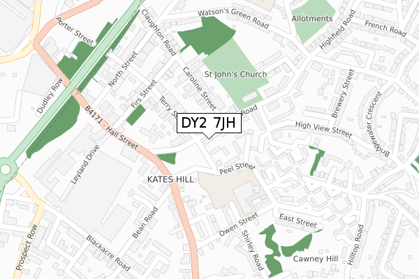
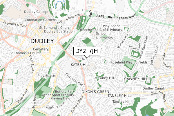
DY2 7JH lies on St Johns Road in Dudley. DY2 7JH is located in the St Thomas's electoral ward, within the metropolitan district of Dudley and the English Parliamentary constituency of Dudley North. The Sub Integrated Care Board (ICB) Location is NHS Black Country ICB - D2P2L and the police force is West Midlands. This postcode has been in use since January 1980.
DY2 7JH maps


Licence: Open Government Licence (requires attribution)
Attribution: Contains OS data © Crown copyright and database right 2026
Source: Open Postcode Geo
Licence: Open Government Licence (requires attribution)
Attribution: Contains OS data © Crown copyright and database right 2026; Contains Royal Mail data © Royal Mail copyright and database right 2026; Source: Office for National Statistics licensed under the Open Government Licence v.3.0
DY2 7JH geodata
| Easting | 395099 |
| Northing | 289997 |
| Latitude | 52.507859 |
| Longitude | -2.073633 |
Where is DY2 7JH?
| Street | St Johns Road |
| Town/City | Dudley |
| Country | England |
| Postcode District | DY2 |
DY2 7JH Elevation
Elevation or altitude of DY2 7JH as distance above sea level:
| Metres | Feet | |
|---|---|---|
| Elevation | 220m | 722ft |
Elevation is measured from the approximate centre of the postcode, to the nearest point on an OS contour line from OS Terrain 50, which has contour spacing of ten vertical metres.
➜ How high above sea level am I? Find the elevation of your current position using your device's GPS.
Politics
| Ward | St Thomas's |
|---|---|
| Constituency | Dudley North |
House Prices
Sales of detached houses in DY2 7JH
1A, ST JOHNS ROAD, DUDLEY, DY2 7JH 2019 1 JUL £200,000 |
1A, ST JOHNS ROAD, DUDLEY, DY2 7JH 2002 20 DEC £127,000 |
Licence: Contains HM Land Registry data © Crown copyright and database right 2026. This data is licensed under the Open Government Licence v3.0.
Transport
Nearest bus stops to DY2 7JH
| Caroline St (Saint Johns Rd) | Kates Hill | 76m |
| Caroline St (Saint Johns Rd) | Kates Hill | 76m |
| St John's Rd (Dixons Green Rd) | Kates Hill | 130m |
| St John's Rd (Dixons Green Rd) | Kates Hill | 155m |
| Owen St (Peel St) | Kates Hill | 209m |
Nearest railway stations to DY2 7JH
| Dudley Port Station | 2.5km |
| Tipton Station | 2.6km |
| Sandwell & Dudley Station | 4.2km |
Broadband
Broadband access in DY2 7JH (2020 data)
| Percentage of properties with Next Generation Access | 100.0% |
| Percentage of properties with Superfast Broadband | 100.0% |
| Percentage of properties with Ultrafast Broadband | 100.0% |
| Percentage of properties with Full Fibre Broadband | 0.0% |
Superfast Broadband is between 30Mbps and 300Mbps
Ultrafast Broadband is > 300Mbps
Broadband speed in DY2 7JH (2019 data)
Download
| Median download speed | 50.0Mbps |
| Average download speed | 51.2Mbps |
| Maximum download speed | 80.00Mbps |
Upload
| Median upload speed | 10.0Mbps |
| Average upload speed | 10.4Mbps |
| Maximum upload speed | 20.00Mbps |
Broadband limitations in DY2 7JH (2020 data)
| Percentage of properties unable to receive 2Mbps | 0.0% |
| Percentage of properties unable to receive 5Mbps | 0.0% |
| Percentage of properties unable to receive 10Mbps | 0.0% |
| Percentage of properties unable to receive 30Mbps | 0.0% |
DY2 7JH gas and electricity consumption
Estimated total energy consumption in DY2 7JH by fuel type, 2015.
Gas
| Consumption (kWh) | 194,515 |
|---|---|
| Meter count | 16 |
| Mean (kWh/meter) | 12,157 |
| Median (kWh/meter) | 9,345 |
Electricity
| Consumption (kWh) | 24,305 |
|---|---|
| Meter count | 7 |
| Mean (kWh/meter) | 3,472 |
| Median (kWh/meter) | 2,745 |
- Consumption: The estimated total energy consumption, in kWh, across all meters in DY2 7JH, for 2015.
- Meter count: The total number of meters in DY2 7JH.
- Mean: The mean average consumption per meter, in kWh.
- Median: The median average consumption per meter, in kWh.
Source: Postcode level electricity estimates: 2015 (experimental)
Licence: Open Government Licence
Deprivation
97.4% of English postcodes are less deprived than DY2 7JH:Food Standards Agency
Three nearest food hygiene ratings to DY2 7JH (metres)


➜ Get more ratings from the Food Standards Agency
Nearest post box to DY2 7JH
| Last Collection | |||
|---|---|---|---|
| Location | Mon-Fri | Sat | Distance |
| Hall Street | 17:30 | 11:00 | 179m |
| Highfield Road | 17:30 | 11:00 | 323m |
| Hill Top Road | 17:30 | 11:00 | 410m |
DY2 7JH ITL and DY2 7JH LAU
The below table lists the International Territorial Level (ITL) codes (formerly Nomenclature of Territorial Units for Statistics (NUTS) codes) and Local Administrative Units (LAU) codes for DY2 7JH:
| ITL 1 Code | Name |
|---|---|
| TLG | West Midlands (England) |
| ITL 2 Code | Name |
| TLG3 | West Midlands |
| ITL 3 Code | Name |
| TLG36 | Dudley |
| LAU 1 Code | Name |
| E08000027 | Dudley |
DY2 7JH census areas
The below table lists the Census Output Area (OA), Lower Layer Super Output Area (LSOA), and Middle Layer Super Output Area (MSOA) for DY2 7JH:
| Code | Name | |
|---|---|---|
| OA | E00050043 | |
| LSOA | E01009892 | Dudley 010B |
| MSOA | E02002009 | Dudley 010 |
Nearest postcodes to DY2 7JH
| DY2 7JJ | St Johns Road | 30m |
| DY2 7DR | Terry Street | 83m |
| DY2 7DY | Caroline Street | 104m |
| DY2 7DP | Terry Street | 132m |
| DY2 7HW | Peel Street | 158m |
| DY2 7DZ | Caroline Street | 161m |
| DY2 7JR | Highview Street | 168m |
| DY2 7JT | St Johns Road | 180m |
| DY2 7HP | Peel Street | 190m |
| DY2 7HX | Leveson Walk | 192m |