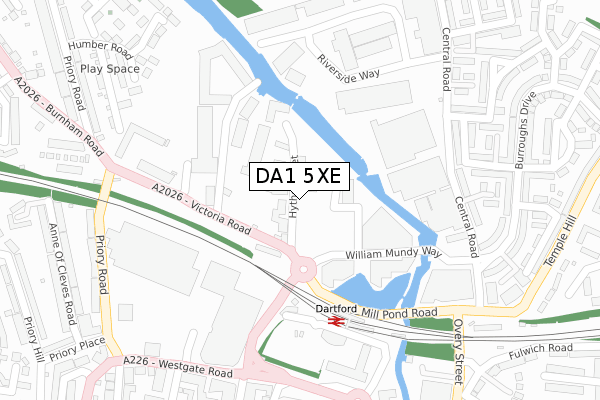
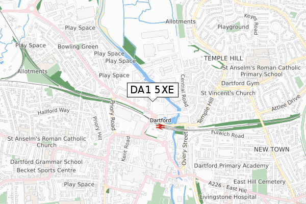
DA1 5XE is located in the Town electoral ward, within the local authority district of Dartford and the English Parliamentary constituency of Dartford. The Sub Integrated Care Board (ICB) Location is NHS Kent and Medway ICB - 91Q and the police force is Kent. This postcode has been in use since July 2019.


GetTheData
Source: OS Open Zoomstack (Ordnance Survey)
Licence: Open Government Licence (requires attribution)
Attribution: Contains OS data © Crown copyright and database right 2024
Source: Open Postcode Geo
Licence: Open Government Licence (requires attribution)
Attribution: Contains OS data © Crown copyright and database right 2024; Contains Royal Mail data © Royal Mail copyright and database right 2024; Source: Office for National Statistics licensed under the Open Government Licence v.3.0
| Easting | 554235 |
| Northing | 174586 |
| Latitude | 51.449260 |
| Longitude | 0.218230 |
GetTheData
Source: Open Postcode Geo
Licence: Open Government Licence
| Country | England |
| Postcode District | DA1 |
| ➜ DA1 open data dashboard ➜ See where DA1 is on a map ➜ Where is Dartford? | |
GetTheData
Source: Land Registry Price Paid Data
Licence: Open Government Licence
| Ward | Town |
| Constituency | Dartford |
GetTheData
Source: ONS Postcode Database
Licence: Open Government Licence
| June 2022 | Anti-social behaviour | On or near Hythe Street | 24m |
| June 2022 | Burglary | On or near Hythe Street | 24m |
| June 2022 | Other theft | On or near Hythe Street | 24m |
| ➜ Get more crime data in our Crime section | |||
GetTheData
Source: data.police.uk
Licence: Open Government Licence
| Mill Pond Road | Dartford | 209m |
| Prospect Place (Hythe Street) | Dartford | 212m |
| Railway Station (Station Approach) | Dartford | 214m |
| Mill Pond Road | Dartford | 237m |
| The Base (Victoria Road) | Dartford | 254m |
| Dartford Station | 0.2km |
| Crayford Station | 2.7km |
| Slade Green Station | 2.8km |
GetTheData
Source: NaPTAN
Licence: Open Government Licence
GetTheData
Source: ONS Postcode Database
Licence: Open Government Licence

➜ Get more ratings from the Food Standards Agency
GetTheData
Source: Food Standards Agency
Licence: FSA terms & conditions
| Last Collection | |||
|---|---|---|---|
| Location | Mon-Fri | Sat | Distance |
| Dartford Station | 18:30 | 12:00 | 223m |
| High Street | 18:30 | 12:15 | 566m |
| Bean Road | 17:30 | 11:15 | 641m |
GetTheData
Source: Dracos
Licence: Creative Commons Attribution-ShareAlike
| Facility | Distance |
|---|---|
| Snap Fitness (Dartford) Central Road, Central Road, Dartford Health and Fitness Gym | 311m |
| The Gym Group (Dartford) The Orchards, Dartford Health and Fitness Gym | 448m |
| River Mill Primary School Central Road, Central Road, Dartford Grass Pitches | 512m |
GetTheData
Source: Active Places
Licence: Open Government Licence
| School | Phase of Education | Distance |
|---|---|---|
| River Mill Primary School Central Road, Dartford, DA1 5XR | Primary | 512m |
| Our Lady's Catholic Primary School, Dartford King Edward Avenue, Dartford, DA1 2HX | Primary | 737m |
| Westgate Primary School Summerhill Road, Dartford, DA1 2LP | Primary | 836m |
GetTheData
Source: Edubase
Licence: Open Government Licence
| Risk of DA1 5XE flooding from rivers and sea | Very Low |
| ➜ DA1 5XE flood map | |
GetTheData
Source: Open Flood Risk by Postcode
Licence: Open Government Licence
The below table lists the International Territorial Level (ITL) codes (formerly Nomenclature of Territorial Units for Statistics (NUTS) codes) and Local Administrative Units (LAU) codes for DA1 5XE:
| ITL 1 Code | Name |
|---|---|
| TLJ | South East (England) |
| ITL 2 Code | Name |
| TLJ4 | Kent |
| ITL 3 Code | Name |
| TLJ43 | Kent Thames Gateway |
| LAU 1 Code | Name |
| E07000107 | Dartford |
GetTheData
Source: ONS Postcode Directory
Licence: Open Government Licence
The below table lists the Census Output Area (OA), Lower Layer Super Output Area (LSOA), and Middle Layer Super Output Area (MSOA) for DA1 5XE:
| Code | Name | |
|---|---|---|
| OA | E00122761 | |
| LSOA | E01024180 | Dartford 003A |
| MSOA | E02005030 | Dartford 003 |
GetTheData
Source: ONS Postcode Directory
Licence: Open Government Licence
| DA1 1BQ | Hythe Street | 24m |
| DA1 1BN | Hythe Street | 33m |
| DA1 5AE | Victoria Road | 76m |
| DA1 5AJ | Victoria Road | 211m |
| DA1 5FS | Victoria Road | 255m |
| DA1 2AD | Westgate Road | 338m |
| DA1 5BS | Riverside Industrial Estate | 342m |
| DA1 2BL | Kingsfield Terrace | 355m |
| DA1 2TJ | Kenwyn Road | 366m |
| DA1 1BG | Hythe Street | 366m |
GetTheData
Source: Open Postcode Geo; Land Registry Price Paid Data
Licence: Open Government Licence