CM16 6EY maps, stats, and open data
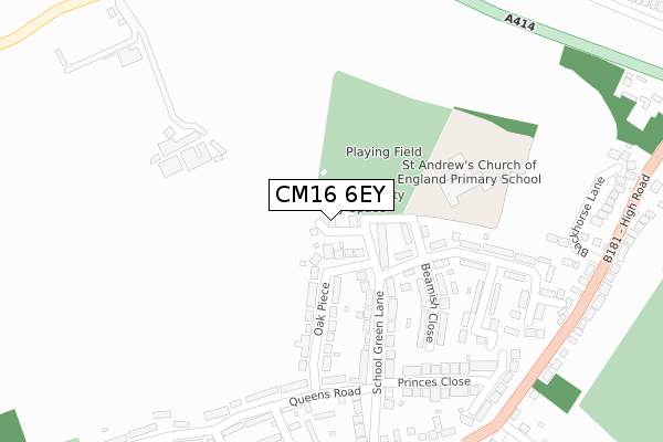
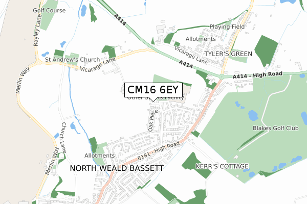
CM16 6EY lies on The Pavilions in North Weald, Epping. CM16 6EY is located in the North Weald Bassett electoral ward, within the local authority district of Epping Forest and the English Parliamentary constituency of Brentwood and Ongar. The Sub Integrated Care Board (ICB) Location is NHS Hertfordshire and West Essex ICB - 07H and the police force is Essex. This postcode has been in use since May 1994.
CM16 6EY maps


Licence: Open Government Licence (requires attribution)
Attribution: Contains OS data © Crown copyright and database right 2026
Source: Open Postcode Geo
Licence: Open Government Licence (requires attribution)
Attribution: Contains OS data © Crown copyright and database right 2026; Contains Royal Mail data © Royal Mail copyright and database right 2026; Source: Office for National Statistics licensed under the Open Government Licence v.3.0
CM16 6EY geodata
| Easting | 550198 |
| Northing | 204854 |
| Latitude | 51.722298 |
| Longitude | 0.173091 |
Where is CM16 6EY?
| Street | The Pavilions |
| Locality | North Weald |
| Town/City | Epping |
| Country | England |
| Postcode District | CM16 |
CM16 6EY Elevation
Elevation or altitude of CM16 6EY as distance above sea level:
| Metres | Feet | |
|---|---|---|
| Elevation | 90m | 295ft |
Elevation is measured from the approximate centre of the postcode, to the nearest point on an OS contour line from OS Terrain 50, which has contour spacing of ten vertical metres.
➜ How high above sea level am I? Find the elevation of your current position using your device's GPS.
Politics
| Ward | North Weald Bassett |
|---|---|
| Constituency | Brentwood And Ongar |
Transport
Nearest bus stops to CM16 6EY
| Skips Corner (High Road) | North Weald | 373m |
| Blackhorse Lane (High Road (B181)) | North Weald | 402m |
| Blackhorse Lane (B181) | North Weald | 403m |
| Skips Corner (High Road) | North Weald | 411m |
| Emberson Way (High Road) | North Weald | 512m |
Broadband
Broadband access in CM16 6EY (2020 data)
| Percentage of properties with Next Generation Access | 25.0% |
| Percentage of properties with Superfast Broadband | 25.0% |
| Percentage of properties with Ultrafast Broadband | 25.0% |
| Percentage of properties with Full Fibre Broadband | 0.0% |
Superfast Broadband is between 30Mbps and 300Mbps
Ultrafast Broadband is > 300Mbps
Broadband limitations in CM16 6EY (2020 data)
| Percentage of properties unable to receive 2Mbps | 0.0% |
| Percentage of properties unable to receive 5Mbps | 0.0% |
| Percentage of properties unable to receive 10Mbps | 0.0% |
| Percentage of properties unable to receive 30Mbps | 75.0% |
Deprivation
32% of English postcodes are less deprived than CM16 6EY:Food Standards Agency
Three nearest food hygiene ratings to CM16 6EY (metres)


➜ Get more ratings from the Food Standards Agency
Nearest post box to CM16 6EY
| Last Collection | |||
|---|---|---|---|
| Location | Mon-Fri | Sat | Distance |
| Greenstead Green | 16:30 | 07:30 | 2,687m |
| Thornwood Commonepping | 16:45 | 11:00 | 3,091m |
| Commonside Road | 17:30 | 12:00 | 4,041m |
CM16 6EY ITL and CM16 6EY LAU
The below table lists the International Territorial Level (ITL) codes (formerly Nomenclature of Territorial Units for Statistics (NUTS) codes) and Local Administrative Units (LAU) codes for CM16 6EY:
| ITL 1 Code | Name |
|---|---|
| TLH | East |
| ITL 2 Code | Name |
| TLH3 | Essex |
| ITL 3 Code | Name |
| TLH35 | West Essex |
| LAU 1 Code | Name |
| E07000072 | Epping Forest |
CM16 6EY census areas
The below table lists the Census Output Area (OA), Lower Layer Super Output Area (LSOA), and Middle Layer Super Output Area (MSOA) for CM16 6EY:
| Code | Name | |
|---|---|---|
| OA | E00110729 | |
| LSOA | E01021797 | Epping Forest 001C |
| MSOA | E02004527 | Epping Forest 001 |
Nearest postcodes to CM16 6EY
| CM16 6JH | Oak Piece | 111m |
| CM16 6JJ | Oak Piece | 155m |
| CM16 6EJ | School Green Lane | 171m |
| CM16 6EH | School Green Lane | 189m |
| CM16 6UA | Beamish Close | 191m |
| CM16 6JW | Beamish Close | 213m |
| CM16 6JN | Beamish Close | 225m |
| CM16 6JS | Gibson Close | 285m |
| CM16 6JQ | Queens Road | 295m |
| CM16 6EN | Princes Close | 299m |