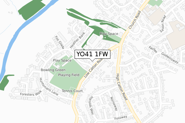
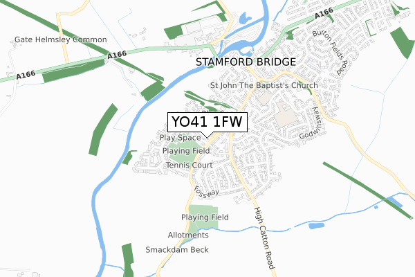
YO41 1FW is located in the Pocklington Provincial electoral ward, within the unitary authority of East Riding of Yorkshire and the English Parliamentary constituency of East Yorkshire. The Sub Integrated Care Board (ICB) Location is NHS Humber and North Yorkshire ICB - 03Q and the police force is Humberside. This postcode has been in use since September 2017.


GetTheData
Source: OS Open Zoomstack (Ordnance Survey)
Licence: Open Government Licence (requires attribution)
Attribution: Contains OS data © Crown copyright and database right 2024
Source: Open Postcode Geo
Licence: Open Government Licence (requires attribution)
Attribution: Contains OS data © Crown copyright and database right 2024; Contains Royal Mail data © Royal Mail copyright and database right 2024; Source: Office for National Statistics licensed under the Open Government Licence v.3.0
| Easting | 471068 |
| Northing | 455113 |
| Latitude | 53.987207 |
| Longitude | -0.917655 |
GetTheData
Source: Open Postcode Geo
Licence: Open Government Licence
| Country | England |
| Postcode District | YO41 |
| ➜ YO41 open data dashboard ➜ See where YO41 is on a map ➜ Where is Stamford Bridge? | |
GetTheData
Source: Land Registry Price Paid Data
Licence: Open Government Licence
| Ward | Pocklington Provincial |
| Constituency | East Yorkshire |
GetTheData
Source: ONS Postcode Database
Licence: Open Government Licence
| November 2023 | Possession of weapons | On or near Viking Road | 397m |
| June 2022 | Violence and sexual offences | On or near Tostig Close | 241m |
| May 2022 | Criminal damage and arson | On or near Tostig Close | 241m |
| ➜ Get more crime data in our Crime section | |||
GetTheData
Source: data.police.uk
Licence: Open Government Licence
| Stamford Bridge Church Rd (Church Road) | Stamford Bridge | 224m |
| Stamford Bridge Church Rd (Church Road) | Stamford Bridge | 241m |
| Stamford Bridge Roman Ave (Roman Avenue) | Stamford Bridge | 408m |
| Stamford Bridge High Catton Rd (High Catton Road) | Stamford Bridge | 431m |
| Stamford Bridge Roman Av (High Catton Road) | Stamford Bridge | 432m |
GetTheData
Source: NaPTAN
Licence: Open Government Licence
| Percentage of properties with Next Generation Access | 100.0% |
| Percentage of properties with Superfast Broadband | 100.0% |
| Percentage of properties with Ultrafast Broadband | 100.0% |
| Percentage of properties with Full Fibre Broadband | 0.0% |
Superfast Broadband is between 30Mbps and 300Mbps
Ultrafast Broadband is > 300Mbps
| Percentage of properties unable to receive 2Mbps | 0.0% |
| Percentage of properties unable to receive 5Mbps | 0.0% |
| Percentage of properties unable to receive 10Mbps | 0.0% |
| Percentage of properties unable to receive 30Mbps | 0.0% |
GetTheData
Source: Ofcom
Licence: Ofcom Terms of Use (requires attribution)
GetTheData
Source: ONS Postcode Database
Licence: Open Government Licence


➜ Get more ratings from the Food Standards Agency
GetTheData
Source: Food Standards Agency
Licence: FSA terms & conditions
| Last Collection | |||
|---|---|---|---|
| Location | Mon-Fri | Sat | Distance |
| Stamford Bridge Post Office | 17:30 | 11:25 | 488m |
| 8 Battleflats Way Stamford Bdg | 17:20 | 09:30 | 630m |
| Chestnut Cottage Gate Helmsley | 17:45 | 09:30 | 1,806m |
GetTheData
Source: Dracos
Licence: Creative Commons Attribution-ShareAlike
| Facility | Distance |
|---|---|
| Low Catton Road Playing Field Low Catton Road, Stamford Bridge, York Grass Pitches, Outdoor Tennis Courts | 145m |
| Stamford Bridge Community Pool Church Road, Stamford Bridge, York Swimming Pool | 409m |
| Reckondales Playing Field Stamford Bridge, York Grass Pitches | 476m |
GetTheData
Source: Active Places
Licence: Open Government Licence
| School | Phase of Education | Distance |
|---|---|---|
| Stamford Bridge Primary School Church Road, Stamford Bridge, York, YO41 1BP | Primary | 430m |
| Warthill Church of England Voluntary Controlled Primary School Warthill, York, YO19 5XL | Primary | 3.6km |
| Sand Hutton Church of England Voluntary Controlled Primary School Sand Hutton, York, YO41 1LB | Primary | 3.7km |
GetTheData
Source: Edubase
Licence: Open Government Licence
The below table lists the International Territorial Level (ITL) codes (formerly Nomenclature of Territorial Units for Statistics (NUTS) codes) and Local Administrative Units (LAU) codes for YO41 1FW:
| ITL 1 Code | Name |
|---|---|
| TLE | Yorkshire and The Humber |
| ITL 2 Code | Name |
| TLE1 | East Yorkshire and Northern Lincolnshire |
| ITL 3 Code | Name |
| TLE12 | East Riding of Yorkshire |
| LAU 1 Code | Name |
| E06000011 | East Riding of Yorkshire |
GetTheData
Source: ONS Postcode Directory
Licence: Open Government Licence
The below table lists the Census Output Area (OA), Lower Layer Super Output Area (LSOA), and Middle Layer Super Output Area (MSOA) for YO41 1FW:
| Code | Name | |
|---|---|---|
| OA | E00065897 | |
| LSOA | E01013060 | East Riding of Yorkshire 009C |
| MSOA | E02002692 | East Riding of Yorkshire 009 |
GetTheData
Source: ONS Postcode Directory
Licence: Open Government Licence
| YO41 1DQ | Low Catton Road | 80m |
| YO41 1DJ | Low Catton Road | 92m |
| YO41 1DY | Low Catton Road | 116m |
| YO41 1DZ | Low Catton Road | 129m |
| YO41 1EU | Heather Bank | 134m |
| YO41 1DH | High Catton Road | 144m |
| YO41 1ES | Huntsmans Lane | 157m |
| YO41 1PD | Butts Close | 167m |
| YO41 1PA | Cloverley Close | 173m |
| YO41 1EX | Fox Glade | 177m |
GetTheData
Source: Open Postcode Geo; Land Registry Price Paid Data
Licence: Open Government Licence