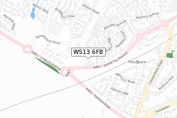
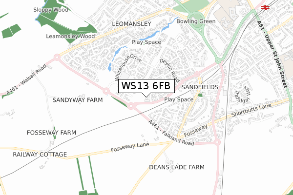
WS13 6FB is located in the Leomansley electoral ward, within the local authority district of Lichfield and the English Parliamentary constituency of Lichfield. The Sub Integrated Care Board (ICB) Location is NHS Staffordshire and Stoke-on-Trent ICB - 05Q and the police force is Staffordshire. This postcode has been in use since November 2017.


GetTheData
Source: OS Open Zoomstack (Ordnance Survey)
Licence: Open Government Licence (requires attribution)
Attribution: Contains OS data © Crown copyright and database right 2024
Source: Open Postcode Geo
Licence: Open Government Licence (requires attribution)
Attribution: Contains OS data © Crown copyright and database right 2024; Contains Royal Mail data © Royal Mail copyright and database right 2024; Source: Office for National Statistics licensed under the Open Government Licence v.3.0
| Easting | 410874 |
| Northing | 308396 |
| Latitude | 52.673180 |
| Longitude | -1.840614 |
GetTheData
Source: Open Postcode Geo
Licence: Open Government Licence
| Country | England |
| Postcode District | WS13 |
| ➜ WS13 open data dashboard ➜ See where WS13 is on a map ➜ Where is Lichfield? | |
GetTheData
Source: Land Registry Price Paid Data
Licence: Open Government Licence
| Ward | Leomansley |
| Constituency | Lichfield |
GetTheData
Source: ONS Postcode Database
Licence: Open Government Licence
10, PARSONS VIEW, LICHFIELD, WS13 6FB 2018 16 MAR £387,500 |
1, PARSONS VIEW, LICHFIELD, WS13 6FB 2018 28 FEB £325,000 |
2, PARSONS VIEW, LICHFIELD, WS13 6FB 2018 24 JAN £380,000 |
6, PARSONS VIEW, LICHFIELD, WS13 6FB 2018 10 JAN £335,000 |
8, PARSONS VIEW, LICHFIELD, WS13 6FB 2017 15 DEC £335,000 |
4, PARSONS VIEW, LICHFIELD, WS13 6FB 2017 15 DEC £405,000 |
14, PARSONS VIEW, LICHFIELD, WS13 6FB 2017 12 DEC £322,500 |
12, PARSONS VIEW, LICHFIELD, WS13 6FB 2017 8 NOV £363,000 |
GetTheData
Source: HM Land Registry Price Paid Data
Licence: Contains HM Land Registry data © Crown copyright and database right 2024. This data is licensed under the Open Government Licence v3.0.
| January 2024 | Violence and sexual offences | On or near Whitehouse Drive | 342m |
| November 2023 | Vehicle crime | On or near Whitehouse Drive | 342m |
| June 2023 | Anti-social behaviour | On or near Whitehouse Drive | 342m |
| ➜ Get more crime data in our Crime section | |||
GetTheData
Source: data.police.uk
Licence: Open Government Licence
| Deykin Road (Sainte Foy Avenue) | Lichfield | 203m |
| Deykin Road (Sainte Foy Avenue) | Lichfield | 228m |
| Kemberton House (Deykin Road) | Lichfield | 259m |
| Waitrose (Stonneyland Drive) | Lichfield | 306m |
| Waitrose (Stonneyland Drive) | Lichfield | 311m |
| Lichfield City Station | 1.3km |
| Lichfield Trent Valley High Level Station | 3.1km |
| Lichfield Trent Valley Station | 3.1km |
GetTheData
Source: NaPTAN
Licence: Open Government Licence
➜ Broadband speed and availability dashboard for WS13 6FB
| Percentage of properties with Next Generation Access | 100.0% |
| Percentage of properties with Superfast Broadband | 100.0% |
| Percentage of properties with Ultrafast Broadband | 0.0% |
| Percentage of properties with Full Fibre Broadband | 0.0% |
Superfast Broadband is between 30Mbps and 300Mbps
Ultrafast Broadband is > 300Mbps
| Median download speed | 12.8Mbps |
| Average download speed | 17.7Mbps |
| Maximum download speed | 40.00Mbps |
| Median upload speed | 1.3Mbps |
| Average upload speed | 3.0Mbps |
| Maximum upload speed | 9.01Mbps |
| Percentage of properties unable to receive 2Mbps | 0.0% |
| Percentage of properties unable to receive 5Mbps | 0.0% |
| Percentage of properties unable to receive 10Mbps | 0.0% |
| Percentage of properties unable to receive 30Mbps | 0.0% |
➜ Broadband speed and availability dashboard for WS13 6FB
GetTheData
Source: Ofcom
Licence: Ofcom Terms of Use (requires attribution)
GetTheData
Source: ONS Postcode Database
Licence: Open Government Licence


➜ Get more ratings from the Food Standards Agency
GetTheData
Source: Food Standards Agency
Licence: FSA terms & conditions
| Last Collection | |||
|---|---|---|---|
| Location | Mon-Fri | Sat | Distance |
| Waitrose | 16:45 | 11:00 | 315m |
| Fosseway | 18:00 | 11:00 | 556m |
| Chesterfield Road | 16:45 | 11:00 | 652m |
GetTheData
Source: Dracos
Licence: Creative Commons Attribution-ShareAlike
| Facility | Distance |
|---|---|
| Anna Seward Primary School Bridgeman Way, Lichfield Grass Pitches | 651m |
| Queen's Croft High School Birmingham Road, Lichfield Grass Pitches, Sports Hall | 935m |
| Shortbutts Lane Shortbutts Lane, Lichfield Grass Pitches | 1km |
GetTheData
Source: Active Places
Licence: Open Government Licence
| School | Phase of Education | Distance |
|---|---|---|
| Queen's Croft High School Birmingham Road, Lichfield, WS13 6PJ | Not applicable | 820m |
| Christ Church CofE (C) Primary School Christ Church Lane, Lichfield, WS13 8AY | Primary | 869m |
| King Edward VI School Upper St John Street, Lichfield, WS14 9EE | Secondary | 1.3km |
GetTheData
Source: Edubase
Licence: Open Government Licence
The below table lists the International Territorial Level (ITL) codes (formerly Nomenclature of Territorial Units for Statistics (NUTS) codes) and Local Administrative Units (LAU) codes for WS13 6FB:
| ITL 1 Code | Name |
|---|---|
| TLG | West Midlands (England) |
| ITL 2 Code | Name |
| TLG2 | Shropshire and Staffordshire |
| ITL 3 Code | Name |
| TLG24 | Staffordshire CC |
| LAU 1 Code | Name |
| E07000194 | Lichfield |
GetTheData
Source: ONS Postcode Directory
Licence: Open Government Licence
The below table lists the Census Output Area (OA), Lower Layer Super Output Area (LSOA), and Middle Layer Super Output Area (MSOA) for WS13 6FB:
| Code | Name | |
|---|---|---|
| OA | E00168382 | |
| LSOA | E01032900 | Lichfield 004G |
| MSOA | E02006149 | Lichfield 004 |
GetTheData
Source: ONS Postcode Directory
Licence: Open Government Licence
| WS13 6RP | The Whytmore | 53m |
| WS13 6RQ | Heathcot Place | 68m |
| WS13 6RD | Lawrence Way | 144m |
| WS14 0GF | Waterloo Croft | 146m |
| WS14 0GL | Waterloo Croft | 162m |
| WS13 8FJ | Colling Drive | 209m |
| WS13 6QF | Newbold Close | 213m |
| WS13 6LT | Maddocke Walk | 218m |
| WS14 0GG | Alamein Way | 224m |
| WS13 6PF | Allington Avenue | 230m |
GetTheData
Source: Open Postcode Geo; Land Registry Price Paid Data
Licence: Open Government Licence