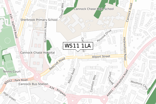
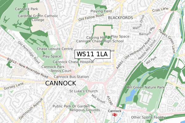
WS11 1LA is located in the Cannock West electoral ward, within the local authority district of Cannock Chase and the English Parliamentary constituency of Cannock Chase. The Sub Integrated Care Board (ICB) Location is NHS Staffordshire and Stoke-on-Trent ICB - 04Y and the police force is Staffordshire. This postcode has been in use since April 2018.


GetTheData
Source: OS Open Zoomstack (Ordnance Survey)
Licence: Open Government Licence (requires attribution)
Attribution: Contains OS data © Crown copyright and database right 2024
Source: Open Postcode Geo
Licence: Open Government Licence (requires attribution)
Attribution: Contains OS data © Crown copyright and database right 2024; Contains Royal Mail data © Royal Mail copyright and database right 2024; Source: Office for National Statistics licensed under the Open Government Licence v.3.0
| Easting | 398286 |
| Northing | 310544 |
| Latitude | 52.692593 |
| Longitude | -2.026791 |
GetTheData
Source: Open Postcode Geo
Licence: Open Government Licence
| Country | England |
| Postcode District | WS11 |
| ➜ WS11 open data dashboard ➜ See where WS11 is on a map ➜ Where is Cannock? | |
GetTheData
Source: Land Registry Price Paid Data
Licence: Open Government Licence
| Ward | Cannock West |
| Constituency | Cannock Chase |
GetTheData
Source: ONS Postcode Database
Licence: Open Government Licence
| January 2024 | Burglary | On or near Stoney Croft | 449m |
| July 2023 | Violence and sexual offences | On or near Stoney Croft | 449m |
| July 2023 | Violence and sexual offences | On or near Stoney Croft | 449m |
| ➜ Get more crime data in our Crime section | |||
GetTheData
Source: data.police.uk
Licence: Open Government Licence
| Brunswick Road (Beecroft Road) | Cannock | 118m |
| Cannock Chase Hospital (Brunswick Rd) | Cannock | 206m |
| Cannock Chase Hospital (Brunswick Rd) | Cannock | 212m |
| Elmcroft Court (Church Street) | Cannock | 298m |
| Georgian Place (Brunswick Road) | Cannock | 321m |
| Cannock Station | 0.8km |
| Hednesford Station | 2.6km |
| Landywood Station | 4km |
GetTheData
Source: NaPTAN
Licence: Open Government Licence
| Percentage of properties with Next Generation Access | 100.0% |
| Percentage of properties with Superfast Broadband | 100.0% |
| Percentage of properties with Ultrafast Broadband | 100.0% |
| Percentage of properties with Full Fibre Broadband | 100.0% |
Superfast Broadband is between 30Mbps and 300Mbps
Ultrafast Broadband is > 300Mbps
| Percentage of properties unable to receive 2Mbps | 0.0% |
| Percentage of properties unable to receive 5Mbps | 0.0% |
| Percentage of properties unable to receive 10Mbps | 0.0% |
| Percentage of properties unable to receive 30Mbps | 0.0% |
GetTheData
Source: Ofcom
Licence: Ofcom Terms of Use (requires attribution)
GetTheData
Source: ONS Postcode Database
Licence: Open Government Licence


➜ Get more ratings from the Food Standards Agency
GetTheData
Source: Food Standards Agency
Licence: FSA terms & conditions
| Last Collection | |||
|---|---|---|---|
| Location | Mon-Fri | Sat | Distance |
| Bridgetown Post Office | 18:30 | 11:00 | 553m |
| Market Street | 18:00 | 11:15 | 2,585m |
| Cannock Delivery Office | 18:30 | 12:00 | 2,765m |
GetTheData
Source: Dracos
Licence: Creative Commons Attribution-ShareAlike
| Facility | Distance |
|---|---|
| Cannock Chase High School Hednesford Road, Cannock Grass Pitches, Health and Fitness Gym, Sports Hall, Swimming Pool, Outdoor Tennis Courts | 276m |
| Chase Leisure Centre Stafford Road, Cannock Sports Hall, Swimming Pool, Health and Fitness Gym, Indoor Bowls, Studio, Golf | 533m |
| Club Fitness International (Closed) High Green, Cannock Studio, Health and Fitness Gym | 540m |
GetTheData
Source: Active Places
Licence: Open Government Licence
| School | Phase of Education | Distance |
|---|---|---|
| Cannock Chase High School Hednesford Road, Cannock, WS11 1JT | Secondary | 276m |
| Sherbrook Primary School Grainger Court, Cannock, WS11 5SA | Not applicable | 300m |
| Cardinal Griffin Catholic College Cardinal Way, Stafford Road, Cannock, WS11 4AW | Secondary | 779m |
GetTheData
Source: Edubase
Licence: Open Government Licence
The below table lists the International Territorial Level (ITL) codes (formerly Nomenclature of Territorial Units for Statistics (NUTS) codes) and Local Administrative Units (LAU) codes for WS11 1LA:
| ITL 1 Code | Name |
|---|---|
| TLG | West Midlands (England) |
| ITL 2 Code | Name |
| TLG2 | Shropshire and Staffordshire |
| ITL 3 Code | Name |
| TLG24 | Staffordshire CC |
| LAU 1 Code | Name |
| E07000192 | Cannock Chase |
GetTheData
Source: ONS Postcode Directory
Licence: Open Government Licence
The below table lists the Census Output Area (OA), Lower Layer Super Output Area (LSOA), and Middle Layer Super Output Area (MSOA) for WS11 1LA:
| Code | Name | |
|---|---|---|
| OA | E00149627 | |
| LSOA | E01029367 | Cannock Chase 011E |
| MSOA | E02006128 | Cannock Chase 011 |
GetTheData
Source: ONS Postcode Directory
Licence: Open Government Licence
| WS11 1JS | Calving Hill | 108m |
| WS11 1DU | Windermere Place | 133m |
| WS11 1DY | Allport Road | 141m |
| WS11 1JZ | Allport Street | 164m |
| WS11 1JX | Pennine Drive | 166m |
| WS11 1JP | Beecroft Road | 175m |
| WS11 1DX | Ullswater Place | 212m |
| WS11 1DT | Coniston Way | 218m |
| WS11 1EF | Thirlmere Close | 234m |
| WS11 1JY | Greenfields | 246m |
GetTheData
Source: Open Postcode Geo; Land Registry Price Paid Data
Licence: Open Government Licence