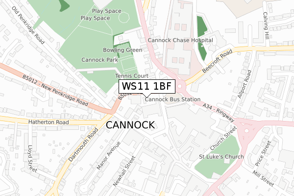
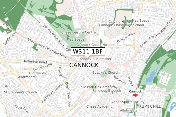
WS11 1BF is located in the Cannock West electoral ward, within the local authority district of Cannock Chase and the English Parliamentary constituency of Cannock Chase. The Sub Integrated Care Board (ICB) Location is NHS Staffordshire and Stoke-on-Trent ICB - 04Y and the police force is Staffordshire. This postcode has been in use since December 2018.


GetTheData
Source: OS Open Zoomstack (Ordnance Survey)
Licence: Open Government Licence (requires attribution)
Attribution: Contains OS data © Crown copyright and database right 2024
Source: Open Postcode Geo
Licence: Open Government Licence (requires attribution)
Attribution: Contains OS data © Crown copyright and database right 2024; Contains Royal Mail data © Royal Mail copyright and database right 2024; Source: Office for National Statistics licensed under the Open Government Licence v.3.0
| Easting | 397912 |
| Northing | 310343 |
| Latitude | 52.690785 |
| Longitude | -2.032323 |
GetTheData
Source: Open Postcode Geo
Licence: Open Government Licence
| Country | England |
| Postcode District | WS11 |
| ➜ WS11 open data dashboard ➜ See where WS11 is on a map ➜ Where is Cannock? | |
GetTheData
Source: Land Registry Price Paid Data
Licence: Open Government Licence
| Ward | Cannock West |
| Constituency | Cannock Chase |
GetTheData
Source: ONS Postcode Database
Licence: Open Government Licence
| January 2024 | Anti-social behaviour | On or near Parking Area | 213m |
| January 2024 | Criminal damage and arson | On or near Parking Area | 213m |
| January 2024 | Public order | On or near Parking Area | 213m |
| ➜ Get more crime data in our Crime section | |||
GetTheData
Source: data.police.uk
Licence: Open Government Licence
| Old Penkridge Mews (New Penkridge Rd) | Cannock Town Centre | 176m |
| Old Penkridge Mews (New Penkridge Rd) | Cannock Town Centre | 204m |
| Cannock Chase Hospital (Brunswick Rd) | Cannock | 215m |
| Chase Leisure Centre (Stafford Road) | Cannock | 216m |
| Hatherton Road (Dartmouth Rd) | Cannock Town Centre | 224m |
| Cannock Station | 0.9km |
| Hednesford Station | 3km |
| Landywood Station | 3.9km |
GetTheData
Source: NaPTAN
Licence: Open Government Licence
GetTheData
Source: ONS Postcode Database
Licence: Open Government Licence


➜ Get more ratings from the Food Standards Agency
GetTheData
Source: Food Standards Agency
Licence: FSA terms & conditions
| Last Collection | |||
|---|---|---|---|
| Location | Mon-Fri | Sat | Distance |
| Bridgetown Post Office | 18:30 | 11:00 | 361m |
| Anson Road | 16:00 | 10:00 | 2,442m |
| Darges Lane | 17:00 | 10:00 | 2,670m |
GetTheData
Source: Dracos
Licence: Creative Commons Attribution-ShareAlike
| Facility | Distance |
|---|---|
| Club Fitness International (Closed) High Green, Cannock Studio, Health and Fitness Gym | 143m |
| Chase Leisure Centre Stafford Road, Cannock Sports Hall, Swimming Pool, Health and Fitness Gym, Indoor Bowls, Studio, Golf | 393m |
| Avon Road Youth Centre (Closed) Avon Road, Cannock Grass Pitches | 485m |
GetTheData
Source: Active Places
Licence: Open Government Licence
| School | Phase of Education | Distance |
|---|---|---|
| Sherbrook Primary School Grainger Court, Cannock, WS11 5SA | Not applicable | 398m |
| St Lukes CofE Primary School New Penkridge Road, Cannock, WS11 1HN | Primary | 605m |
| Cannock Chase High School Hednesford Road, Cannock, WS11 1JT | Secondary | 696m |
GetTheData
Source: Edubase
Licence: Open Government Licence
The below table lists the International Territorial Level (ITL) codes (formerly Nomenclature of Territorial Units for Statistics (NUTS) codes) and Local Administrative Units (LAU) codes for WS11 1BF:
| ITL 1 Code | Name |
|---|---|
| TLG | West Midlands (England) |
| ITL 2 Code | Name |
| TLG2 | Shropshire and Staffordshire |
| ITL 3 Code | Name |
| TLG24 | Staffordshire CC |
| LAU 1 Code | Name |
| E07000192 | Cannock Chase |
GetTheData
Source: ONS Postcode Directory
Licence: Open Government Licence
The below table lists the Census Output Area (OA), Lower Layer Super Output Area (LSOA), and Middle Layer Super Output Area (MSOA) for WS11 1BF:
| Code | Name | |
|---|---|---|
| OA | E00149630 | |
| LSOA | E01029364 | Cannock Chase 011B |
| MSOA | E02006128 | Cannock Chase 011 |
GetTheData
Source: ONS Postcode Directory
Licence: Open Government Licence
| WS11 1JN | Park Road | 37m |
| WS11 1NZ | Park Road | 54m |
| WS11 1BE | High Green | 75m |
| WS11 1WS | Cannock Shopping Centre | 118m |
| WS11 1BJ | High Green | 132m |
| WS11 4AF | Stafford Road | 141m |
| WS11 1NX | Dartmouth Mews | 144m |
| WS11 1BN | High Green | 153m |
| WS11 1GW | New Penkridge Road | 164m |
| WS11 1JR | Beecroft Road | 167m |
GetTheData
Source: Open Postcode Geo; Land Registry Price Paid Data
Licence: Open Government Licence