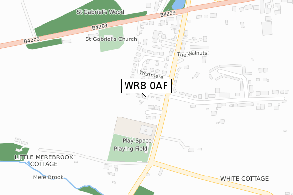
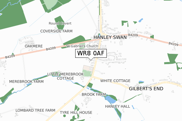
WR8 0AF is located in the Powick & the Hanleys electoral ward, within the local authority district of Malvern Hills and the English Parliamentary constituency of West Worcestershire. The Sub Integrated Care Board (ICB) Location is NHS Herefordshire and Worcestershire ICB - 18C and the police force is West Mercia. This postcode has been in use since July 2018.


GetTheData
Source: OS Open Zoomstack (Ordnance Survey)
Licence: Open Government Licence (requires attribution)
Attribution: Contains OS data © Crown copyright and database right 2024
Source: Open Postcode Geo
Licence: Open Government Licence (requires attribution)
Attribution: Contains OS data © Crown copyright and database right 2024; Contains Royal Mail data © Royal Mail copyright and database right 2024; Source: Office for National Statistics licensed under the Open Government Licence v.3.0
| Easting | 381149 |
| Northing | 242565 |
| Latitude | 52.081127 |
| Longitude | -2.276491 |
GetTheData
Source: Open Postcode Geo
Licence: Open Government Licence
| Country | England |
| Postcode District | WR8 |
| ➜ WR8 open data dashboard ➜ See where WR8 is on a map ➜ Where is Hanley Swan? | |
GetTheData
Source: Land Registry Price Paid Data
Licence: Open Government Licence
| Ward | Powick & The Hanleys |
| Constituency | West Worcestershire |
GetTheData
Source: ONS Postcode Database
Licence: Open Government Licence
2, CHERRY BLOSSOM CLOSE, HANLEY SWAN, WORCESTER, WR8 0AF 2019 6 NOV £570,000 |
3, CHERRY BLOSSOM CLOSE, HANLEY SWAN, WORCESTER, WR8 0AF 2019 25 JAN £592,500 |
1, CHERRY BLOSSOM CLOSE, HANLEY SWAN, WORCESTER, WR8 0AF 2018 24 AUG £627,000 |
4, CHERRY BLOSSOM CLOSE, HANLEY SWAN, WORCESTER, WR8 0AF 2018 23 JUL £645,000 |
GetTheData
Source: HM Land Registry Price Paid Data
Licence: Contains HM Land Registry data © Crown copyright and database right 2024. This data is licensed under the Open Government Licence v3.0.
| June 2022 | Burglary | On or near Winnington Gardens | 341m |
| June 2022 | Violence and sexual offences | On or near Coverfield | 362m |
| June 2022 | Violence and sexual offences | On or near Coverfield | 362m |
| ➜ Get more crime data in our Crime section | |||
GetTheData
Source: data.police.uk
Licence: Open Government Licence
| Welland Road | Hanley Swan | 100m |
| Welland Road | Hanley Swan | 129m |
| Post Office (Malvern Road) | Hanley Swan | 285m |
| Post Office (Malvern Road) | Hanley Swan | 317m |
| Swan Inn (Blackmore Road) | Hanley Swan | 421m |
| Great Malvern Station | 4.2km |
| Malvern Link Station | 5.7km |
GetTheData
Source: NaPTAN
Licence: Open Government Licence
| Percentage of properties with Next Generation Access | 100.0% |
| Percentage of properties with Superfast Broadband | 100.0% |
| Percentage of properties with Ultrafast Broadband | 0.0% |
| Percentage of properties with Full Fibre Broadband | 0.0% |
Superfast Broadband is between 30Mbps and 300Mbps
Ultrafast Broadband is > 300Mbps
| Percentage of properties unable to receive 2Mbps | 0.0% |
| Percentage of properties unable to receive 5Mbps | 0.0% |
| Percentage of properties unable to receive 10Mbps | 0.0% |
| Percentage of properties unable to receive 30Mbps | 0.0% |
GetTheData
Source: Ofcom
Licence: Ofcom Terms of Use (requires attribution)
GetTheData
Source: ONS Postcode Database
Licence: Open Government Licence

➜ Get more ratings from the Food Standards Agency
GetTheData
Source: Food Standards Agency
Licence: FSA terms & conditions
| Last Collection | |||
|---|---|---|---|
| Location | Mon-Fri | Sat | Distance |
| Hanley Swan P.o. | 17:00 | 10:30 | 313m |
| Picken End | 16:45 | 08:30 | 330m |
| Oakmere | 763m | ||
GetTheData
Source: Dracos
Licence: Creative Commons Attribution-ShareAlike
| Facility | Distance |
|---|---|
| Hanley Swan St Gabriel's With St Mary's C Of E Primary School Hanley Swan, Worcester Grass Pitches | 117m |
| Hanley Swan Playing Fields Welland Road, Hanley Swan Grass Pitches | 164m |
| The Glebe (Hanley Castle) Church End, Hanley Castle Grass Pitches | 2.7km |
GetTheData
Source: Active Places
Licence: Open Government Licence
| School | Phase of Education | Distance |
|---|---|---|
| Hanley Swan St Gabriel's with St Mary's CofE Primary School Welland Road, Hanley Swan, WR8 0EQ | Primary | 117m |
| Bridge School Malvern Unit 2, Hanley Workshops, Hanley Road, Hanley Swan, WR8 0DX | Not applicable | 1.6km |
| Hanley Castle High School Church End, Hanley Castle, Worcester, WR8 0BL | Secondary | 2.9km |
GetTheData
Source: Edubase
Licence: Open Government Licence
The below table lists the International Territorial Level (ITL) codes (formerly Nomenclature of Territorial Units for Statistics (NUTS) codes) and Local Administrative Units (LAU) codes for WR8 0AF:
| ITL 1 Code | Name |
|---|---|
| TLG | West Midlands (England) |
| ITL 2 Code | Name |
| TLG1 | Herefordshire, Worcestershire and Warwickshire |
| ITL 3 Code | Name |
| TLG12 | Worcestershire CC |
| LAU 1 Code | Name |
| E07000235 | Malvern Hills |
GetTheData
Source: ONS Postcode Directory
Licence: Open Government Licence
The below table lists the Census Output Area (OA), Lower Layer Super Output Area (LSOA), and Middle Layer Super Output Area (MSOA) for WR8 0AF:
| Code | Name | |
|---|---|---|
| OA | E00164333 | |
| LSOA | E01032217 | Malvern Hills 005D |
| MSOA | E02006714 | Malvern Hills 005 |
GetTheData
Source: ONS Postcode Directory
Licence: Open Government Licence
| WR8 0AN | Chapmans Orchard | 31m |
| WR8 0DG | Westmere | 66m |
| WR8 0DS | Hanley Orchard | 156m |
| WR8 0EL | Hillview Drive | 194m |
| WR8 0DA | Welland Road | 200m |
| WR8 0AW | Jasmine Close | 226m |
| WR8 0DU | The Walnuts | 249m |
| WR8 0DY | St Gabriels Terrace | 253m |
| WR8 0DH | Picken End | 257m |
| WR8 0DJ | Winnington Gardens | 301m |
GetTheData
Source: Open Postcode Geo; Land Registry Price Paid Data
Licence: Open Government Licence