WR1 9EJ maps, stats, and open data
WR1 9EJ is located in the Cathedral electoral ward, within the local authority district of Worcester and the English Parliamentary constituency of Worcester. The Sub Integrated Care Board (ICB) Location is NHS Herefordshire and Worcestershire ICB - 18C and the police force is West Mercia. This postcode has been in use since December 2022.
WR1 9EJ geodata
| Easting | 385268 |
| Northing | 255404 |
| Latitude | 52.196683 |
| Longitude | -2.216947 |
Where is WR1 9EJ?
| Country | England |
| Postcode District | WR1 |
Politics
| Ward | Cathedral |
|---|
| Constituency | Worcester |
|---|
Transport
Nearest bus stops to WR1 9EJ
| Lowesmoor (B4550) | Lowesmoor | 152m |
| Lowesmoor (B4550) | Lowesmoor | 157m |
| Lowesmoor Terrace | Lowesmoor | 176m |
| Sansome Walk | Arboretum | 264m |
| Kenilworth Close (B4550) | Rainbow Hill | 288m |
Nearest railway stations to WR1 9EJ
| Worcester Foregate Street Station | 0.4km |
| Worcester Shrub Hill Station | 0.6km |
Deprivation
87.3% of English postcodes are less deprived than
WR1 9EJ:
Food Standards Agency
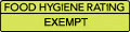
Three nearest food hygiene ratings to WR1 9EJ (metres)
786 Peri Peri
Freedom Church Worcester
The Bridge Inn
➜ Get more ratings from the Food Standards Agency
Nearest post box to WR1 9EJ
| | Last Collection | |
|---|
| Location | Mon-Fri | Sat | Distance |
|---|
| Lowesmoor Place | 18:00 | 11:30 | 157m |
| Lowesmoor P.o. | 18:15 | 11:30 | 246m |
| Arboretum | 18:30 | 11:30 | 251m |
WR1 9EJ ITL and WR1 9EJ LAU
The below table lists the International Territorial Level (ITL) codes (formerly Nomenclature of Territorial Units for Statistics (NUTS) codes) and Local Administrative Units (LAU) codes for WR1 9EJ:
| ITL 1 Code | Name |
|---|
| TLG | West Midlands (England) |
| ITL 2 Code | Name |
|---|
| TLG1 | Herefordshire, Worcestershire and Warwickshire |
| ITL 3 Code | Name |
|---|
| TLG12 | Worcestershire CC |
| LAU 1 Code | Name |
|---|
| E07000237 | Worcester |
WR1 9EJ census areas
The below table lists the Census Output Area (OA), Lower Layer Super Output Area (LSOA), and Middle Layer Super Output Area (MSOA) for WR1 9EJ:
| Code | Name |
|---|
| OA | E00172270 | |
|---|
| LSOA | E01033248 | Worcester 011E |
|---|
| MSOA | E02006744 | Worcester 011 |
|---|
Nearest postcodes to WR1 9EJ