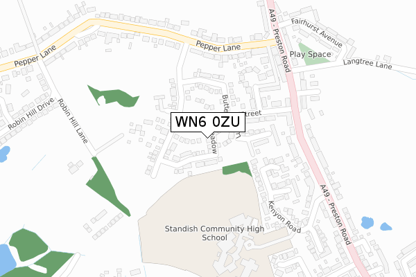
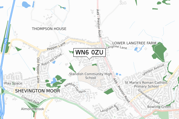
WN6 0ZU is located in the Standish with Langtree electoral ward, within the metropolitan district of Wigan and the English Parliamentary constituency of Wigan. The Sub Integrated Care Board (ICB) Location is NHS Greater Manchester ICB - 02H and the police force is Greater Manchester. This postcode has been in use since May 2018.


GetTheData
Source: OS Open Zoomstack (Ordnance Survey)
Licence: Open Government Licence (requires attribution)
Attribution: Contains OS data © Crown copyright and database right 2024
Source: Open Postcode Geo
Licence: Open Government Licence (requires attribution)
Attribution: Contains OS data © Crown copyright and database right 2024; Contains Royal Mail data © Royal Mail copyright and database right 2024; Source: Office for National Statistics licensed under the Open Government Licence v.3.0
| Easting | 355393 |
| Northing | 411007 |
| Latitude | 53.593745 |
| Longitude | -2.675419 |
GetTheData
Source: Open Postcode Geo
Licence: Open Government Licence
| Country | England |
| Postcode District | WN6 |
| ➜ WN6 open data dashboard ➜ See where WN6 is on a map ➜ Where is Shevington Moor? | |
GetTheData
Source: Land Registry Price Paid Data
Licence: Open Government Licence
| Ward | Standish With Langtree |
| Constituency | Wigan |
GetTheData
Source: ONS Postcode Database
Licence: Open Government Licence
| February 2021 | Violence and sexual offences | On or near Quakers Terrace | 192m |
| ➜ Get more crime data in our Crime section | |||
GetTheData
Source: data.police.uk
Licence: Open Government Licence
| Preston Rd/Pepper Ln (Preston Rd) | Langtree | 245m |
| Pepper Ln/Preston Rd (Pepper Ln) | Langtree | 256m |
| Pepper Ln/Preston Rd (Pepper Ln) | Langtree | 258m |
| Standish High School (Nebnd) (Kenyon Road) | Standish | 276m |
| Pepper Ln/Lyndene (Pepper Ln) | Langtree | 287m |
| Appley Bridge Station | 3.4km |
| Gathurst Station | 4km |
| Adlington (Lancs) Station | 5.3km |
GetTheData
Source: NaPTAN
Licence: Open Government Licence
| Percentage of properties with Next Generation Access | 100.0% |
| Percentage of properties with Superfast Broadband | 100.0% |
| Percentage of properties with Ultrafast Broadband | 100.0% |
| Percentage of properties with Full Fibre Broadband | 100.0% |
Superfast Broadband is between 30Mbps and 300Mbps
Ultrafast Broadband is > 300Mbps
| Percentage of properties unable to receive 2Mbps | 0.0% |
| Percentage of properties unable to receive 5Mbps | 0.0% |
| Percentage of properties unable to receive 10Mbps | 0.0% |
| Percentage of properties unable to receive 30Mbps | 0.0% |
GetTheData
Source: Ofcom
Licence: Ofcom Terms of Use (requires attribution)
GetTheData
Source: ONS Postcode Database
Licence: Open Government Licence


➜ Get more ratings from the Food Standards Agency
GetTheData
Source: Food Standards Agency
Licence: FSA terms & conditions
| Last Collection | |||
|---|---|---|---|
| Location | Mon-Fri | Sat | Distance |
| 2 Tansley Avenue, Coppull | 16:30 | 11:00 | 750m |
| Coppull Post Office | 17:00 | 11:00 | 1,364m |
| Shevington P O | 18:35 | 12:25 | 2,837m |
GetTheData
Source: Dracos
Licence: Creative Commons Attribution-ShareAlike
| Facility | Distance |
|---|---|
| Standish Community High School Kenyon Road, Standish, Wigan Grass Pitches, Sports Hall, Artificial Grass Pitch | 339m |
| Spindles Health & Leisure (Wigan) Almond Brook Road, Standish, Wigan Health and Fitness Gym, Swimming Pool | 719m |
| St Marie's Catholic Primary School Avondale Street, Standish, Wigan Grass Pitches | 837m |
GetTheData
Source: Active Places
Licence: Open Government Licence
| School | Phase of Education | Distance |
|---|---|---|
| Standish Community High School Kenyon Road, Standish, Wigan, WN6 0NX | Secondary | 339m |
| My Life Learning C/O Thompson House, Pepper Lane, Standish, Wigan, WN6 0PP | Not applicable | 711m |
| St Marie's Catholic Primary School Standish Avondale Street, Standish, Wigan, WN6 0LF | Primary | 838m |
GetTheData
Source: Edubase
Licence: Open Government Licence
The below table lists the International Territorial Level (ITL) codes (formerly Nomenclature of Territorial Units for Statistics (NUTS) codes) and Local Administrative Units (LAU) codes for WN6 0ZU:
| ITL 1 Code | Name |
|---|---|
| TLD | North West (England) |
| ITL 2 Code | Name |
| TLD3 | Greater Manchester |
| ITL 3 Code | Name |
| TLD36 | Greater Manchester North West |
| LAU 1 Code | Name |
| E08000010 | Wigan |
GetTheData
Source: ONS Postcode Directory
Licence: Open Government Licence
The below table lists the Census Output Area (OA), Lower Layer Super Output Area (LSOA), and Middle Layer Super Output Area (MSOA) for WN6 0ZU:
| Code | Name | |
|---|---|---|
| OA | E00031996 | |
| LSOA | E01006317 | Wigan 001C |
| MSOA | E02001287 | Wigan 001 |
GetTheData
Source: ONS Postcode Directory
Licence: Open Government Licence
| WN6 0QN | Ludlow Street | 130m |
| WN6 0QL | Malvern Street | 153m |
| WN6 0PS | Robin Hill Lane | 169m |
| WN6 0QJ | Quakers Terrace | 191m |
| WN6 0NX | Kenyon Road | 201m |
| WN6 0NY | Preston Road | 204m |
| WN6 0NT | Whitwell Close | 235m |
| WN6 0PX | Pepper Lane | 243m |
| WN6 0QH | Preston Road | 252m |
| WN6 0NZ | Preston Road | 273m |
GetTheData
Source: Open Postcode Geo; Land Registry Price Paid Data
Licence: Open Government Licence