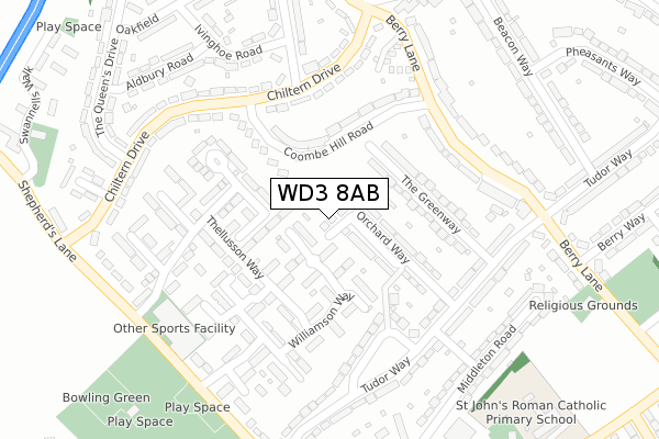
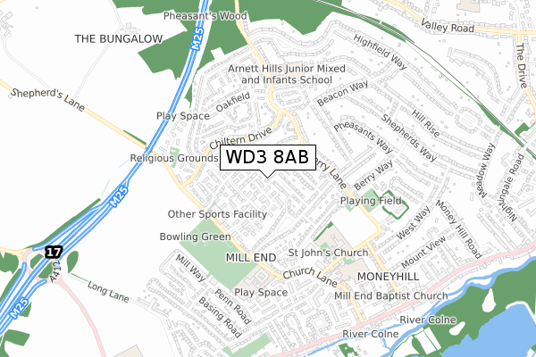
WD3 8AB is located in the Penn & Mill End electoral ward, within the local authority district of Three Rivers and the English Parliamentary constituency of South West Hertfordshire. The Sub Integrated Care Board (ICB) Location is NHS Hertfordshire and West Essex ICB - 06N and the police force is Hertfordshire. This postcode has been in use since September 2018.


GetTheData
Source: OS Open Zoomstack (Ordnance Survey)
Licence: Open Government Licence (requires attribution)
Attribution: Contains OS data © Crown copyright and database right 2024
Source: Open Postcode Geo
Licence: Open Government Licence (requires attribution)
Attribution: Contains OS data © Crown copyright and database right 2024; Contains Royal Mail data © Royal Mail copyright and database right 2024; Source: Office for National Statistics licensed under the Open Government Licence v.3.0
| Easting | 503664 |
| Northing | 193535 |
| Latitude | 51.631090 |
| Longitude | -0.503637 |
GetTheData
Source: Open Postcode Geo
Licence: Open Government Licence
| Country | England |
| Postcode District | WD3 |
| ➜ WD3 open data dashboard ➜ See where WD3 is on a map | |
GetTheData
Source: Land Registry Price Paid Data
Licence: Open Government Licence
| Ward | Penn & Mill End |
| Constituency | South West Hertfordshire |
GetTheData
Source: ONS Postcode Database
Licence: Open Government Licence
| June 2022 | Anti-social behaviour | On or near Eastwick Crescent | 319m |
| June 2022 | Anti-social behaviour | On or near Eastwick Crescent | 319m |
| June 2022 | Anti-social behaviour | On or near Eastwick Crescent | 319m |
| ➜ Get more crime data in our Crime section | |||
GetTheData
Source: data.police.uk
Licence: Open Government Licence
| Long Lane (Uxbridge Road) | Rickmansworth | 294m |
| Long Lane (Uxbridge Road) | Rickmansworth | 301m |
| Hertford Place (Denham Way) | Maple Cross | 357m |
| Hertford Place (Denham Way) | Maple Cross | 473m |
| Whip & Collar Ph (Uxbridge Road) | Rickmansworth | 748m |
| Rickmansworth Station | 2.3km |
| Chorleywood Station | 2.8km |
| Chalfont & Latimer Station | 5.7km |
GetTheData
Source: NaPTAN
Licence: Open Government Licence
GetTheData
Source: ONS Postcode Database
Licence: Open Government Licence


➜ Get more ratings from the Food Standards Agency
GetTheData
Source: Food Standards Agency
Licence: FSA terms & conditions
| Last Collection | |||
|---|---|---|---|
| Location | Mon-Fri | Sat | Distance |
| Uxbridge Road | 18:30 | 12:00 | 294m |
| Penn Road | 18:30 | 12:00 | 660m |
| Grove Road | 18:30 | 12:00 | 723m |
GetTheData
Source: Dracos
Licence: Creative Commons Attribution-ShareAlike
| Facility | Distance |
|---|---|
| The Reach Free School Long Lane, Rickmansworth Sports Hall, Artificial Grass Pitch, Grass Pitches | 0m |
| King George V Playing Field (Mill End) Shepherds Lane, Mill End, Rickmansworth Grass Pitches | 838m |
| William Penn Leisure Centre Shepherds Lane, Mill End, Rickmansworth Sports Hall, Swimming Pool, Health and Fitness Gym, Studio, Squash Courts, Artificial Grass Pitch | 968m |
GetTheData
Source: Active Places
Licence: Open Government Licence
| School | Phase of Education | Distance |
|---|---|---|
| The Reach Free School Long Lane, Rickmansworth, WD3 8AB | Secondary | 248m |
| Shepherd Primary Shepherd's Lane, Rickmansworth, WD3 8JJ | Primary | 828m |
| St Peter's Church of England Voluntary Aided Primary School Church Lane, Mill End, Rickmansworth, WD3 8HD | Primary | 1.1km |
GetTheData
Source: Edubase
Licence: Open Government Licence
The below table lists the International Territorial Level (ITL) codes (formerly Nomenclature of Territorial Units for Statistics (NUTS) codes) and Local Administrative Units (LAU) codes for WD3 8AB:
| ITL 1 Code | Name |
|---|---|
| TLH | East |
| ITL 2 Code | Name |
| TLH2 | Bedfordshire and Hertfordshire |
| ITL 3 Code | Name |
| TLH23 | Hertfordshire CC |
| LAU 1 Code | Name |
| E07000102 | Three Rivers |
GetTheData
Source: ONS Postcode Directory
Licence: Open Government Licence
The below table lists the Census Output Area (OA), Lower Layer Super Output Area (LSOA), and Middle Layer Super Output Area (MSOA) for WD3 8AB:
| Code | Name | |
|---|---|---|
| OA | E00121036 | |
| LSOA | E01023837 | Three Rivers 009C |
| MSOA | E02004964 | Three Rivers 009 |
GetTheData
Source: ONS Postcode Directory
Licence: Open Government Licence
| WD3 8YE | Long Lane | 257m |
| WD3 8XA | Uxbridge Road | 266m |
| WD3 8YF | Long Lane | 321m |
| WD3 8YH | Eastwick Crescent | 388m |
| WD3 8FE | Drayton Ford | 388m |
| WD3 8YL | Uxbridge Road | 392m |
| WD3 8YJ | Eastwick Crescent | 424m |
| WD3 8YQ | Kenwood Drive | 425m |
| WD3 8QQ | Fotherley Road | 470m |
| WD3 8YG | Long Lane | 476m |
GetTheData
Source: Open Postcode Geo; Land Registry Price Paid Data
Licence: Open Government Licence