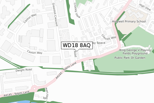
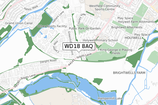
WD18 8AQ is located in the Holywell electoral ward, within the local authority district of Watford and the English Parliamentary constituency of Watford. The Sub Integrated Care Board (ICB) Location is NHS Hertfordshire and West Essex ICB - 06N and the police force is Hertfordshire. This postcode has been in use since September 2018.


GetTheData
Source: OS Open Zoomstack (Ordnance Survey)
Licence: Open Government Licence (requires attribution)
Attribution: Contains OS data © Crown copyright and database right 2024
Source: Open Postcode Geo
Licence: Open Government Licence (requires attribution)
Attribution: Contains OS data © Crown copyright and database right 2024; Contains Royal Mail data © Royal Mail copyright and database right 2024; Source: Office for National Statistics licensed under the Open Government Licence v.3.0
| Easting | 509198 |
| Northing | 194868 |
| Latitude | 51.642026 |
| Longitude | -0.423297 |
GetTheData
Source: Open Postcode Geo
Licence: Open Government Licence
| Country | England |
| Postcode District | WD18 |
| ➜ WD18 open data dashboard ➜ See where WD18 is on a map ➜ Where is Watford? | |
GetTheData
Source: Land Registry Price Paid Data
Licence: Open Government Licence
| Ward | Holywell |
| Constituency | Watford |
GetTheData
Source: ONS Postcode Database
Licence: Open Government Licence
| January 2024 | Anti-social behaviour | On or near Greenhill Crescent | 342m |
| January 2024 | Anti-social behaviour | On or near Croxley View | 449m |
| January 2024 | Anti-social behaviour | On or near Croxley View | 449m |
| ➜ Get more crime data in our Crime section | |||
GetTheData
Source: data.police.uk
Licence: Open Government Licence
| Watford Enterprise Centre (Greenhill Crescent) | Holywell | 238m |
| Chiltern Pines Estate (Croxley View) | Holywell | 272m |
| Caxton Court (Caxton Way) | Holywell | 299m |
| Jewson (Caxton Way) | Holywell | 322m |
| Chesham Way (Croxley View) | Holywell | 387m |
| Croxley Underground Station | Croxley Green | 1,390m |
| Moor Park Underground Station | Moor Park | 1,495m |
| Watford High Street Station | 2.5km |
| Bushey Station | 2.7km |
| Carpenders Park Station | 3km |
GetTheData
Source: NaPTAN
Licence: Open Government Licence
| Percentage of properties with Next Generation Access | 100.0% |
| Percentage of properties with Superfast Broadband | 100.0% |
| Percentage of properties with Ultrafast Broadband | 100.0% |
| Percentage of properties with Full Fibre Broadband | 100.0% |
Superfast Broadband is between 30Mbps and 300Mbps
Ultrafast Broadband is > 300Mbps
| Percentage of properties unable to receive 2Mbps | 0.0% |
| Percentage of properties unable to receive 5Mbps | 0.0% |
| Percentage of properties unable to receive 10Mbps | 0.0% |
| Percentage of properties unable to receive 30Mbps | 0.0% |
GetTheData
Source: Ofcom
Licence: Ofcom Terms of Use (requires attribution)
GetTheData
Source: ONS Postcode Database
Licence: Open Government Licence


➜ Get more ratings from the Food Standards Agency
GetTheData
Source: Food Standards Agency
Licence: FSA terms & conditions
| Last Collection | |||
|---|---|---|---|
| Location | Mon-Fri | Sat | Distance |
| Greenhill Crescent | 18:30 | 12:00 | 279m |
| Dwight Road | 296m | ||
| Dwight Road | 18:30 | 12:00 | 300m |
GetTheData
Source: Dracos
Licence: Creative Commons Attribution-ShareAlike
| Facility | Distance |
|---|---|
| Pump Gyms (Watford) (Closed) Greenhill Crescent, Watford Health and Fitness Gym, Studio | 306m |
| Pump Gyms (Watford) Wolsey Business Park, Tolpits Lane, Watford Health and Fitness Gym, Studio | 505m |
| Anytime Fitness (Croxley Park) Hatters Lane, Watford Health and Fitness Gym | 598m |
GetTheData
Source: Active Places
Licence: Open Government Licence
| School | Phase of Education | Distance |
|---|---|---|
| Holywell Primary School Tolpits Lane, Watford, WD18 6LL | Primary | 428m |
| St Anthony's Catholic Primary School Croxley View, Watford, WD18 6BW | Primary | 677m |
| Westfield Academy Tolpits Lane, Watford, WD18 6NS | Secondary | 752m |
GetTheData
Source: Edubase
Licence: Open Government Licence
The below table lists the International Territorial Level (ITL) codes (formerly Nomenclature of Territorial Units for Statistics (NUTS) codes) and Local Administrative Units (LAU) codes for WD18 8AQ:
| ITL 1 Code | Name |
|---|---|
| TLH | East |
| ITL 2 Code | Name |
| TLH2 | Bedfordshire and Hertfordshire |
| ITL 3 Code | Name |
| TLH23 | Hertfordshire CC |
| LAU 1 Code | Name |
| E07000103 | Watford |
GetTheData
Source: ONS Postcode Directory
Licence: Open Government Licence
The below table lists the Census Output Area (OA), Lower Layer Super Output Area (LSOA), and Middle Layer Super Output Area (MSOA) for WD18 8AQ:
| Code | Name | |
|---|---|---|
| OA | E00121191 | |
| LSOA | E01023866 | Watford 011D |
| MSOA | E02004978 | Watford 011 |
GetTheData
Source: ONS Postcode Directory
Licence: Open Government Licence
| WD18 6XL | Latimer Close | 84m |
| WD18 6US | Chenies Way | 113m |
| WD18 6XE | Marsworth Close | 139m |
| WD18 8QZ | Caxton Way | 152m |
| WD18 6UQ | Chenies Way | 156m |
| WD18 6PP | Croxley View | 157m |
| WD18 6UP | Chenies Way | 161m |
| WD18 6UW | Chenies Way | 181m |
| WD18 6PR | Croxley View | 200m |
| WD18 8JU | Greenhill Crescent | 202m |
GetTheData
Source: Open Postcode Geo; Land Registry Price Paid Data
Licence: Open Government Licence