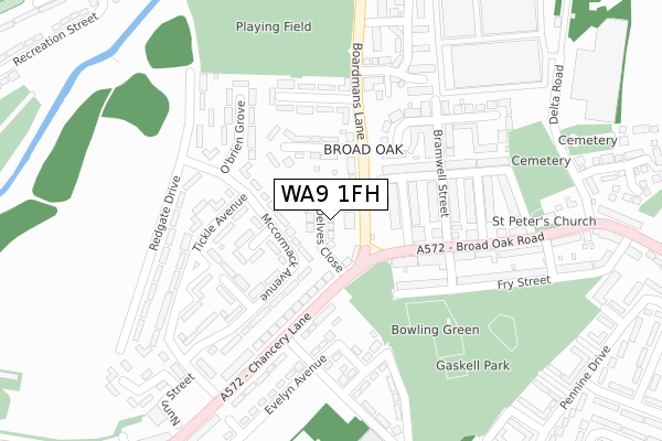
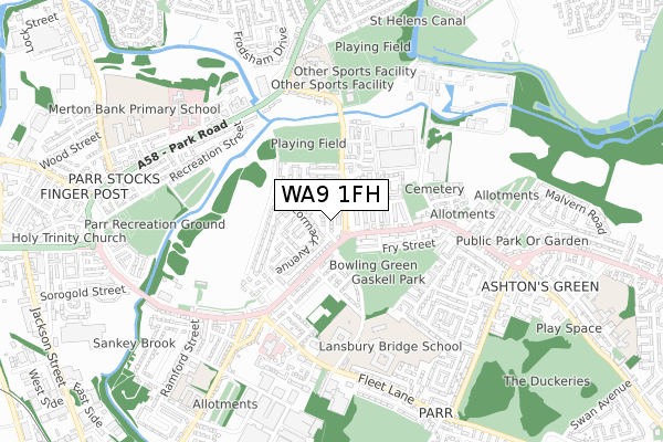
WA9 1FH is located in the Parr electoral ward, within the metropolitan district of St. Helens and the English Parliamentary constituency of St Helens North. The Sub Integrated Care Board (ICB) Location is NHS Cheshire and Merseyside ICB - 01X and the police force is Merseyside. This postcode has been in use since April 2020.


GetTheData
Source: OS Open Zoomstack (Ordnance Survey)
Licence: Open Government Licence (requires attribution)
Attribution: Contains OS data © Crown copyright and database right 2024
Source: Open Postcode Geo
Licence: Open Government Licence (requires attribution)
Attribution: Contains OS data © Crown copyright and database right 2024; Contains Royal Mail data © Royal Mail copyright and database right 2024; Source: Office for National Statistics licensed under the Open Government Licence v.3.0
| Easting | 353228 |
| Northing | 395479 |
| Latitude | 53.453995 |
| Longitude | -2.705802 |
GetTheData
Source: Open Postcode Geo
Licence: Open Government Licence
| Country | England |
| Postcode District | WA9 |
| ➜ WA9 open data dashboard ➜ See where WA9 is on a map ➜ Where is St Helens? | |
GetTheData
Source: Land Registry Price Paid Data
Licence: Open Government Licence
| Ward | Parr |
| Constituency | St Helens North |
GetTheData
Source: ONS Postcode Database
Licence: Open Government Licence
| January 2024 | Public order | On or near Parking Area | 337m |
| January 2024 | Violence and sexual offences | On or near Parking Area | 337m |
| January 2024 | Violence and sexual offences | On or near Parking Area | 337m |
| ➜ Get more crime data in our Crime section | |||
GetTheData
Source: data.police.uk
Licence: Open Government Licence
| Boardmans Lane (Chancery Lane) | Parr Stocks | 94m |
| Reeves Street (Broad Oak Road) | Broad Oak | 136m |
| Hargreaves Street (Broad Oak Road) | Broad Oak | 147m |
| Nicholson Street (Broad Oak Road) | Broad Oak | 246m |
| Tickle Avenue (Chancery Lane) | Parr Stocks | 346m |
| St Helens Central Station | 1.6km |
| St Helens Junction Station | 2.3km |
| Lea Green Station | 3.3km |
GetTheData
Source: NaPTAN
Licence: Open Government Licence
GetTheData
Source: ONS Postcode Database
Licence: Open Government Licence


➜ Get more ratings from the Food Standards Agency
GetTheData
Source: Food Standards Agency
Licence: FSA terms & conditions
| Last Collection | |||
|---|---|---|---|
| Location | Mon-Fri | Sat | Distance |
| Broad Oak Road | 17:00 | 11:00 | 184m |
| Ashtons Green Post Office | 17:00 | 12:00 | 285m |
| Sorogold Street | 17:00 | 11:00 | 799m |
GetTheData
Source: Dracos
Licence: Creative Commons Attribution-ShareAlike
| Facility | Distance |
|---|---|
| Blackbrook Arlfc Boardmans Lane, St. Helens Grass Pitches | 473m |
| Lansbury Bridge School And Sports College Lansbury Avenue, St. Helens Swimming Pool, Sports Hall, Health and Fitness Gym, Grass Pitches | 527m |
| Parr Stocks Playing Fields Parr Stocks Road, St Helens Grass Pitches | 545m |
GetTheData
Source: Active Places
Licence: Open Government Licence
| School | Phase of Education | Distance |
|---|---|---|
| Mill Green School Lansbury Avenue, Parr, St Helens, WA9 1BU | Not applicable | 441m |
| Lansbury Bridge School Lansbury Avenue, Parr, St Helens, WA9 1TB | Not applicable | 529m |
| St Augustine of Canterbury Catholic Academy Boardmans Lane, Blackbrook, St. Helens, WA11 9BB | Secondary | 575m |
GetTheData
Source: Edubase
Licence: Open Government Licence
The below table lists the International Territorial Level (ITL) codes (formerly Nomenclature of Territorial Units for Statistics (NUTS) codes) and Local Administrative Units (LAU) codes for WA9 1FH:
| ITL 1 Code | Name |
|---|---|
| TLD | North West (England) |
| ITL 2 Code | Name |
| TLD7 | Merseyside |
| ITL 3 Code | Name |
| TLD71 | East Merseyside |
| LAU 1 Code | Name |
| E08000013 | St. Helens |
GetTheData
Source: ONS Postcode Directory
Licence: Open Government Licence
The below table lists the Census Output Area (OA), Lower Layer Super Output Area (LSOA), and Middle Layer Super Output Area (MSOA) for WA9 1FH:
| Code | Name | |
|---|---|---|
| OA | E00034847 | |
| LSOA | E01006871 | St. Helens 011D |
| MSOA | E02001416 | St. Helens 011 |
GetTheData
Source: ONS Postcode Directory
Licence: Open Government Licence
| WA9 1QU | Boardmans Lane | 47m |
| WA9 1RD | Mccormack Avenue | 68m |
| WA9 2DH | Hargreaves Street | 98m |
| WA9 1RX | Mccormack Avenue | 127m |
| WA9 1QZ | Seath Avenue | 134m |
| WA9 2ER | Broad Oak Road | 141m |
| WA9 1SH | Chancery Lane | 144m |
| WA9 2DJ | Charnwood Street | 144m |
| WA9 1RE | Kerr Grove | 146m |
| WA9 1SJ | Chancery Lane | 154m |
GetTheData
Source: Open Postcode Geo; Land Registry Price Paid Data
Licence: Open Government Licence