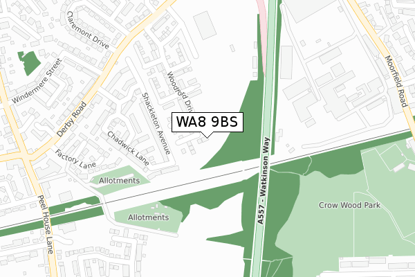
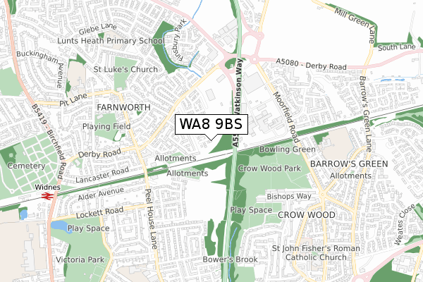
WA8 9BS is located in the Farnworth electoral ward, within the unitary authority of Halton and the English Parliamentary constituency of Halton. The Sub Integrated Care Board (ICB) Location is NHS Cheshire and Merseyside ICB - 01F and the police force is Cheshire. This postcode has been in use since April 2020.


GetTheData
Source: OS Open Zoomstack (Ordnance Survey)
Licence: Open Government Licence (requires attribution)
Attribution: Contains OS data © Crown copyright and database right 2024
Source: Open Postcode Geo
Licence: Open Government Licence (requires attribution)
Attribution: Contains OS data © Crown copyright and database right 2024; Contains Royal Mail data © Royal Mail copyright and database right 2024; Source: Office for National Statistics licensed under the Open Government Licence v.3.0
| Easting | 352270 |
| Northing | 387449 |
| Latitude | 53.381737 |
| Longitude | -2.719010 |
GetTheData
Source: Open Postcode Geo
Licence: Open Government Licence
| Country | England |
| Postcode District | WA8 |
| ➜ WA8 open data dashboard ➜ See where WA8 is on a map ➜ Where is Widnes? | |
GetTheData
Source: Land Registry Price Paid Data
Licence: Open Government Licence
| Ward | Farnworth |
| Constituency | Halton |
GetTheData
Source: ONS Postcode Database
Licence: Open Government Licence
5, ALDERSHOT CLOSE, WIDNES, WA8 9BS 2020 14 AUG £233,995 |
2, ALDERSHOT CLOSE, WIDNES, WA8 9BS 2020 13 AUG £298,995 |
3, ALDERSHOT CLOSE, WIDNES, WA8 9BS 2020 7 AUG £295,995 |
1, ALDERSHOT CLOSE, WIDNES, WA8 9BS 2020 6 AUG £234,995 |
4, ALDERSHOT CLOSE, WIDNES, WA8 9BS 2020 6 AUG £270,995 |
7, ALDERSHOT CLOSE, WIDNES, WA8 9BS 2020 20 FEB £229,995 |
6, ALDERSHOT CLOSE, WIDNES, WA8 9BS 2020 13 FEB £229,995 |
GetTheData
Source: HM Land Registry Price Paid Data
Licence: Contains HM Land Registry data © Crown copyright and database right 2024. This data is licensed under the Open Government Licence v3.0.
| June 2023 | Violence and sexual offences | On or near Marsh Hall Road | 487m |
| June 2022 | Drugs | On or near Derby Road | 329m |
| June 2022 | Other crime | On or near Boxgrove Close | 330m |
| ➜ Get more crime data in our Crime section | |||
GetTheData
Source: data.police.uk
Licence: Open Government Licence
| Everite Works (Derby Road) | Farnworth | 308m |
| Everite Works (Derby Road) | Farnworth | 321m |
| Peelhouse Lane | Farnworth | 438m |
| Peelhouse Lane | Farnworth | 452m |
| Horns (Moorfield Road) | Barrows Green | 468m |
| Widnes Station | 1km |
| Hough Green Station | 3.9km |
| Sankey for Penketh Station | 4.7km |
GetTheData
Source: NaPTAN
Licence: Open Government Licence
GetTheData
Source: ONS Postcode Database
Licence: Open Government Licence


➜ Get more ratings from the Food Standards Agency
GetTheData
Source: Food Standards Agency
Licence: FSA terms & conditions
| Last Collection | |||
|---|---|---|---|
| Location | Mon-Fri | Sat | Distance |
| Farnworth S.o. | 17:15 | 12:00 | 464m |
| Lytham Road | 17:30 | 11:00 | 641m |
| Beaconsfield | 17:15 | 11:00 | 706m |
GetTheData
Source: Dracos
Licence: Creative Commons Attribution-ShareAlike
| Facility | Distance |
|---|---|
| Wade Deacon High School (Closed) Peel House Lane, Widnes Grass Pitches, Sports Hall, Artificial Grass Pitch, Studio | 424m |
| Moorfield Sports And Social Club Moorfield Road, Widnes Grass Pitches | 497m |
| Crow Wood Park Bancroft Road, Widnes Grass Pitches | 533m |
GetTheData
Source: Active Places
Licence: Open Government Licence
| School | Phase of Education | Distance |
|---|---|---|
| Moorfield Primary School School Way, Moorfield Road, Widnes, WA8 3HJ | Primary | 656m |
| Farnworth Church of England Controlled Primary School Pit Lane, Widnes, WA8 9HS | Primary | 853m |
| Lunts Heath Primary School Wedgewood Drive, Widnes, WA8 9RJ | Primary | 863m |
GetTheData
Source: Edubase
Licence: Open Government Licence
The below table lists the International Territorial Level (ITL) codes (formerly Nomenclature of Territorial Units for Statistics (NUTS) codes) and Local Administrative Units (LAU) codes for WA8 9BS:
| ITL 1 Code | Name |
|---|---|
| TLD | North West (England) |
| ITL 2 Code | Name |
| TLD7 | Merseyside |
| ITL 3 Code | Name |
| TLD71 | East Merseyside |
| LAU 1 Code | Name |
| E06000006 | Halton |
GetTheData
Source: ONS Postcode Directory
Licence: Open Government Licence
The below table lists the Census Output Area (OA), Lower Layer Super Output Area (LSOA), and Middle Layer Super Output Area (MSOA) for WA8 9BS:
| Code | Name | |
|---|---|---|
| OA | E00062518 | |
| LSOA | E01012394 | Halton 005B |
| MSOA | E02002578 | Halton 005 |
GetTheData
Source: ONS Postcode Directory
Licence: Open Government Licence
| WA8 9NG | Shackleton Avenue | 184m |
| WA8 9NH | Wallis Drive | 209m |
| WA8 9NN | Chadwick Lane | 210m |
| WA8 9NE | Derby Road | 326m |
| WA8 9NF | Derby Road | 338m |
| WA8 9LU | Derby Road | 338m |
| WA8 9LT | Marsh Hall Road | 377m |
| WA8 9UN | Peel House Lane | 402m |
| WA8 9LN | Windermere Avenue | 408m |
| WA8 9LX | Claremont Drive | 409m |
GetTheData
Source: Open Postcode Geo; Land Registry Price Paid Data
Licence: Open Government Licence