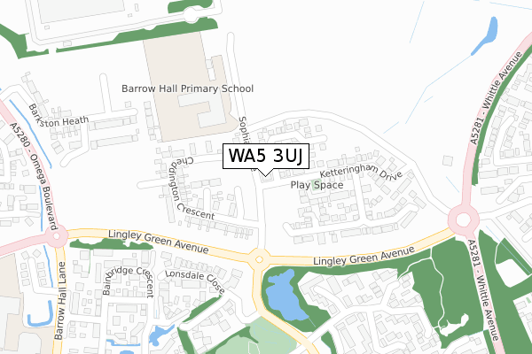
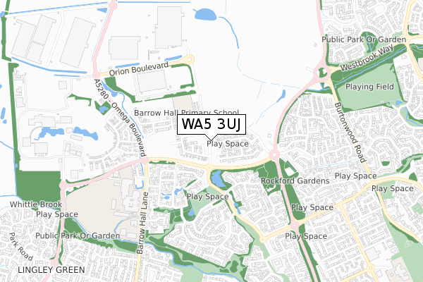
WA5 3UJ is located in the Great Sankey North and Whittle Hall electoral ward, within the unitary authority of Warrington and the English Parliamentary constituency of Warrington South. The Sub Integrated Care Board (ICB) Location is NHS Cheshire and Merseyside ICB - 02E and the police force is Cheshire. This postcode has been in use since April 2020.


GetTheData
Source: OS Open Zoomstack (Ordnance Survey)
Licence: Open Government Licence (requires attribution)
Attribution: Contains OS data © Crown copyright and database right 2024
Source: Open Postcode Geo
Licence: Open Government Licence (requires attribution)
Attribution: Contains OS data © Crown copyright and database right 2024; Contains Royal Mail data © Royal Mail copyright and database right 2024; Source: Office for National Statistics licensed under the Open Government Licence v.3.0
| Easting | 356604 |
| Northing | 389841 |
| Latitude | 53.403610 |
| Longitude | -2.654189 |
GetTheData
Source: Open Postcode Geo
Licence: Open Government Licence
| Country | England |
| Postcode District | WA5 |
| ➜ WA5 open data dashboard ➜ See where WA5 is on a map ➜ Where is Warrington? | |
GetTheData
Source: Land Registry Price Paid Data
Licence: Open Government Licence
| Ward | Great Sankey North And Whittle Hall |
| Constituency | Warrington South |
GetTheData
Source: ONS Postcode Database
Licence: Open Government Licence
| June 2022 | Vehicle crime | On or near Bainbridge Crescent | 312m |
| June 2022 | Violence and sexual offences | On or near Bainbridge Crescent | 312m |
| June 2022 | Anti-social behaviour | On or near Wensleydale Close | 331m |
| ➜ Get more crime data in our Crime section | |||
GetTheData
Source: data.police.uk
Licence: Open Government Licence
| Post Office Sorting Centre (Lingley Green Avenue) | Lingley Green | 218m |
| Kingsdale Mere (Lonsdale Close) | Lingley Green | 225m |
| Kingsdale Mere (Lonsdale Close) | Lingley Green | 229m |
| Post Office Sorting Centre (Lingley Green Avenue) | Lingley Green | 234m |
| Wensleydale Close (Kingsdale Road) | Lingley Green | 373m |
| Sankey for Penketh Station | 1.3km |
| Warrington Bank Quay Station | 4km |
| Warrington Central Station | 4.3km |
GetTheData
Source: NaPTAN
Licence: Open Government Licence
GetTheData
Source: ONS Postcode Database
Licence: Open Government Licence


➜ Get more ratings from the Food Standards Agency
GetTheData
Source: Food Standards Agency
Licence: FSA terms & conditions
| Last Collection | |||
|---|---|---|---|
| Location | Mon-Fri | Sat | Distance |
| Malvern Chase | 17:00 | 11:00 | 454m |
| Kingsdale Road | 16:45 | 11:00 | 540m |
| Bicknell Close | 17:30 | 11:00 | 905m |
GetTheData
Source: Dracos
Licence: Creative Commons Attribution-ShareAlike
| Facility | Distance |
|---|---|
| Barrow Hall Primary School Sophia Drive, Sophia Drive, Great Sankey, Warrington Grass Pitches | 163m |
| Great Sankey Neighbourhood Hub Barrow Hall Lane, Great Sankey, Warrington Sports Hall, Swimming Pool, Health and Fitness Gym, Artificial Grass Pitch, Grass Pitches, Studio, Squash Courts, Outdoor Tennis Courts | 587m |
| Great Sankey High School Barrow Hall Lane, Great Sankey, Warrington Sports Hall | 589m |
GetTheData
Source: Active Places
Licence: Open Government Licence
| School | Phase of Education | Distance |
|---|---|---|
| Barrow Hall Community Primary School Sophia Drive, Great Sankey, Warrington, WA5 3TX | Primary | 163m |
| Great Sankey High School Barrow Hall Lane, Great Sankey, Warrington, WA5 3AA | Secondary | 589m |
| Park Road Community Primary School Wroxham Road, Great Sankey, WARRINGTON, WA5 3EF | Primary | 1.1km |
GetTheData
Source: Edubase
Licence: Open Government Licence
The below table lists the International Territorial Level (ITL) codes (formerly Nomenclature of Territorial Units for Statistics (NUTS) codes) and Local Administrative Units (LAU) codes for WA5 3UJ:
| ITL 1 Code | Name |
|---|---|
| TLD | North West (England) |
| ITL 2 Code | Name |
| TLD6 | Cheshire |
| ITL 3 Code | Name |
| TLD61 | Warrington |
| LAU 1 Code | Name |
| E06000007 | Warrington |
GetTheData
Source: ONS Postcode Directory
Licence: Open Government Licence
The below table lists the Census Output Area (OA), Lower Layer Super Output Area (LSOA), and Middle Layer Super Output Area (MSOA) for WA5 3UJ:
| Code | Name | |
|---|---|---|
| OA | E00063381 | |
| LSOA | E01012567 | Warrington 009C |
| MSOA | E02002598 | Warrington 009 |
GetTheData
Source: ONS Postcode Directory
Licence: Open Government Licence
| WA5 3UA | Lonsdale Close | 255m |
| WA5 3HZ | Wensleydale Close | 274m |
| WA5 3RS | Malham Close | 289m |
| WA5 3RT | Bainbridge Crescent | 333m |
| WA5 3HT | Wensleydale Close | 385m |
| WA5 3RU | Stockdale Drive | 398m |
| WA5 3RW | Stockdale Drive | 405m |
| WA5 3FX | Farndale Close | 410m |
| WA5 3TA | Billington Close | 457m |
| WA5 3RF | Tunbridge Close | 459m |
GetTheData
Source: Open Postcode Geo; Land Registry Price Paid Data
Licence: Open Government Licence