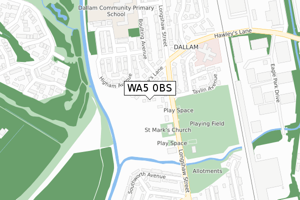
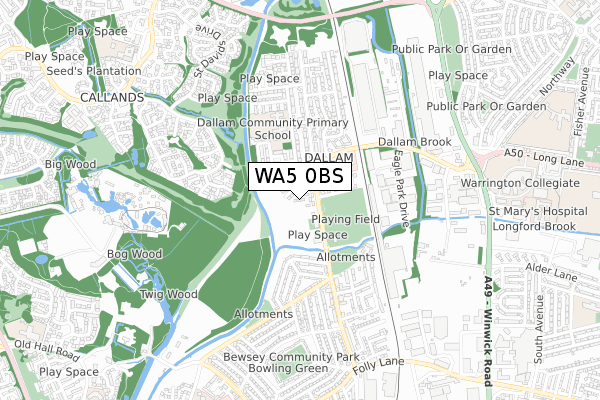
WA5 0BS is located in the Bewsey and Whitecross electoral ward, within the unitary authority of Warrington and the English Parliamentary constituency of Warrington South. The Sub Integrated Care Board (ICB) Location is NHS Cheshire and Merseyside ICB - 02E and the police force is Cheshire. This postcode has been in use since April 2017.


GetTheData
Source: OS Open Zoomstack (Ordnance Survey)
Licence: Open Government Licence (requires attribution)
Attribution: Contains OS data © Crown copyright and database right 2024
Source: Open Postcode Geo
Licence: Open Government Licence (requires attribution)
Attribution: Contains OS data © Crown copyright and database right 2024; Contains Royal Mail data © Royal Mail copyright and database right 2024; Source: Office for National Statistics licensed under the Open Government Licence v.3.0
| Easting | 359794 |
| Northing | 390154 |
| Latitude | 53.406677 |
| Longitude | -2.606251 |
GetTheData
Source: Open Postcode Geo
Licence: Open Government Licence
| Country | England |
| Postcode District | WA5 |
| ➜ WA5 open data dashboard ➜ See where WA5 is on a map ➜ Where is Warrington? | |
GetTheData
Source: Land Registry Price Paid Data
Licence: Open Government Licence
| Ward | Bewsey And Whitecross |
| Constituency | Warrington South |
GetTheData
Source: ONS Postcode Database
Licence: Open Government Licence
| November 2023 | Violence and sexual offences | On or near Caldwell Avenue | 451m |
| November 2023 | Violence and sexual offences | On or near Caldwell Avenue | 451m |
| September 2023 | Violence and sexual offences | On or near Caldwell Avenue | 451m |
| ➜ Get more crime data in our Crime section | |||
GetTheData
Source: data.police.uk
Licence: Open Government Licence
| Hawley's Lane (Longshaw Street) | Dallam | 90m |
| Hawley's Lane (Longshaw Street) | Dallam | 113m |
| Transport Club (Longshaw Street) | Dallam | 202m |
| Transport Club (Longshaw Street) | Dallam | 212m |
| Harrison Square (Longshaw Street) | Dallam | 271m |
| Warrington Central Station | 1.9km |
| Warrington Bank Quay Station | 2.3km |
| Padgate Station | 3.3km |
GetTheData
Source: NaPTAN
Licence: Open Government Licence
➜ Broadband speed and availability dashboard for WA5 0BS
| Percentage of properties with Next Generation Access | 100.0% |
| Percentage of properties with Superfast Broadband | 100.0% |
| Percentage of properties with Ultrafast Broadband | 0.0% |
| Percentage of properties with Full Fibre Broadband | 0.0% |
Superfast Broadband is between 30Mbps and 300Mbps
Ultrafast Broadband is > 300Mbps
| Median download speed | 21.9Mbps |
| Average download speed | 34.0Mbps |
| Maximum download speed | 78.12Mbps |
| Median upload speed | 5.3Mbps |
| Average upload speed | 8.6Mbps |
| Maximum upload speed | 19.93Mbps |
| Percentage of properties unable to receive 2Mbps | 0.0% |
| Percentage of properties unable to receive 5Mbps | 0.0% |
| Percentage of properties unable to receive 10Mbps | 0.0% |
| Percentage of properties unable to receive 30Mbps | 0.0% |
➜ Broadband speed and availability dashboard for WA5 0BS
GetTheData
Source: Ofcom
Licence: Ofcom Terms of Use (requires attribution)
GetTheData
Source: ONS Postcode Database
Licence: Open Government Licence


➜ Get more ratings from the Food Standards Agency
GetTheData
Source: Food Standards Agency
Licence: FSA terms & conditions
| Last Collection | |||
|---|---|---|---|
| Location | Mon-Fri | Sat | Distance |
| Dallam S.o. | 16:00 | 12:00 | 364m |
| Lilford Avenue | 16:00 | 11:00 | 401m |
| Grace Avenue | 16:00 | 11:00 | 993m |
GetTheData
Source: Dracos
Licence: Creative Commons Attribution-ShareAlike
| Facility | Distance |
|---|---|
| Bewsey And Dallam Community Hub Longshaw Street, Longshaw Street, Warrington Swimming Pool, Health and Fitness Gym | 188m |
| Dallam Recreation Ground Charter Avenue, Warrington Grass Pitches | 211m |
| Dallam Community Primary School Boulting Avenue, Warrington Grass Pitches | 303m |
GetTheData
Source: Active Places
Licence: Open Government Licence
| School | Phase of Education | Distance |
|---|---|---|
| Dallam Community Primary School Boulting Avenue, Dallam, Warrington, WA5 0JG | Primary | 317m |
| Warrington and Vale Royal College Winwick Road, Warrington, WA2 8QA | 16 plus | 907m |
| Callands Community Primary School Callands Road, Callands, Warrington, WA5 9RJ | Primary | 938m |
GetTheData
Source: Edubase
Licence: Open Government Licence
The below table lists the International Territorial Level (ITL) codes (formerly Nomenclature of Territorial Units for Statistics (NUTS) codes) and Local Administrative Units (LAU) codes for WA5 0BS:
| ITL 1 Code | Name |
|---|---|
| TLD | North West (England) |
| ITL 2 Code | Name |
| TLD6 | Cheshire |
| ITL 3 Code | Name |
| TLD61 | Warrington |
| LAU 1 Code | Name |
| E06000007 | Warrington |
GetTheData
Source: ONS Postcode Directory
Licence: Open Government Licence
The below table lists the Census Output Area (OA), Lower Layer Super Output Area (LSOA), and Middle Layer Super Output Area (MSOA) for WA5 0BS:
| Code | Name | |
|---|---|---|
| OA | E00062820 | |
| LSOA | E01012453 | Warrington 013A |
| MSOA | E02002602 | Warrington 013 |
GetTheData
Source: ONS Postcode Directory
Licence: Open Government Licence
| WA5 0DY | Longshaw Street | 42m |
| WA5 0EH | Hawleys Lane | 44m |
| WA5 0EJ | Hawleys Lane | 75m |
| WA5 0EG | Longshaw Street | 114m |
| WA5 0HF | Higham Avenue | 124m |
| WA5 0EQ | Hawleys Lane | 126m |
| WA5 0HD | Hindle Avenue | 150m |
| WA5 0HA | Boulting Avenue | 179m |
| WA5 0HB | Gale Avenue | 213m |
| WA5 0JD | Longshaw Street | 217m |
GetTheData
Source: Open Postcode Geo; Land Registry Price Paid Data
Licence: Open Government Licence