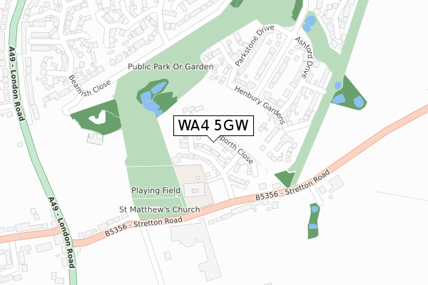
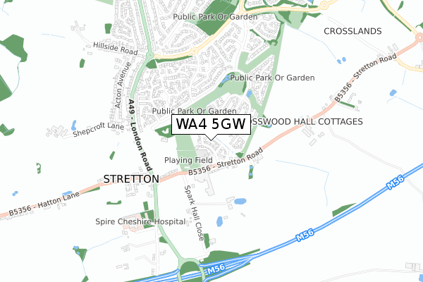
WA4 5GW is located in the Appleton electoral ward, within the unitary authority of Warrington and the English Parliamentary constituency of Warrington South. The Sub Integrated Care Board (ICB) Location is NHS Cheshire and Merseyside ICB - 02E and the police force is Cheshire. This postcode has been in use since April 2020.


GetTheData
Source: OS Open Zoomstack (Ordnance Survey)
Licence: Open Government Licence (requires attribution)
Attribution: Contains OS data © Crown copyright and database right 2024
Source: Open Postcode Geo
Licence: Open Government Licence (requires attribution)
Attribution: Contains OS data © Crown copyright and database right 2024; Contains Royal Mail data © Royal Mail copyright and database right 2024; Source: Office for National Statistics licensed under the Open Government Licence v.3.0
| Easting | 362387 |
| Northing | 382981 |
| Latitude | 53.342397 |
| Longitude | -2.566391 |
GetTheData
Source: Open Postcode Geo
Licence: Open Government Licence
| Country | England |
| Postcode District | WA4 |
| ➜ WA4 open data dashboard ➜ See where WA4 is on a map ➜ Where is Warrington? | |
GetTheData
Source: Land Registry Price Paid Data
Licence: Open Government Licence
| Ward | Appleton |
| Constituency | Warrington South |
GetTheData
Source: ONS Postcode Database
Licence: Open Government Licence
1, HAYLING CLOSE, APPLETON, WARRINGTON, WA4 5GW 2020 26 JUN £292,995 |
5, HAYLING CLOSE, APPLETON, WARRINGTON, WA4 5GW 2020 27 MAR £338,995 |
3, HAYLING CLOSE, APPLETON, WARRINGTON, WA4 5GW 2020 27 MAR £388,995 |
GetTheData
Source: HM Land Registry Price Paid Data
Licence: Contains HM Land Registry data © Crown copyright and database right 2024. This data is licensed under the Open Government Licence v3.0.
| May 2022 | Public order | On or near Henbury Gardens | 154m |
| May 2022 | Violence and sexual offences | On or near Henbury Gardens | 154m |
| May 2022 | Violence and sexual offences | On or near Stretton Road | 177m |
| ➜ Get more crime data in our Crime section | |||
GetTheData
Source: data.police.uk
Licence: Open Government Licence
| Hanover Hotel (Stretton Road) | Stretton | 299m |
| Hanover Hotel (Stretton Road) | Stretton | 308m |
| Pewterspear Green Road | Appleton | 313m |
| Pewterspear Green Road | Appleton | 329m |
| Playing Field (Pewterspear Green Road) | Appleton Cross | 361m |
| Warrington Bank Quay Station | 5.4km |
GetTheData
Source: NaPTAN
Licence: Open Government Licence
GetTheData
Source: ONS Postcode Database
Licence: Open Government Licence


➜ Get more ratings from the Food Standards Agency
GetTheData
Source: Food Standards Agency
Licence: FSA terms & conditions
| Last Collection | |||
|---|---|---|---|
| Location | Mon-Fri | Sat | Distance |
| Stretton So | 17:30 | 12:00 | 625m |
| Woodbridge Close | 17:30 | 11:00 | 625m |
| Hillside Road | 17:30 | 08:30 | 732m |
GetTheData
Source: Dracos
Licence: Creative Commons Attribution-ShareAlike
| Facility | Distance |
|---|---|
| Stretton St Matthews C Of E Primary School Stretton Road, Stretton, Warrington Grass Pitches | 309m |
| Village Pond Pitch Pewterspear Green Road, Appleton, Warrington Grass Pitches | 310m |
| The Park Royal Stretton Road, Stretton, Warrington Swimming Pool, Health and Fitness Gym, Studio, Outdoor Tennis Courts | 385m |
GetTheData
Source: Active Places
Licence: Open Government Licence
| School | Phase of Education | Distance |
|---|---|---|
| Stretton St Matthew's CofE Primary School Stretton Road, Stretton, Warrington, WA4 4NT | Primary | 309m |
| Appleton Thorn Primary School Arley Road, Appleton Thorn, Warrington, WA4 4RW | Primary | 1.8km |
| Grappenhall Heys Community Primary School Stansfield Drive, Grappenhall Heys, Warrington, WA4 3EA | Primary | 2.2km |
GetTheData
Source: Edubase
Licence: Open Government Licence
The below table lists the International Territorial Level (ITL) codes (formerly Nomenclature of Territorial Units for Statistics (NUTS) codes) and Local Administrative Units (LAU) codes for WA4 5GW:
| ITL 1 Code | Name |
|---|---|
| TLD | North West (England) |
| ITL 2 Code | Name |
| TLD6 | Cheshire |
| ITL 3 Code | Name |
| TLD61 | Warrington |
| LAU 1 Code | Name |
| E06000007 | Warrington |
GetTheData
Source: ONS Postcode Directory
Licence: Open Government Licence
The below table lists the Census Output Area (OA), Lower Layer Super Output Area (LSOA), and Middle Layer Super Output Area (MSOA) for WA4 5GW:
| Code | Name | |
|---|---|---|
| OA | E00063052 | |
| LSOA | E01012503 | Warrington 024D |
| MSOA | E02002613 | Warrington 024 |
GetTheData
Source: ONS Postcode Directory
Licence: Open Government Licence
| WA4 5GG | Ashford Drive | 76m |
| WA4 5GH | Henbury Gardens | 143m |
| WA4 5FR | Pewterspear Green Road | 161m |
| WA4 4NP | Stretton Road | 173m |
| WA4 4NR | Beech Cottages | 292m |
| WA4 5FQ | Westcliff Gardens | 325m |
| WA4 5FE | Pewterspear Green Road | 354m |
| WA4 5RB | St Georges Close | 394m |
| WA4 5FD | Pewterspear Green Road | 432m |
| WA4 5QZ | Hartswood Close | 454m |
GetTheData
Source: Open Postcode Geo; Land Registry Price Paid Data
Licence: Open Government Licence