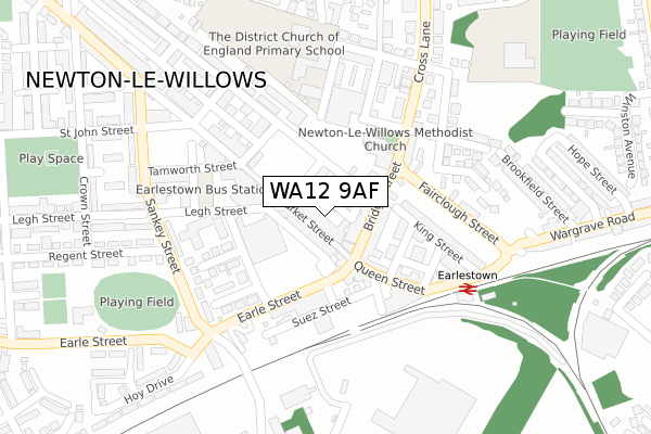
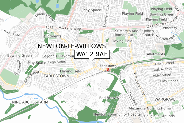
WA12 9AF is located in the Newton-le-Willows West electoral ward, within the metropolitan district of St. Helens and the English Parliamentary constituency of St Helens North. The Sub Integrated Care Board (ICB) Location is NHS Cheshire and Merseyside ICB - 01X and the police force is Merseyside. This postcode has been in use since February 2020.


GetTheData
Source: OS Open Zoomstack (Ordnance Survey)
Licence: Open Government Licence (requires attribution)
Attribution: Contains OS data © Crown copyright and database right 2024
Source: Open Postcode Geo
Licence: Open Government Licence (requires attribution)
Attribution: Contains OS data © Crown copyright and database right 2024; Contains Royal Mail data © Royal Mail copyright and database right 2024; Source: Office for National Statistics licensed under the Open Government Licence v.3.0
| Easting | 357537 |
| Northing | 395234 |
| Latitude | 53.452159 |
| Longitude | -2.640885 |
GetTheData
Source: Open Postcode Geo
Licence: Open Government Licence
| Country | England |
| Postcode District | WA12 |
| ➜ WA12 open data dashboard ➜ See where WA12 is on a map ➜ Where is Newton-le-Willows? | |
GetTheData
Source: Land Registry Price Paid Data
Licence: Open Government Licence
| Ward | Newton-le-willows West |
| Constituency | St Helens North |
GetTheData
Source: ONS Postcode Database
Licence: Open Government Licence
| January 2024 | Burglary | On or near Stanley Street | 153m |
| January 2024 | Violence and sexual offences | On or near Stanley Street | 153m |
| January 2024 | Violence and sexual offences | On or near Police Station | 172m |
| ➜ Get more crime data in our Crime section | |||
GetTheData
Source: data.police.uk
Licence: Open Government Licence
| Oxford Street (Haydock Street) | Earlestown | 70m |
| Oxford Street (Haydock Street) | Earlestown | 115m |
| Wellington Street (Earle Street) | Earlestown | 125m |
| Market Street (Stanley Street) | Earlestown | 145m |
| Wellington Street (Earle Street) | Earlestown | 172m |
| Earlestown Station | 0.2km |
| Newton-le-Willows Station | 1.8km |
| St Helens Junction Station | 4.4km |
GetTheData
Source: NaPTAN
Licence: Open Government Licence
GetTheData
Source: ONS Postcode Database
Licence: Open Government Licence


➜ Get more ratings from the Food Standards Agency
GetTheData
Source: Food Standards Agency
Licence: FSA terms & conditions
| Last Collection | |||
|---|---|---|---|
| Location | Mon-Fri | Sat | Distance |
| Market Street | 18:30 | 11:00 | 77m |
| Wood Court | 16:00 | 11:00 | 227m |
| Bank Street | 16:00 | 11:00 | 612m |
GetTheData
Source: Dracos
Licence: Creative Commons Attribution-ShareAlike
| Facility | Distance |
|---|---|
| Newton Boys And Girls Club Haydock Street, Newton-le-willows Sports Hall | 40m |
| The District Ce Primary School Patterson Street, Newton-le-willows Grass Pitches | 232m |
| Griffin Fitness Studio (Closed) Earle Street, Newton-le-willows Health and Fitness Gym | 253m |
GetTheData
Source: Active Places
Licence: Open Government Licence
| School | Phase of Education | Distance |
|---|---|---|
| The District CofE Primary School Patterson Street, Newton-le-Willows, WA12 9PZ | Primary | 191m |
| St Mary's Catholic Academy Junior School Barn Way, Newton-le-Willows, WA12 9QQ | Primary | 394m |
| St Mary's Catholic Junior School Barn Way, Newton-le-Willows, WA12 9QQ | Primary | 394m |
GetTheData
Source: Edubase
Licence: Open Government Licence
The below table lists the International Territorial Level (ITL) codes (formerly Nomenclature of Territorial Units for Statistics (NUTS) codes) and Local Administrative Units (LAU) codes for WA12 9AF:
| ITL 1 Code | Name |
|---|---|
| TLD | North West (England) |
| ITL 2 Code | Name |
| TLD7 | Merseyside |
| ITL 3 Code | Name |
| TLD71 | East Merseyside |
| LAU 1 Code | Name |
| E08000013 | St. Helens |
GetTheData
Source: ONS Postcode Directory
Licence: Open Government Licence
The below table lists the Census Output Area (OA), Lower Layer Super Output Area (LSOA), and Middle Layer Super Output Area (MSOA) for WA12 9AF:
| Code | Name | |
|---|---|---|
| OA | E00034814 | |
| LSOA | E01006863 | St. Helens 013A |
| MSOA | E02001418 | St. Helens 013 |
GetTheData
Source: ONS Postcode Directory
Licence: Open Government Licence
| WA12 9AN | Market Street | 6m |
| WA12 9BQ | Market Street | 29m |
| WA12 9BE | Bridge Street | 59m |
| WA12 9AQ | Oxford Street | 61m |
| WA12 9BA | Bridge Street | 87m |
| WA12 9AE | Haydock Street | 91m |
| WA12 9AZ | Queen Street | 106m |
| WA12 9AT | Chemical Street | 123m |
| WA12 9LW | Earle Street | 126m |
| WA12 9BH | Market Street | 137m |
GetTheData
Source: Open Postcode Geo; Land Registry Price Paid Data
Licence: Open Government Licence