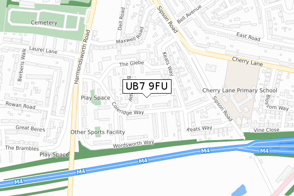
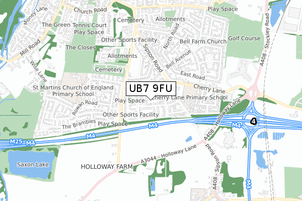
UB7 9FU is located in the Heathrow Villages electoral ward, within the London borough of Hillingdon and the English Parliamentary constituency of Hayes and Harlington. The Sub Integrated Care Board (ICB) Location is NHS North West London ICB - W2U3Z and the police force is Metropolitan Police. This postcode has been in use since February 2020.


GetTheData
Source: OS Open Zoomstack (Ordnance Survey)
Licence: Open Government Licence (requires attribution)
Attribution: Contains OS data © Crown copyright and database right 2024
Source: Open Postcode Geo
Licence: Open Government Licence (requires attribution)
Attribution: Contains OS data © Crown copyright and database right 2024; Contains Royal Mail data © Royal Mail copyright and database right 2024; Source: Office for National Statistics licensed under the Open Government Licence v.3.0
| Easting | 506635 |
| Northing | 178720 |
| Latitude | 51.497374 |
| Longitude | -0.465219 |
GetTheData
Source: Open Postcode Geo
Licence: Open Government Licence
| Country | England |
| Postcode District | UB7 |
| ➜ UB7 open data dashboard ➜ See where UB7 is on a map ➜ Where is West Drayton? | |
GetTheData
Source: Land Registry Price Paid Data
Licence: Open Government Licence
| Ward | Heathrow Villages |
| Constituency | Hayes And Harlington |
GetTheData
Source: ONS Postcode Database
Licence: Open Government Licence
| January 2024 | Violence and sexual offences | On or near Great Benty | 463m |
| December 2023 | Violence and sexual offences | On or near Great Benty | 463m |
| November 2023 | Violence and sexual offences | On or near Great Benty | 463m |
| ➜ Get more crime data in our Crime section | |||
GetTheData
Source: data.police.uk
Licence: Open Government Licence
| Harmondsworth Road | West Drayton | 248m |
| Harmondsworth Road | West Drayton | 263m |
| Maxwell Road | West Drayton | 283m |
| Berberis Walk (Laurel Lane) | West Drayton | 339m |
| Maxwell Road | West Drayton | 362m |
| West Drayton Station | 1.5km |
| Heathrow Terminals 1-3 Station | 3km |
| Heathrow Airport Central Bus Stn (Rail-Air) | 3km |
GetTheData
Source: NaPTAN
Licence: Open Government Licence
GetTheData
Source: ONS Postcode Database
Licence: Open Government Licence


➜ Get more ratings from the Food Standards Agency
GetTheData
Source: Food Standards Agency
Licence: FSA terms & conditions
| Last Collection | |||
|---|---|---|---|
| Location | Mon-Fri | Sat | Distance |
| Mulberry Parade Post Office | 17:15 | 12:00 | 1,114m |
| Mill Road | 18:00 | 12:30 | 1,159m |
| 424 Sipson Road Post Office | 17:15 | 12:00 | 1,222m |
GetTheData
Source: Dracos
Licence: Creative Commons Attribution-ShareAlike
| Facility | Distance |
|---|---|
| West Drayton Youth Football Club (Cherry Lane) Cherry Lane, West Drayton Grass Pitches, Sports Hall | 249m |
| Cherry Lane Primary School Sipson Road, West Drayton Grass Pitches | 304m |
| St Martins Primary School Rowan Road, West Drayton Grass Pitches | 563m |
GetTheData
Source: Active Places
Licence: Open Government Licence
| School | Phase of Education | Distance |
|---|---|---|
| Cherry Lane Primary School Sipson Road, West Drayton, UB7 9DL | Primary | 305m |
| St Martin's Church of England Primary School Rowan Road, West Drayton, UB7 7UF | Primary | 602m |
| Laurel Lane Primary School Laurel Lane, West Drayton, UB7 7TX | Primary | 619m |
GetTheData
Source: Edubase
Licence: Open Government Licence
The below table lists the International Territorial Level (ITL) codes (formerly Nomenclature of Territorial Units for Statistics (NUTS) codes) and Local Administrative Units (LAU) codes for UB7 9FU:
| ITL 1 Code | Name |
|---|---|
| TLI | London |
| ITL 2 Code | Name |
| TLI7 | Outer London - West and North West |
| ITL 3 Code | Name |
| TLI74 | Harrow and Hillingdon |
| LAU 1 Code | Name |
| E09000017 | Hillingdon |
GetTheData
Source: ONS Postcode Directory
Licence: Open Government Licence
The below table lists the Census Output Area (OA), Lower Layer Super Output Area (LSOA), and Middle Layer Super Output Area (MSOA) for UB7 9FU:
| Code | Name | |
|---|---|---|
| OA | E00012174 | |
| LSOA | E01002445 | Hillingdon 029A |
| MSOA | E02000522 | Hillingdon 029 |
GetTheData
Source: ONS Postcode Directory
Licence: Open Government Licence
| UB7 9DX | Scott Close | 30m |
| UB7 9HR | Coleridge Way | 63m |
| UB7 9JD | Byron Way | 79m |
| UB7 9HT | Wordsworth Way | 93m |
| UB7 9JE | The Glebe | 104m |
| UB7 9HS | Coleridge Way | 123m |
| UB7 9JB | Milton Way | 127m |
| UB7 9DS | Keats Way | 128m |
| UB7 9HU | Wordsworth Way | 138m |
| UB7 9DR | Keats Way | 150m |
GetTheData
Source: Open Postcode Geo; Land Registry Price Paid Data
Licence: Open Government Licence