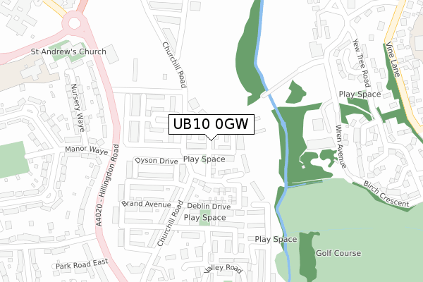
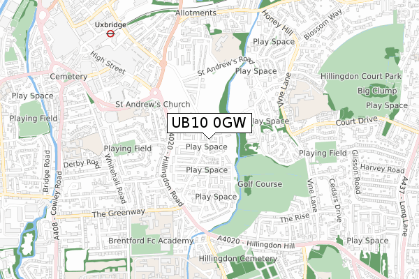
UB10 0GW is located in the Hillingdon West electoral ward, within the London borough of Hillingdon and the English Parliamentary constituency of Uxbridge and South Ruislip. The Sub Integrated Care Board (ICB) Location is NHS North West London ICB - W2U3Z and the police force is Metropolitan Police. This postcode has been in use since September 2017.


GetTheData
Source: OS Open Zoomstack (Ordnance Survey)
Licence: Open Government Licence (requires attribution)
Attribution: Contains OS data © Crown copyright and database right 2024
Source: Open Postcode Geo
Licence: Open Government Licence (requires attribution)
Attribution: Contains OS data © Crown copyright and database right 2024; Contains Royal Mail data © Royal Mail copyright and database right 2024; Source: Office for National Statistics licensed under the Open Government Licence v.3.0
| Easting | 506277 |
| Northing | 183563 |
| Latitude | 51.540972 |
| Longitude | -0.468915 |
GetTheData
Source: Open Postcode Geo
Licence: Open Government Licence
| Country | England |
| Postcode District | UB10 |
| ➜ UB10 open data dashboard ➜ See where UB10 is on a map ➜ Where is London? | |
GetTheData
Source: Land Registry Price Paid Data
Licence: Open Government Licence
| Ward | Hillingdon West |
| Constituency | Uxbridge And South Ruislip |
GetTheData
Source: ONS Postcode Database
Licence: Open Government Licence
| June 2022 | Vehicle crime | On or near Sports/Recreation Area | 208m |
| June 2022 | Vehicle crime | On or near Sports/Recreation Area | 208m |
| June 2022 | Vehicle crime | On or near Sports/Recreation Area | 208m |
| ➜ Get more crime data in our Crime section | |||
GetTheData
Source: data.police.uk
Licence: Open Government Licence
| Manor Waye (Hillingdon Road) | Uxbridge | 225m |
| Manor Waye (Hillingdon Road) | Uxbridge | 279m |
| St Andrew's Church Hillingdon Road (Hillingdon Road) | Uxbridge | 301m |
| St Andrew's Church (Ub8) (Hillingdon Road) | Uxbridge | 350m |
| The Greenway | Pield Heath | 424m |
| Uxbridge Underground Station | Uxbridge | 882m |
| Hillingdon Underground Station | North Hillingdon | 1,940m |
| West Drayton Station | 3.4km |
| West Ruislip Station | 3.9km |
| Iver Station | 4.5km |
GetTheData
Source: NaPTAN
Licence: Open Government Licence
➜ Broadband speed and availability dashboard for UB10 0GW
| Percentage of properties with Next Generation Access | 92.9% |
| Percentage of properties with Superfast Broadband | 92.9% |
| Percentage of properties with Ultrafast Broadband | 92.9% |
| Percentage of properties with Full Fibre Broadband | 0.0% |
Superfast Broadband is between 30Mbps and 300Mbps
Ultrafast Broadband is > 300Mbps
| Median download speed | 100.0Mbps |
| Average download speed | 120.4Mbps |
| Maximum download speed | 350.00Mbps |
| Median upload speed | 1.0Mbps |
| Average upload speed | 1.0Mbps |
| Maximum upload speed | 1.00Mbps |
| Percentage of properties unable to receive 2Mbps | 0.0% |
| Percentage of properties unable to receive 5Mbps | 0.0% |
| Percentage of properties unable to receive 10Mbps | 7.1% |
| Percentage of properties unable to receive 30Mbps | 7.1% |
➜ Broadband speed and availability dashboard for UB10 0GW
GetTheData
Source: Ofcom
Licence: Ofcom Terms of Use (requires attribution)
GetTheData
Source: ONS Postcode Database
Licence: Open Government Licence


➜ Get more ratings from the Food Standards Agency
GetTheData
Source: Food Standards Agency
Licence: FSA terms & conditions
| Last Collection | |||
|---|---|---|---|
| Location | Mon-Fri | Sat | Distance |
| Manor Waye | 18:15 | 12:45 | 245m |
| Whitehall Road | 18:30 | 12:30 | 609m |
| Uxbridge Common Post Office | 18:30 | 12:00 | 721m |
GetTheData
Source: Dracos
Licence: Creative Commons Attribution-ShareAlike
| Facility | Distance |
|---|---|
| Raf Uxbridge (Closed) Hillingdon Road, Uxbridge Artificial Grass Pitch, Sports Hall, Health and Fitness Gym, Grass Pitches | 229m |
| St Andrews Cofe Primary School Nursery Waye, Uxbridge Grass Pitches | 451m |
| Uxbridge High School The Greenway, Uxbridge Grass Pitches, Sports Hall, Artificial Grass Pitch | 519m |
GetTheData
Source: Active Places
Licence: Open Government Licence
| School | Phase of Education | Distance |
|---|---|---|
| John Locke Academy Bader Way, Uxbridge, UB10 0FW | Primary | 142m |
| St Andrew's C of E Primary School Nursery Waye, Uxbridge, UB8 2BX | Primary | 451m |
| Uxbridge High School The Greenway, Uxbridge, UB8 2PR | Secondary | 519m |
GetTheData
Source: Edubase
Licence: Open Government Licence
The below table lists the International Territorial Level (ITL) codes (formerly Nomenclature of Territorial Units for Statistics (NUTS) codes) and Local Administrative Units (LAU) codes for UB10 0GW:
| ITL 1 Code | Name |
|---|---|
| TLI | London |
| ITL 2 Code | Name |
| TLI7 | Outer London - West and North West |
| ITL 3 Code | Name |
| TLI74 | Harrow and Hillingdon |
| LAU 1 Code | Name |
| E09000017 | Hillingdon |
GetTheData
Source: ONS Postcode Directory
Licence: Open Government Licence
The below table lists the Census Output Area (OA), Lower Layer Super Output Area (LSOA), and Middle Layer Super Output Area (MSOA) for UB10 0GW:
| Code | Name | |
|---|---|---|
| OA | E00012493 | |
| LSOA | E01033725 | Hillingdon 015F |
| MSOA | E02000508 | Hillingdon 015 |
GetTheData
Source: ONS Postcode Directory
Licence: Open Government Licence
| UB10 0GF | Deblin Drive | 164m |
| UB10 0FL | Churchill Road | 176m |
| UB10 0FX | Willoughby Avenue | 185m |
| UB10 0FN | Churchill Road | 219m |
| UB10 0FF | Lawrence Grove | 219m |
| UB10 0FU | Brand Avenue | 233m |
| UB10 0FY | Willoughby Avenue | 246m |
| UB10 0FP | Fowler Way | 262m |
| UB10 0SB | Wallace Close | 276m |
| UB10 0AE | Hillingdon Road | 277m |
GetTheData
Source: Open Postcode Geo; Land Registry Price Paid Data
Licence: Open Government Licence