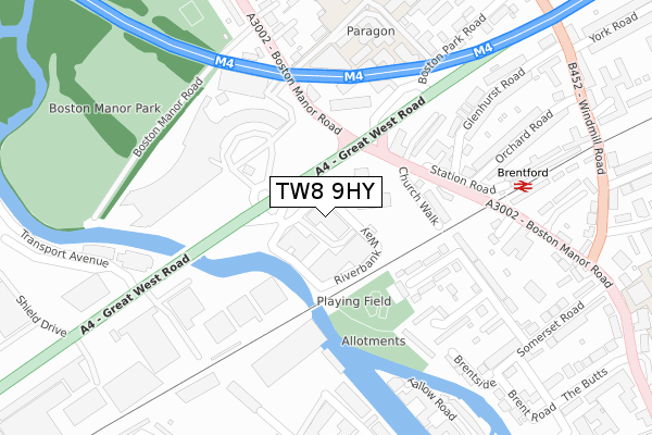
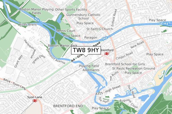
TW8 9HY is located in the Brentford West electoral ward, within the London borough of Hounslow and the English Parliamentary constituency of Brentford and Isleworth. The Sub Integrated Care Board (ICB) Location is NHS North West London ICB - W2U3Z and the police force is Metropolitan Police. This postcode has been in use since January 2020.


GetTheData
Source: OS Open Zoomstack (Ordnance Survey)
Licence: Open Government Licence (requires attribution)
Attribution: Contains OS data © Crown copyright and database right 2024
Source: Open Postcode Geo
Licence: Open Government Licence (requires attribution)
Attribution: Contains OS data © Crown copyright and database right 2024; Contains Royal Mail data © Royal Mail copyright and database right 2024; Source: Office for National Statistics licensed under the Open Government Licence v.3.0
| Easting | 517153 |
| Northing | 177827 |
| Latitude | 51.487268 |
| Longitude | -0.314061 |
GetTheData
Source: Open Postcode Geo
Licence: Open Government Licence
| Country | England |
| Postcode District | TW8 |
| ➜ TW8 open data dashboard ➜ See where TW8 is on a map ➜ Where is Brentford? | |
GetTheData
Source: Land Registry Price Paid Data
Licence: Open Government Licence
| Ward | Brentford West |
| Constituency | Brentford And Isleworth |
GetTheData
Source: ONS Postcode Database
Licence: Open Government Licence
| December 2023 | Vehicle crime | On or near Church Walk | 190m |
| December 2023 | Burglary | On or near Church Walk | 190m |
| October 2023 | Other theft | On or near Church Walk | 190m |
| ➜ Get more crime data in our Crime section | |||
GetTheData
Source: data.police.uk
Licence: Open Government Licence
| Boston Manor Road | Brentford | 81m |
| Boston Manor Road | Brentford | 138m |
| Great West Rd Boston Manor Rd (Boston Manor Road) | Brentford | 149m |
| Brentford (Boston Manor Road) | Brentford | 152m |
| Great West Rd Boston Manor Rd (Boston Manor Road) | Brentford | 165m |
| Boston Manor Underground Station | Boston Manor | 1,198m |
| Northfields Underground Station | Northfields | 1,341m |
| Brentford Station | 0.3km |
| Syon Lane Station | 1km |
| Kew Bridge Station | 1.9km |
GetTheData
Source: NaPTAN
Licence: Open Government Licence
GetTheData
Source: ONS Postcode Database
Licence: Open Government Licence


➜ Get more ratings from the Food Standards Agency
GetTheData
Source: Food Standards Agency
Licence: FSA terms & conditions
| Last Collection | |||
|---|---|---|---|
| Location | Mon-Fri | Sat | Distance |
| Brentford Railway Station | 17:00 | 11:30 | 287m |
| Boston Rise, Boston Manor Road | 18:30 | 11:15 | 356m |
| Somerset Road | 17:00 | 11:30 | 366m |
GetTheData
Source: Dracos
Licence: Creative Commons Attribution-ShareAlike
| Facility | Distance |
|---|---|
| Boston Manor Park Boston Manor Road, Brentford Grass Pitches | 425m |
| Boston Manor Tennis Club Boston Manor Road, Brentford Outdoor Tennis Courts | 494m |
| Brentford School For Girls Boston Manor Road, Brentford Sports Hall | 496m |
GetTheData
Source: Active Places
Licence: Open Government Licence
| School | Phase of Education | Distance |
|---|---|---|
| Our Lady and St John's Catholic Primary School Boston Park Road, Brentford, TW8 9JF | Primary | 369m |
| Brentford School for Girls 5 Boston Manor Road, Brentford, TW8 0PG | Secondary | 575m |
| Gunnersbury Catholic School The Ride, Boston Manor Road, Brentford, TW8 9LB | Secondary | 679m |
GetTheData
Source: Edubase
Licence: Open Government Licence
The below table lists the International Territorial Level (ITL) codes (formerly Nomenclature of Territorial Units for Statistics (NUTS) codes) and Local Administrative Units (LAU) codes for TW8 9HY:
| ITL 1 Code | Name |
|---|---|
| TLI | London |
| ITL 2 Code | Name |
| TLI7 | Outer London - West and North West |
| ITL 3 Code | Name |
| TLI75 | Hounslow and Richmond upon Thames |
| LAU 1 Code | Name |
| E09000018 | Hounslow |
GetTheData
Source: ONS Postcode Directory
Licence: Open Government Licence
The below table lists the Census Output Area (OA), Lower Layer Super Output Area (LSOA), and Middle Layer Super Output Area (MSOA) for TW8 9HY:
| Code | Name | |
|---|---|---|
| OA | E00013322 | |
| LSOA | E01002684 | Hounslow 006D |
| MSOA | E02000531 | Hounslow 006 |
GetTheData
Source: ONS Postcode Directory
Licence: Open Government Licence
| TW8 9GB | Boston Manor Road | 190m |
| TW8 8DG | Robin Grove | 193m |
| TW8 8DQ | Boston Manor Road | 199m |
| TW8 8DB | Church Walk | 214m |
| TW8 8DE | Willow Close | 257m |
| TW8 8DY | The Dell | 257m |
| TW8 8ET | Tallow Road | 272m |
| TW8 8DD | Church Walk | 276m |
| TW8 0QS | Glenhurst Road | 295m |
| TW8 0QU | Orchard Road | 303m |
GetTheData
Source: Open Postcode Geo; Land Registry Price Paid Data
Licence: Open Government Licence