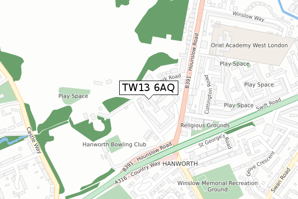
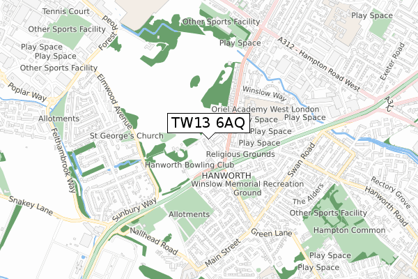
TW13 6AQ is located in the Hanworth Village electoral ward, within the London borough of Hounslow and the English Parliamentary constituency of Feltham and Heston. The Sub Integrated Care Board (ICB) Location is NHS North West London ICB - W2U3Z and the police force is Metropolitan Police. This postcode has been in use since March 2019.


GetTheData
Source: OS Open Zoomstack (Ordnance Survey)
Licence: Open Government Licence (requires attribution)
Attribution: Contains OS data © Crown copyright and database right 2024
Source: Open Postcode Geo
Licence: Open Government Licence (requires attribution)
Attribution: Contains OS data © Crown copyright and database right 2024; Contains Royal Mail data © Royal Mail copyright and database right 2024; Source: Office for National Statistics licensed under the Open Government Licence v.3.0
| Easting | 511753 |
| Northing | 171872 |
| Latitude | 51.434836 |
| Longitude | -0.393682 |
GetTheData
Source: Open Postcode Geo
Licence: Open Government Licence
| Country | England |
| Postcode District | TW13 |
| ➜ TW13 open data dashboard ➜ See where TW13 is on a map ➜ Where is London? | |
GetTheData
Source: Land Registry Price Paid Data
Licence: Open Government Licence
| Ward | Hanworth Village |
| Constituency | Feltham And Heston |
GetTheData
Source: ONS Postcode Database
Licence: Open Government Licence
| January 2024 | Violence and sexual offences | On or near Park Road | 34m |
| January 2024 | Drugs | On or near Park Road | 34m |
| January 2024 | Burglary | On or near Petrol Station | 112m |
| ➜ Get more crime data in our Crime section | |||
GetTheData
Source: data.police.uk
Licence: Open Government Licence
| Bear Road Flyover | Hanworth | 133m |
| Bear Road Flyover | Hanworth | 180m |
| Park Road Hounslow Road | Hanworth | 184m |
| Bear Road Flyover | Hanworth | 199m |
| Bear Road Flyover (Bear Road) | Hanworth | 257m |
| Feltham Station | 1.8km |
| Kempton Park Station | 1.9km |
| Sunbury Station | 2.5km |
GetTheData
Source: NaPTAN
Licence: Open Government Licence
| Percentage of properties with Next Generation Access | 100.0% |
| Percentage of properties with Superfast Broadband | 100.0% |
| Percentage of properties with Ultrafast Broadband | 0.0% |
| Percentage of properties with Full Fibre Broadband | 0.0% |
Superfast Broadband is between 30Mbps and 300Mbps
Ultrafast Broadband is > 300Mbps
| Percentage of properties unable to receive 2Mbps | 0.0% |
| Percentage of properties unable to receive 5Mbps | 0.0% |
| Percentage of properties unable to receive 10Mbps | 0.0% |
| Percentage of properties unable to receive 30Mbps | 0.0% |
GetTheData
Source: Ofcom
Licence: Ofcom Terms of Use (requires attribution)
GetTheData
Source: ONS Postcode Database
Licence: Open Government Licence


➜ Get more ratings from the Food Standards Agency
GetTheData
Source: Food Standards Agency
Licence: FSA terms & conditions
| Last Collection | |||
|---|---|---|---|
| Location | Mon-Fri | Sat | Distance |
| Park Parade, Hounslow Road | 18:30 | 11:45 | 154m |
| Churchfields Avenue | 17:00 | 11:30 | 228m |
| Castle Way | 18:30 | 11:30 | 417m |
GetTheData
Source: Dracos
Licence: Creative Commons Attribution-ShareAlike
| Facility | Distance |
|---|---|
| Hanworth Villa Fc Park Road, Feltham Grass Pitches | 222m |
| Oriel Primary Academy Hounslow Road, Hanworth, Feltham Grass Pitches | 317m |
| Hanworth Park Hounslow Road, Hanworth, Feltham Grass Pitches | 474m |
GetTheData
Source: Active Places
Licence: Open Government Licence
| School | Phase of Education | Distance |
|---|---|---|
| The St Michael Steiner School Park Road, Hanworth Park, London, TW13 6PN | Not applicable | 196m |
| Oriel Academy West London Hounslow Road, Hanworth, Feltham, TW13 6QQ | Primary | 302m |
| Lindon Bennett School Main Street, Hanworth, Feltham, TW13 6ST | Not applicable | 796m |
GetTheData
Source: Edubase
Licence: Open Government Licence
The below table lists the International Territorial Level (ITL) codes (formerly Nomenclature of Territorial Units for Statistics (NUTS) codes) and Local Administrative Units (LAU) codes for TW13 6AQ:
| ITL 1 Code | Name |
|---|---|
| TLI | London |
| ITL 2 Code | Name |
| TLI7 | Outer London - West and North West |
| ITL 3 Code | Name |
| TLI75 | Hounslow and Richmond upon Thames |
| LAU 1 Code | Name |
| E09000018 | Hounslow |
GetTheData
Source: ONS Postcode Directory
Licence: Open Government Licence
The below table lists the Census Output Area (OA), Lower Layer Super Output Area (LSOA), and Middle Layer Super Output Area (MSOA) for TW13 6AQ:
| Code | Name | |
|---|---|---|
| OA | E00013023 | |
| LSOA | E01002615 | Hounslow 026E |
| MSOA | E02000551 | Hounslow 026 |
GetTheData
Source: ONS Postcode Directory
Licence: Open Government Licence
| TW13 6PW | Park Road | 38m |
| TW13 6PQ | The Hollands | 85m |
| TW13 6PR | The Hollands | 100m |
| TW13 6PP | Park Road | 108m |
| TW13 6PN | Park Road | 117m |
| TW13 6QH | Hounslow Road | 138m |
| TW13 6QY | Swift Road | 192m |
| TW13 6QA | Hounslow Road | 216m |
| TW13 6YL | Cottington Road | 227m |
| TW13 6SD | Oxford Way | 235m |
GetTheData
Source: Open Postcode Geo; Land Registry Price Paid Data
Licence: Open Government Licence