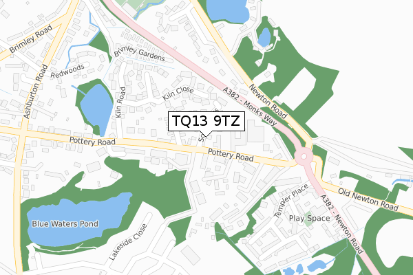
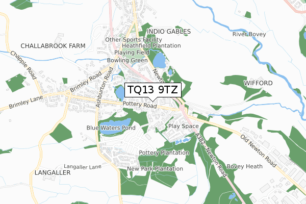
TQ13 9TZ is located in the Bovey electoral ward, within the local authority district of Teignbridge and the English Parliamentary constituency of Central Devon. The Sub Integrated Care Board (ICB) Location is NHS Devon ICB - 15N and the police force is Devon & Cornwall. This postcode has been in use since September 2018.


GetTheData
Source: OS Open Zoomstack (Ordnance Survey)
Licence: Open Government Licence (requires attribution)
Attribution: Contains OS data © Crown copyright and database right 2024
Source: Open Postcode Geo
Licence: Open Government Licence (requires attribution)
Attribution: Contains OS data © Crown copyright and database right 2024; Contains Royal Mail data © Royal Mail copyright and database right 2024; Source: Office for National Statistics licensed under the Open Government Licence v.3.0
| Easting | 281470 |
| Northing | 77185 |
| Latitude | 50.582326 |
| Longitude | -3.675579 |
GetTheData
Source: Open Postcode Geo
Licence: Open Government Licence
| Country | England |
| Postcode District | TQ13 |
| ➜ TQ13 open data dashboard ➜ See where TQ13 is on a map ➜ Where is Bovey Tracey? | |
GetTheData
Source: Land Registry Price Paid Data
Licence: Open Government Licence
| Ward | Bovey |
| Constituency | Central Devon |
GetTheData
Source: ONS Postcode Database
Licence: Open Government Licence
| June 2022 | Other crime | On or near Pottery Close | 228m |
| June 2022 | Violence and sexual offences | On or near Petrol Station | 315m |
| June 2022 | Violence and sexual offences | On or near Petrol Station | 315m |
| ➜ Get more crime data in our Crime section | |||
GetTheData
Source: data.police.uk
Licence: Open Government Licence
| Fairview Park (Pottery Road) | Bovey Tracey | 98m |
| House Of Marbles (Pottery Road) | Bovey Tracey | 128m |
| Fairview Park (Pottery Road) | Bovey Tracey | 135m |
| House Of Marbles (Pottery Road) | Bovey Tracey | 139m |
| Kiln Road (Pottery Road) | Bovey Tracey | 205m |
GetTheData
Source: NaPTAN
Licence: Open Government Licence
GetTheData
Source: ONS Postcode Database
Licence: Open Government Licence


➜ Get more ratings from the Food Standards Agency
GetTheData
Source: Food Standards Agency
Licence: FSA terms & conditions
| Last Collection | |||
|---|---|---|---|
| Location | Mon-Fri | Sat | Distance |
| Coombe Cross | 16:00 | 08:30 | 1,435m |
| East Street | 16:00 | 08:15 | 1,502m |
| Shewte Cross | 16:15 | 08:00 | 2,577m |
GetTheData
Source: Dracos
Licence: Creative Commons Attribution-ShareAlike
| Facility | Distance |
|---|---|
| Bovey Tracey Recreation Ground Newton Road, Bovey Tracey Grass Pitches, Outdoor Tennis Courts | 470m |
| Bovey Tracey Swimming Pool Ashburton Road, Bovey Tracey Swimming Pool | 537m |
| Mill Marsh Park St Johns Lane, Bovey Tracey Grass Pitches | 1.3km |
GetTheData
Source: Active Places
Licence: Open Government Licence
| School | Phase of Education | Distance |
|---|---|---|
| Bovey Tracey Primary School Abbey Road, Bovey Tracey, Newton Abbot, TQ13 9HZ | Primary | 1.4km |
| The Greater Horseshoe School Little Bovey Lane, Heathfield, Newton Abbot, Devon, TQ12 6RH | Not applicable | 1.7km |
| St Catherine's CofE Primary School Musket Road, Heathfield, Newton Abbot, TQ12 6SB | Primary | 2.1km |
GetTheData
Source: Edubase
Licence: Open Government Licence
The below table lists the International Territorial Level (ITL) codes (formerly Nomenclature of Territorial Units for Statistics (NUTS) codes) and Local Administrative Units (LAU) codes for TQ13 9TZ:
| ITL 1 Code | Name |
|---|---|
| TLK | South West (England) |
| ITL 2 Code | Name |
| TLK4 | Devon |
| ITL 3 Code | Name |
| TLK43 | Devon CC |
| LAU 1 Code | Name |
| E07000045 | Teignbridge |
GetTheData
Source: ONS Postcode Directory
Licence: Open Government Licence
The below table lists the Census Output Area (OA), Lower Layer Super Output Area (LSOA), and Middle Layer Super Output Area (MSOA) for TQ13 9TZ:
| Code | Name | |
|---|---|---|
| OA | E00102352 | |
| LSOA | E01020202 | Teignbridge 007A |
| MSOA | E02004207 | Teignbridge 007 |
GetTheData
Source: ONS Postcode Directory
Licence: Open Government Licence
| TQ13 9JJ | Pottery Road | 133m |
| TQ13 9YL | Kiln Close | 146m |
| TQ13 9YF | Blue Waters Industrial Estate | 149m |
| TQ13 9DS | Pottery Road | 160m |
| TQ13 9DR | Pottery Road | 175m |
| TQ13 9YH | Pottery Close | 213m |
| TQ13 9YJ | Kiln Road | 244m |
| TQ13 9GR | Templer Place | 247m |
| TQ13 9DZ | Heathfield Close | 274m |
| TQ13 9DY | Newton Road | 283m |
GetTheData
Source: Open Postcode Geo; Land Registry Price Paid Data
Licence: Open Government Licence