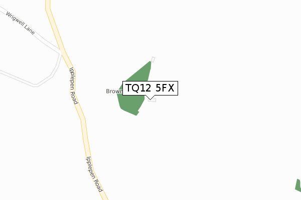
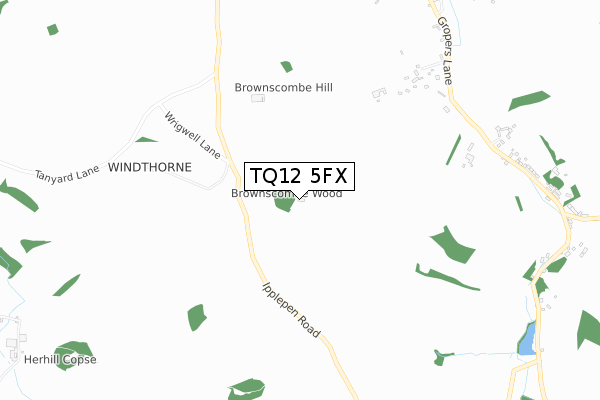
TQ12 5FX is located in the Marldon & Littlehempston electoral ward, within the local authority district of South Hams and the English Parliamentary constituency of Totnes. The Sub Integrated Care Board (ICB) Location is NHS Devon ICB - 15N and the police force is Devon & Cornwall. This postcode has been in use since September 2019.


GetTheData
Source: OS Open Zoomstack (Ordnance Survey)
Licence: Open Government Licence (requires attribution)
Attribution: Contains OS data © Crown copyright and database right 2024
Source: Open Postcode Geo
Licence: Open Government Licence (requires attribution)
Attribution: Contains OS data © Crown copyright and database right 2024; Contains Royal Mail data © Royal Mail copyright and database right 2024; Source: Office for National Statistics licensed under the Open Government Licence v.3.0
| Easting | 285828 |
| Northing | 64681 |
| Latitude | 50.470788 |
| Longitude | -3.610220 |
GetTheData
Source: Open Postcode Geo
Licence: Open Government Licence
| Country | England |
| Postcode District | TQ12 |
| ➜ TQ12 open data dashboard ➜ See where TQ12 is on a map | |
GetTheData
Source: Land Registry Price Paid Data
Licence: Open Government Licence
| Ward | Marldon & Littlehempston |
| Constituency | Totnes |
GetTheData
Source: ONS Postcode Database
Licence: Open Government Licence
| Peters Crescent (Millmans Road) | Marldon | 1,651m |
| Peters Crescent (Millmans Road) | Marldon | 1,656m |
| Meadow Park (Parkfield Close) | Marldon | 1,722m |
| Meadow Park (Parkfield Close) | Marldon | 1,722m |
| Pembroke Park (Vicarage Hill) | Marldon | 1,773m |
| Torre Station | 4.5km |
| Torquay Station | 4.9km |
| Paignton Station | 5.1km |
GetTheData
Source: NaPTAN
Licence: Open Government Licence
GetTheData
Source: ONS Postcode Database
Licence: Open Government Licence


➜ Get more ratings from the Food Standards Agency
GetTheData
Source: Food Standards Agency
Licence: FSA terms & conditions
| Last Collection | |||
|---|---|---|---|
| Location | Mon-Fri | Sat | Distance |
| Compton | 17:00 | 09:00 | 1,023m |
| Nether Meadow | 17:00 | 12:15 | 1,794m |
| Marldon Post Office | 17:00 | 12:00 | 2,013m |
GetTheData
Source: Dracos
Licence: Creative Commons Attribution-ShareAlike
| Facility | Distance |
|---|---|
| Jubilee Meadow Love Lane, Marldon, Paignton Grass Pitches | 1.4km |
| Marldon Village Hall Marldon, Paignton Sports Hall | 1.4km |
| Ipplepen Primary School Biltor Road, Ipplepen, Newton Abbot Grass Pitches, Sports Hall | 2.9km |
GetTheData
Source: Active Places
Licence: Open Government Licence
| School | Phase of Education | Distance |
|---|---|---|
| Marldon Church of England Primary School Marldon Cross Hill, Marldon, Paignton, TQ3 1PD | Primary | 1.7km |
| Ipplepen Primary School Biltor Road, Ipplepen, Newton Abbot, TQ12 5QL | Primary | 2.9km |
| Shiphay Learning Academy Exe Hill, Shiphay, Torquay, TQ2 7NF | Primary | 3.4km |
GetTheData
Source: Edubase
Licence: Open Government Licence
The below table lists the International Territorial Level (ITL) codes (formerly Nomenclature of Territorial Units for Statistics (NUTS) codes) and Local Administrative Units (LAU) codes for TQ12 5FX:
| ITL 1 Code | Name |
|---|---|
| TLK | South West (England) |
| ITL 2 Code | Name |
| TLK4 | Devon |
| ITL 3 Code | Name |
| TLK43 | Devon CC |
| LAU 1 Code | Name |
| E07000044 | South Hams |
GetTheData
Source: ONS Postcode Directory
Licence: Open Government Licence
The below table lists the Census Output Area (OA), Lower Layer Super Output Area (LSOA), and Middle Layer Super Output Area (MSOA) for TQ12 5FX:
| Code | Name | |
|---|---|---|
| OA | E00102156 | |
| LSOA | E01020170 | South Hams 004C |
| MSOA | E02004192 | South Hams 004 |
GetTheData
Source: ONS Postcode Directory
Licence: Open Government Licence
| TQ3 1TA | 927m | |
| TQ3 1TB | 1091m | |
| TQ3 1TD | 1131m | |
| TQ12 5UA | 1210m | |
| TQ3 1SG | Ipplepen Road | 1293m |
| TQ3 1SN | Butterlake | 1301m |
| TQ3 1SL | 1375m | |
| TQ3 1SF | Church Hill | 1387m |
| TQ3 1SQ | 1431m | |
| TQ3 1SE | Ipplepen Road | 1441m |
GetTheData
Source: Open Postcode Geo; Land Registry Price Paid Data
Licence: Open Government Licence