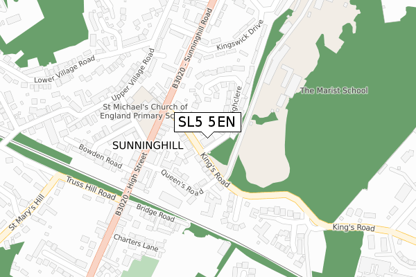
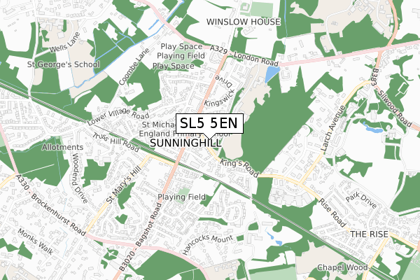
SL5 5EN is located in the Ascot & Sunninghill electoral ward, within the unitary authority of Windsor and Maidenhead and the English Parliamentary constituency of Windsor. The Sub Integrated Care Board (ICB) Location is NHS Frimley ICB - D4U1Y and the police force is Thames Valley. This postcode has been in use since August 2019.


GetTheData
Source: OS Open Zoomstack (Ordnance Survey)
Licence: Open Government Licence (requires attribution)
Attribution: Contains OS data © Crown copyright and database right 2024
Source: Open Postcode Geo
Licence: Open Government Licence (requires attribution)
Attribution: Contains OS data © Crown copyright and database right 2024; Contains Royal Mail data © Royal Mail copyright and database right 2024; Source: Office for National Statistics licensed under the Open Government Licence v.3.0
| Easting | 493768 |
| Northing | 167833 |
| Latitude | 51.401788 |
| Longitude | -0.653402 |
GetTheData
Source: Open Postcode Geo
Licence: Open Government Licence
| Country | England |
| Postcode District | SL5 |
| ➜ SL5 open data dashboard ➜ See where SL5 is on a map ➜ Where is Sunninghill? | |
GetTheData
Source: Land Registry Price Paid Data
Licence: Open Government Licence
| Ward | Ascot & Sunninghill |
| Constituency | Windsor |
GetTheData
Source: ONS Postcode Database
Licence: Open Government Licence
| September 2023 | Vehicle crime | On or near Quince Close | 348m |
| January 2023 | Criminal damage and arson | On or near Quince Close | 348m |
| June 2022 | Burglary | On or near Theatre/Concert Hall | 94m |
| ➜ Get more crime data in our Crime section | |||
GetTheData
Source: data.police.uk
Licence: Open Government Licence
| St Michaels School (High Street) | Sunninghill | 117m |
| St Michaels School (High Street) | Sunninghill | 130m |
| High Street Shops (High Street) | Sunninghill | 286m |
| High Street Shops (High Street) | Sunninghill | 316m |
| Church Lane (London Road) | Sunninghill | 527m |
| Ascot Station | 1.6km |
| Sunningdale Station | 1.8km |
| Longcross Station | 4.5km |
GetTheData
Source: NaPTAN
Licence: Open Government Licence
GetTheData
Source: ONS Postcode Database
Licence: Open Government Licence


➜ Get more ratings from the Food Standards Agency
GetTheData
Source: Food Standards Agency
Licence: FSA terms & conditions
| Last Collection | |||
|---|---|---|---|
| Location | Mon-Fri | Sat | Distance |
| Sunninghill Post Office | 18:30 | 13:00 | 24m |
| Lower Village Road | 17:45 | 11:45 | 283m |
| Upper Village Road | 17:30 | 11:30 | 474m |
GetTheData
Source: Dracos
Licence: Creative Commons Attribution-ShareAlike
| Facility | Distance |
|---|---|
| Marist Senior School Kings Road, Sunninghill, Ascot Grass Pitches, Sports Hall, Swimming Pool, Studio | 214m |
| St Michaels Field Bagshot Road, Ascot Grass Pitches | 366m |
| Victory Fields London Road, Ascot Outdoor Tennis Courts, Grass Pitches | 528m |
GetTheData
Source: Active Places
Licence: Open Government Licence
| School | Phase of Education | Distance |
|---|---|---|
| St Michael's CofE Primary School, Sunninghill School Road, Sunninghill, Ascot, SL5 7AD | Primary | 163m |
| The Marist School Kings Road, Sunninghill, Ascot, SL5 7PS | Not applicable | 263m |
| Charters School Charters Road, Sunningdale, Ascot, SL5 9QY | Secondary | 1.1km |
GetTheData
Source: Edubase
Licence: Open Government Licence
The below table lists the International Territorial Level (ITL) codes (formerly Nomenclature of Territorial Units for Statistics (NUTS) codes) and Local Administrative Units (LAU) codes for SL5 5EN:
| ITL 1 Code | Name |
|---|---|
| TLJ | South East (England) |
| ITL 2 Code | Name |
| TLJ1 | Berkshire, Buckinghamshire and Oxfordshire |
| ITL 3 Code | Name |
| TLJ11 | Berkshire |
| LAU 1 Code | Name |
| E06000040 | Windsor and Maidenhead |
GetTheData
Source: ONS Postcode Directory
Licence: Open Government Licence
The below table lists the Census Output Area (OA), Lower Layer Super Output Area (LSOA), and Middle Layer Super Output Area (MSOA) for SL5 5EN:
| Code | Name | |
|---|---|---|
| OA | E00083843 | |
| LSOA | E01016608 | Windsor and Maidenhead 018F |
| MSOA | E02003438 | Windsor and Maidenhead 018 |
GetTheData
Source: ONS Postcode Directory
Licence: Open Government Licence
| SL5 9AB | Kings Road | 48m |
| SL5 9AD | Kings Road | 51m |
| SL5 9AF | Queens Road | 109m |
| SL5 0AA | Highclere | 111m |
| SL5 9AE | Kings Road | 115m |
| SL5 9NE | High Street | 124m |
| SL5 9FN | Queens Road | 154m |
| SL5 7BX | Sunninghill Road | 156m |
| SL5 7AD | School Road | 167m |
| SL5 7BU | Sunninghill Road | 170m |
GetTheData
Source: Open Postcode Geo; Land Registry Price Paid Data
Licence: Open Government Licence