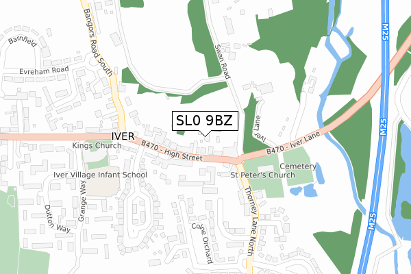
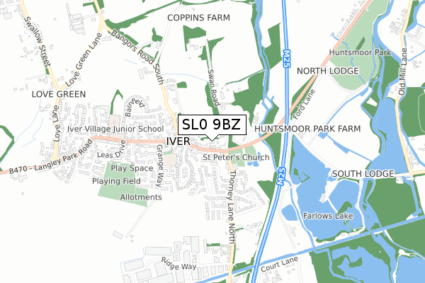
SL0 9BZ is located in the Iver electoral ward, within the unitary authority of Buckinghamshire and the English Parliamentary constituency of Beaconsfield. The Sub Integrated Care Board (ICB) Location is NHS Buckinghamshire, Oxfordshire and Berkshire West ICB - 14Y and the police force is Thames Valley. This postcode has been in use since September 2018.


GetTheData
Source: OS Open Zoomstack (Ordnance Survey)
Licence: Open Government Licence (requires attribution)
Attribution: Contains OS data © Crown copyright and database right 2024
Source: Open Postcode Geo
Licence: Open Government Licence (requires attribution)
Attribution: Contains OS data © Crown copyright and database right 2024; Contains Royal Mail data © Royal Mail copyright and database right 2024; Source: Office for National Statistics licensed under the Open Government Licence v.3.0
| Easting | 503831 |
| Northing | 181254 |
| Latitude | 51.520673 |
| Longitude | -0.504852 |
GetTheData
Source: Open Postcode Geo
Licence: Open Government Licence
| Country | England |
| Postcode District | SL0 |
| ➜ SL0 open data dashboard ➜ See where SL0 is on a map ➜ Where is Iver? | |
GetTheData
Source: Land Registry Price Paid Data
Licence: Open Government Licence
| Ward | Iver |
| Constituency | Beaconsfield |
GetTheData
Source: ONS Postcode Database
Licence: Open Government Licence
| June 2022 | Violence and sexual offences | On or near High Street | 105m |
| June 2022 | Possession of weapons | On or near Holmsdale Close | 208m |
| June 2022 | Vehicle crime | On or near Holmsdale Close | 208m |
| ➜ Get more crime data in our Crime section | |||
GetTheData
Source: data.police.uk
Licence: Open Government Licence
| Chequers Orchard (High Street) | Iver | 156m |
| King's Church (High Street) | Iver | 237m |
| King's Church (High Street) | Iver | 264m |
| Evreham Road (Bangors Road South) | Iver | 359m |
| Evreham Road (Bangors Road South) | Iver | 388m |
| Iver Station | 1.4km |
| West Drayton Station | 2.6km |
| Langley (Berks) Station | 2.9km |
GetTheData
Source: NaPTAN
Licence: Open Government Licence
| Percentage of properties with Next Generation Access | 100.0% |
| Percentage of properties with Superfast Broadband | 100.0% |
| Percentage of properties with Ultrafast Broadband | 100.0% |
| Percentage of properties with Full Fibre Broadband | 0.0% |
Superfast Broadband is between 30Mbps and 300Mbps
Ultrafast Broadband is > 300Mbps
| Percentage of properties unable to receive 2Mbps | 0.0% |
| Percentage of properties unable to receive 5Mbps | 0.0% |
| Percentage of properties unable to receive 10Mbps | 0.0% |
| Percentage of properties unable to receive 30Mbps | 0.0% |
GetTheData
Source: Ofcom
Licence: Ofcom Terms of Use (requires attribution)
GetTheData
Source: ONS Postcode Database
Licence: Open Government Licence


➜ Get more ratings from the Food Standards Agency
GetTheData
Source: Food Standards Agency
Licence: FSA terms & conditions
| Last Collection | |||
|---|---|---|---|
| Location | Mon-Fri | Sat | Distance |
| High Street | 17:15 | 11:00 | 97m |
| Bathurst Walk | 18:30 | 12:30 | 1,424m |
| Iver Post Office | 17:30 | 12:15 | 1,467m |
GetTheData
Source: Dracos
Licence: Creative Commons Attribution-ShareAlike
| Facility | Distance |
|---|---|
| Iver Recreation Ground High Street, Iver Grass Pitches | 607m |
| Evreham Sports Centre Swallow Street, Iver Sports Hall, Health and Fitness Gym, Grass Pitches, Studio, Artificial Grass Pitch | 1.4km |
| Cowley Recreation Ground High Street, Uxbridge Grass Pitches | 1.7km |
GetTheData
Source: Active Places
Licence: Open Government Licence
| School | Phase of Education | Distance |
|---|---|---|
| Iver Village Infant Academy Grange Way, Iver, SL0 9NT | Primary | 258m |
| The Iver Village Junior School High Street, Iver, SL0 9QA | Primary | 587m |
| Cowley St Laurence CofE Primary School Worcester Road, Cowley, Uxbridge, UB8 3TH | Primary | 1.9km |
GetTheData
Source: Edubase
Licence: Open Government Licence
The below table lists the International Territorial Level (ITL) codes (formerly Nomenclature of Territorial Units for Statistics (NUTS) codes) and Local Administrative Units (LAU) codes for SL0 9BZ:
| ITL 1 Code | Name |
|---|---|
| TLJ | South East (England) |
| ITL 2 Code | Name |
| TLJ1 | Berkshire, Buckinghamshire and Oxfordshire |
| ITL 3 Code | Name |
| TLJ13 | Buckinghamshire |
| LAU 1 Code | Name |
| E06000060 | Buckinghamshire |
GetTheData
Source: ONS Postcode Directory
Licence: Open Government Licence
The below table lists the Census Output Area (OA), Lower Layer Super Output Area (LSOA), and Middle Layer Super Output Area (MSOA) for SL0 9BZ:
| Code | Name | |
|---|---|---|
| OA | E00089957 | |
| LSOA | E01017827 | South Bucks 008D |
| MSOA | E02003695 | South Bucks 008 |
GetTheData
Source: ONS Postcode Directory
Licence: Open Government Licence
| SL0 9NG | High Street | 41m |
| SL0 9NP | High Street | 45m |
| SL0 9NQ | High Street | 64m |
| SL0 9JZ | Swan Road | 76m |
| SL0 9ND | High Street | 86m |
| SL0 9NE | High Street | 96m |
| SL0 9JY | Thorney Lane North | 172m |
| SL0 9NN | High Street | 195m |
| SL0 9NJ | Chequers Orchard | 221m |
| SL0 9LA | Swan Road | 228m |
GetTheData
Source: Open Postcode Geo; Land Registry Price Paid Data
Licence: Open Government Licence