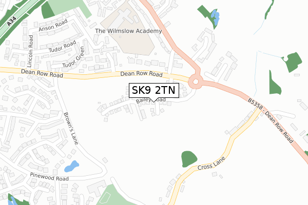
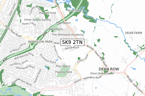
SK9 2TN is located in the Wilmslow Dean Row electoral ward, within the unitary authority of Cheshire East and the English Parliamentary constituency of Tatton. The Sub Integrated Care Board (ICB) Location is NHS Cheshire and Merseyside ICB - 27D and the police force is Cheshire. This postcode has been in use since October 2019.


GetTheData
Source: OS Open Zoomstack (Ordnance Survey)
Licence: Open Government Licence (requires attribution)
Attribution: Contains OS data © Crown copyright and database right 2024
Source: Open Postcode Geo
Licence: Open Government Licence (requires attribution)
Attribution: Contains OS data © Crown copyright and database right 2024; Contains Royal Mail data © Royal Mail copyright and database right 2024; Source: Office for National Statistics licensed under the Open Government Licence v.3.0
| Easting | 386581 |
| Northing | 381940 |
| Latitude | 53.334212 |
| Longitude | -2.202969 |
GetTheData
Source: Open Postcode Geo
Licence: Open Government Licence
| Country | England |
| Postcode District | SK9 |
| ➜ SK9 open data dashboard ➜ See where SK9 is on a map ➜ Where is Wilmslow? | |
GetTheData
Source: Land Registry Price Paid Data
Licence: Open Government Licence
| Ward | Wilmslow Dean Row |
| Constituency | Tatton |
GetTheData
Source: ONS Postcode Database
Licence: Open Government Licence
| May 2023 | Burglary | On or near Fieldhead Mews | 415m |
| December 2022 | Violence and sexual offences | On or near Fieldhead Mews | 415m |
| June 2022 | Public order | On or near Hunters Close | 171m |
| ➜ Get more crime data in our Crime section | |||
GetTheData
Source: data.police.uk
Licence: Open Government Licence
| Handforth Road (Dean Row Road) | Wilmslow | 109m |
| Handforth Road (Dean Row Road) | Wilmslow | 131m |
| Oaklands Close (Handforth Road) | Wilmslow | 421m |
| Oaklands Close (Handforth Road) | Wilmslow | 427m |
| Lincoln Road (Dean Row Road) | Wilmslow | 447m |
| Handforth Station | 1.5km |
| Wilmslow Station | 1.8km |
| Styal Station | 2.9km |
GetTheData
Source: NaPTAN
Licence: Open Government Licence
GetTheData
Source: ONS Postcode Database
Licence: Open Government Licence


➜ Get more ratings from the Food Standards Agency
GetTheData
Source: Food Standards Agency
Licence: FSA terms & conditions
| Last Collection | |||
|---|---|---|---|
| Location | Mon-Fri | Sat | Distance |
| Handforth Road | 17:45 | 11:45 | 212m |
| Lincoln Road | 17:30 | 11:45 | 442m |
| Pinewood Road | 17:15 | 12:00 | 569m |
GetTheData
Source: Dracos
Licence: Creative Commons Attribution-ShareAlike
| Facility | Distance |
|---|---|
| Energie Fitness Club (Wilmslow) (Closed) Village Way, Wilmslow Swimming Pool, Health and Fitness Gym, Studio | 980m |
| Total Fitness (Wilmslow) Wilmslow Way, Handforth, Wilmslow Swimming Pool, Health and Fitness Gym, Studio, Squash Courts, Outdoor Tennis Courts | 1.8km |
| Wilmslow Leisure Centre Station Road, Wilmslow Sports Hall, Swimming Pool, Health and Fitness Gym, Studio, Squash Courts, Artificial Grass Pitch | 1.8km |
GetTheData
Source: Active Places
Licence: Open Government Licence
| School | Phase of Education | Distance |
|---|---|---|
| The Wilmslow Academy Handforth Road, Wilmslow, SK9 2LX | Primary | 309m |
| St Benedict's Catholic Primary School Hall Road, Handforth, Wilmslow, SK9 3AE | Primary | 1.5km |
| Lacey Green Primary Academy Barlow Road, Wilmslow, SK9 4DP | Primary | 2.1km |
GetTheData
Source: Edubase
Licence: Open Government Licence
The below table lists the International Territorial Level (ITL) codes (formerly Nomenclature of Territorial Units for Statistics (NUTS) codes) and Local Administrative Units (LAU) codes for SK9 2TN:
| ITL 1 Code | Name |
|---|---|
| TLD | North West (England) |
| ITL 2 Code | Name |
| TLD6 | Cheshire |
| ITL 3 Code | Name |
| TLD62 | Cheshire East |
| LAU 1 Code | Name |
| E06000049 | Cheshire East |
GetTheData
Source: ONS Postcode Directory
Licence: Open Government Licence
The below table lists the Census Output Area (OA), Lower Layer Super Output Area (LSOA), and Middle Layer Super Output Area (MSOA) for SK9 2TN:
| Code | Name | |
|---|---|---|
| OA | E00093776 | |
| LSOA | E01018582 | Cheshire East 004A |
| MSOA | E02003856 | Cheshire East 004 |
GetTheData
Source: ONS Postcode Directory
Licence: Open Government Licence
| SK9 2BY | Dean Row Road | 170m |
| SK9 2LY | Hunters Close | 172m |
| SK9 2ST | Turing Drive | 217m |
| SK9 2DA | Browns Lane | 227m |
| SK9 2DB | Cross Lane | 248m |
| SK9 2BZ | Beaufort Chase | 271m |
| SK9 2DE | Moss Terrace | 278m |
| SK9 2DD | Cross Lane | 291m |
| SK9 2DT | Woodcote View | 304m |
| SK9 2RG | Tudor Green | 310m |
GetTheData
Source: Open Postcode Geo; Land Registry Price Paid Data
Licence: Open Government Licence